Lonsdale Topo Map Minnesota
To zoom in, hover over the map of Lonsdale
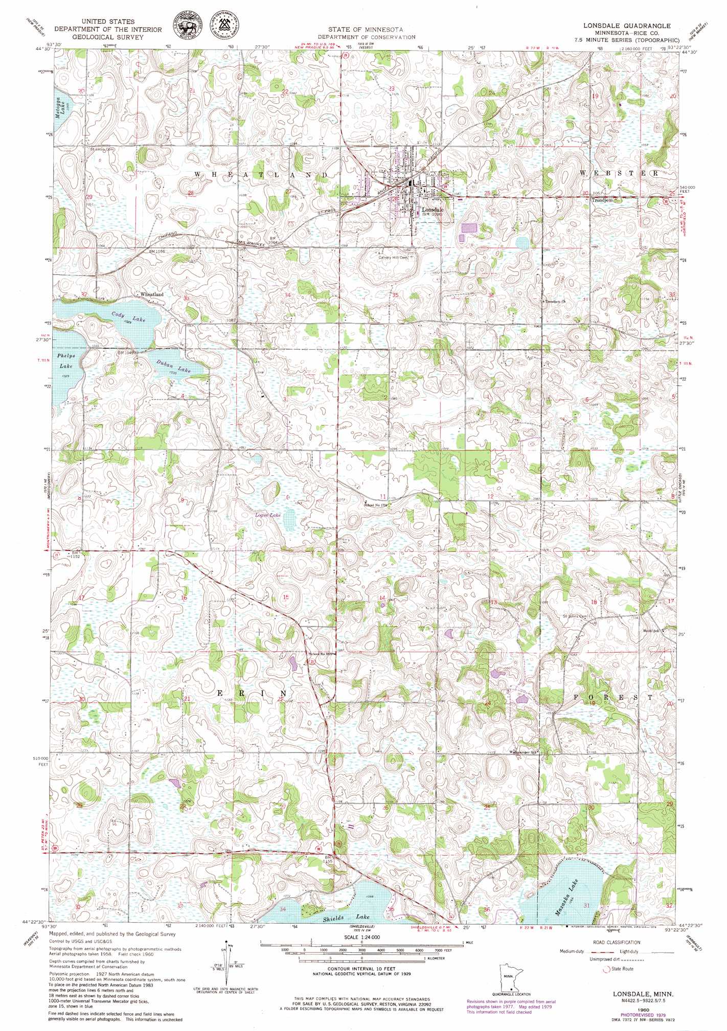
USGS Topo Quad 44093d4 - 1:24,000 scale
| Topo Map Name: | Lonsdale |
| USGS Topo Quad ID: | 44093d4 |
| Print Size: | ca. 21 1/4" wide x 27" high |
| Southeast Coordinates: | 44.375° N latitude / 93.375° W longitude |
| Map Center Coordinates: | 44.4375° N latitude / 93.4375° W longitude |
| U.S. State: | MN |
| Filename: | o44093d4.jpg |
| Download Map JPG Image: | Lonsdale topo map 1:24,000 scale |
| Map Type: | Topographic |
| Topo Series: | 7.5´ |
| Map Scale: | 1:24,000 |
| Source of Map Images: | United States Geological Survey (USGS) |
| Alternate Map Versions: |
Lonsdale MN 1960, updated 1961 Download PDF Buy paper map Lonsdale MN 2010 Download PDF Buy paper map Lonsdale MN 2013 Download PDF Buy paper map Lonsdale MN 2016 Download PDF Buy paper map |
1:24,000 Topo Quads surrounding Lonsdale
Jordan West |
Jordan East |
Prior Lake |
Orchard Lake |
Farmington |
Union Hill |
New Prague |
Veseli |
New Market |
Castle Rock |
Le Center |
Montgomery |
Lonsdale |
Little Chicago |
Northfield |
Cordova |
Kilkenny |
Shieldsville |
Faribault |
Cannon City |
Elysian |
Waterville |
Morristown |
Medford West |
Medford East |
> Back to 44093a1 at 1:100,000 scale
> Back to 44092a1 at 1:250,000 scale
> Back to U.S. Topo Maps home
Lonsdale topo map: Gazetteer
Lonsdale: Dams
Doctor John Komarek Dam elevation 316m 1036′Lonsdale: Lakes
Cody Lake elevation 312m 1023′Duban Lake elevation 316m 1036′
DuBon Lake elevation 312m 1023′
Lonsdale: Populated Places
Lonsdale elevation 333m 1092′Trondjem elevation 322m 1056′
Wheatland elevation 321m 1053′
Lonsdale digital topo map on disk
Buy this Lonsdale topo map showing relief, roads, GPS coordinates and other geographical features, as a high-resolution digital map file on DVD: