Randolph Topo Map Minnesota
To zoom in, hover over the map of Randolph
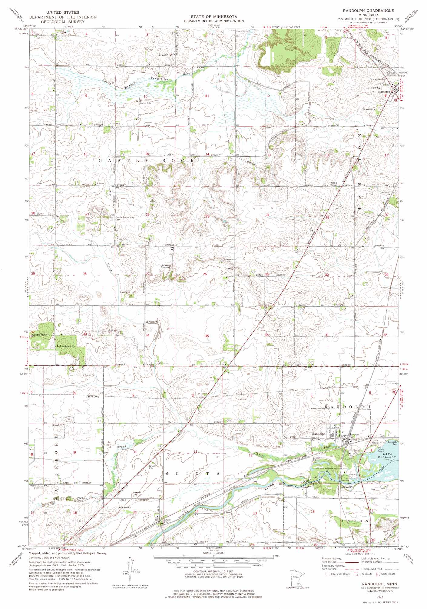
USGS Topo Quad 44093e1 - 1:24,000 scale
| Topo Map Name: | Randolph |
| USGS Topo Quad ID: | 44093e1 |
| Print Size: | ca. 21 1/4" wide x 27" high |
| Southeast Coordinates: | 44.5° N latitude / 93° W longitude |
| Map Center Coordinates: | 44.5625° N latitude / 93.0625° W longitude |
| U.S. State: | MN |
| Filename: | o44093e1.jpg |
| Download Map JPG Image: | Randolph topo map 1:24,000 scale |
| Map Type: | Topographic |
| Topo Series: | 7.5´ |
| Map Scale: | 1:24,000 |
| Source of Map Images: | United States Geological Survey (USGS) |
| Alternate Map Versions: |
Randolph MN 1974, updated 1976 Download PDF Buy paper map Randolph MN 2010 Download PDF Buy paper map Randolph MN 2013 Download PDF Buy paper map Randolph MN 2016 Download PDF Buy paper map |
1:24,000 Topo Quads surrounding Randolph
Bloomington |
Saint Paul Sw |
Inver Grove Heights |
Saint Paul Park |
Prescott |
Orchard Lake |
Farmington |
Coates |
Vermillion |
Hastings |
New Market |
Castle Rock |
Randolph |
Cannon Falls |
Miesville |
Little Chicago |
Northfield |
Dennison |
Sogn |
White Rock |
Faribault |
Cannon City |
Nerstrand |
Kenyon |
Wanamingo |
> Back to 44093e1 at 1:100,000 scale
> Back to 44092a1 at 1:250,000 scale
> Back to U.S. Topo Maps home
Randolph topo map: Gazetteer
Randolph: Airports
Lucht Field elevation 281m 921′Randolph: Pillars
Castle Rock elevation 291m 954′Randolph: Populated Places
Hampton elevation 302m 990′Randolph elevation 268m 879′
Randolph: Post Offices
Hampton Post Office elevation 300m 984′Lewiston Post Office (historical) elevation 271m 889′
Randolph Post Office elevation 268m 879′
Randolph: Streams
Chub Creek elevation 262m 859′North Branch Chub Creek elevation 270m 885′
Randolph digital topo map on disk
Buy this Randolph topo map showing relief, roads, GPS coordinates and other geographical features, as a high-resolution digital map file on DVD: