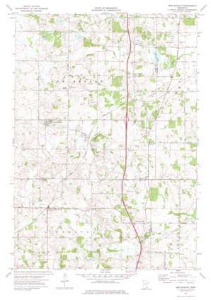
New Market Topo Map Minnesota
To zoom in, hover over the map of New Market
USGS Topo Quad 44093e3 - 1:24,000 scale
| Topo Map Name: | New Market |
| USGS Topo Quad ID: | 44093e3 |
| Print Size: | ca. 21 1/4" wide x 27" high |
| Southeast Coordinates: | 44.5° N latitude / 93.25° W longitude |
| Map Center Coordinates: | 44.5625° N latitude / 93.3125° W longitude |
| U.S. State: | MN |
| Filename: | o44093e3.jpg |
| Download Map JPG Image: | New Market topo map 1:24,000 scale |
| Map Type: | Topographic |
| Topo Series: | 7.5´ |
| Map Scale: | 1:24,000 |
| Source of Map Images: | United States Geological Survey (USGS) |
| Alternate Map Versions: |
New Market MN 1974, updated 1976 Download PDF Buy paper map New Market MN 2010 Download PDF Buy paper map New Market MN 2013 Download PDF Buy paper map New Market MN 2016 Download PDF Buy paper map |
1:24,000 Topo Quads surrounding New Market
> Back to 44093e1 at 1:100,000 scale
> Back to 44092a1 at 1:250,000 scale
> Back to U.S. Topo Maps home
New Market topo map: Gazetteer
New Market: Airports
Sky Harbor Residential Airpark elevation 336m 1102′New Market: Crossings
Interchange 76 elevation 342m 1122′New Market: Dams
Pettit Wildlife Pond Dam elevation 319m 1046′Steve Maza Pond Dam elevation 313m 1026′
New Market: Lakes
Rice Lake elevation 303m 994′Sweetbrier Lake elevation 328m 1076′
New Market: Parks
Big Woods Historical Marker elevation 341m 1118′New Market: Populated Places
Eidswold elevation 343m 1125′Elko elevation 348m 1141′
Elko New Market elevation 348m 1141′
Hazelwood elevation 319m 1046′
New Market elevation 339m 1112′
Webster elevation 318m 1043′
New Market: Post Offices
Eidswold Post Office (historical) elevation 343m 1125′Elko Post Office elevation 347m 1138′
New Market Post Office elevation 338m 1108′
New Market: Reservoirs
Pettit Wildlife Pond elevation 319m 1046′New Market digital topo map on disk
Buy this New Market topo map showing relief, roads, GPS coordinates and other geographical features, as a high-resolution digital map file on DVD:


