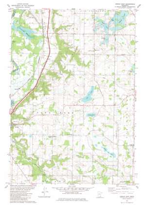
Jordan East Topo Map Minnesota
To zoom in, hover over the map of Jordan East
USGS Topo Quad 44093f5 - 1:24,000 scale
| Topo Map Name: | Jordan East |
| USGS Topo Quad ID: | 44093f5 |
| Print Size: | ca. 21 1/4" wide x 27" high |
| Southeast Coordinates: | 44.625° N latitude / 93.5° W longitude |
| Map Center Coordinates: | 44.6875° N latitude / 93.5625° W longitude |
| U.S. State: | MN |
| Filename: | o44093f5.jpg |
| Download Map JPG Image: | Jordan East topo map 1:24,000 scale |
| Map Type: | Topographic |
| Topo Series: | 7.5´ |
| Map Scale: | 1:24,000 |
| Source of Map Images: | United States Geological Survey (USGS) |
| Alternate Map Versions: |
Jordan East MN 1981, updated 1982 Download PDF Buy paper map Jordan East MN 2010 Download PDF Buy paper map Jordan East MN 2013 Download PDF Buy paper map Jordan East MN 2016 Download PDF Buy paper map |
1:24,000 Topo Quads surrounding Jordan East
> Back to 44093e1 at 1:100,000 scale
> Back to 44092a1 at 1:250,000 scale
> Back to U.S. Topo Maps home
Jordan East topo map: Gazetteer
Jordan East: Airports
Sky Park Landing Strip elevation 285m 935′Jordan East: Dams
Theis-Bendzick Pond Dam elevation 292m 958′Jordan East: Lakes
Geis Lake elevation 282m 925′O'Dowd Lake elevation 288m 944′
Schneider Lake elevation 288m 944′
Sutton Lake elevation 285m 935′
Swamp Lake elevation 288m 944′
Thole Lake elevation 288m 944′
Jordan East: Populated Places
Baden elevation 231m 757′Lydia elevation 289m 948′
Marystown elevation 297m 974′
Merriam elevation 230m 754′
Mudbaden elevation 224m 734′
Saint Josephs elevation 299m 980′
Jordan East: Post Offices
Helena Post Office (historical) elevation 263m 862′Lydia Post Office (historical) elevation 289m 948′
Marystown Post Office (historical) elevation 297m 974′
Merriam Post Office (historical) elevation 230m 754′
Mudbaden Post Office (historical) elevation 224m 734′
Jordan East: Reservoirs
Bendzick Pond elevation 292m 958′Jordan East: Streams
Picha Creek elevation 212m 695′Porter Creek elevation 255m 836′
Sand Creek elevation 212m 695′
Jordan East: Swamps
Diddle De Woddle Lake elevation 276m 905′Louisville Swamp elevation 219m 718′
Jordan East digital topo map on disk
Buy this Jordan East topo map showing relief, roads, GPS coordinates and other geographical features, as a high-resolution digital map file on DVD:


