Cambria Topo Map Minnesota
To zoom in, hover over the map of Cambria
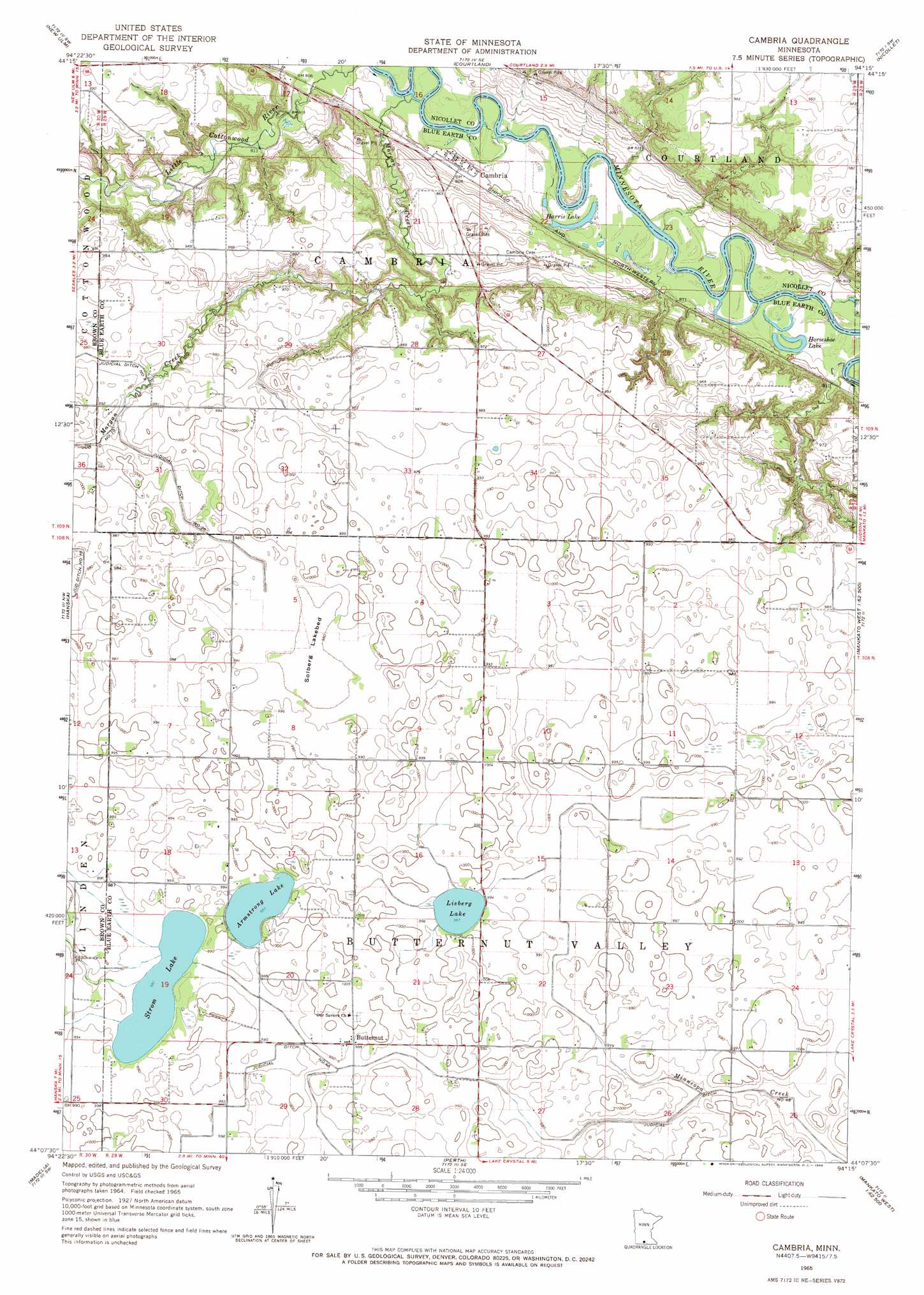
USGS Topo Quad 44094b3 - 1:24,000 scale
| Topo Map Name: | Cambria |
| USGS Topo Quad ID: | 44094b3 |
| Print Size: | ca. 21 1/4" wide x 27" high |
| Southeast Coordinates: | 44.125° N latitude / 94.25° W longitude |
| Map Center Coordinates: | 44.1875° N latitude / 94.3125° W longitude |
| U.S. State: | MN |
| Filename: | o44094b3.jpg |
| Download Map JPG Image: | Cambria topo map 1:24,000 scale |
| Map Type: | Topographic |
| Topo Series: | 7.5´ |
| Map Scale: | 1:24,000 |
| Source of Map Images: | United States Geological Survey (USGS) |
| Alternate Map Versions: |
Cambria MN 1965, updated 1966 Download PDF Buy paper map Cambria MN 2010 Download PDF Buy paper map Cambria MN 2013 Download PDF Buy paper map Cambria MN 2016 Download PDF Buy paper map |
1:24,000 Topo Quads surrounding Cambria
Saint George |
Lafayette |
Bernadotte |
New Sweden |
Norseland |
Essig |
New Ulm |
Courtland |
Nicollet |
North Star |
Lake Hanska East |
Hanska |
Cambria |
Judson |
Mankato West |
La Salle |
Madelia |
Perth |
Lake Crystal |
Good Thunder |
Saint James East |
Lewisville |
Willow Creek |
Amboy |
Sterling Center |
> Back to 44094a1 at 1:100,000 scale
> Back to 44094a1 at 1:250,000 scale
> Back to U.S. Topo Maps home
Cambria topo map: Gazetteer
Cambria: Canals
Judicial Ditch Number Fortyeight elevation 298m 977′Judicial Ditch Number Thirtysix elevation 297m 974′
Cambria: Flats
Solberg Lakebed elevation 298m 977′Cambria: Lakes
Armstrong Lake elevation 300m 984′Harris Lake elevation 237m 777′
Horseshoe Lake elevation 237m 777′
Lieberg Lake elevation 301m 987′
Strom Lake elevation 299m 980′
Cambria: Populated Places
Butternut elevation 301m 987′Cambria elevation 246m 807′
Cambria: Post Offices
Butternut Post Office (historical) elevation 301m 987′Cambria Post Office (historical) elevation 246m 807′
Cambria: Streams
Morgan Creek elevation 237m 777′Cambria digital topo map on disk
Buy this Cambria topo map showing relief, roads, GPS coordinates and other geographical features, as a high-resolution digital map file on DVD: