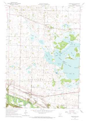
Courtland Topo Map Minnesota
To zoom in, hover over the map of Courtland
USGS Topo Quad 44094c3 - 1:24,000 scale
| Topo Map Name: | Courtland |
| USGS Topo Quad ID: | 44094c3 |
| Print Size: | ca. 21 1/4" wide x 27" high |
| Southeast Coordinates: | 44.25° N latitude / 94.25° W longitude |
| Map Center Coordinates: | 44.3125° N latitude / 94.3125° W longitude |
| U.S. State: | MN |
| Filename: | o44094c3.jpg |
| Download Map JPG Image: | Courtland topo map 1:24,000 scale |
| Map Type: | Topographic |
| Topo Series: | 7.5´ |
| Map Scale: | 1:24,000 |
| Source of Map Images: | United States Geological Survey (USGS) |
| Alternate Map Versions: |
Courtland MN 1964, updated 1965 Download PDF Buy paper map Courtland MN 2010 Download PDF Buy paper map Courtland MN 2013 Download PDF Buy paper map Courtland MN 2016 Download PDF Buy paper map |
1:24,000 Topo Quads surrounding Courtland
> Back to 44094a1 at 1:100,000 scale
> Back to 44094a1 at 1:250,000 scale
> Back to U.S. Topo Maps home
Courtland topo map: Gazetteer
Courtland: Bays
Gieseke Bay elevation 298m 977′Gimmer Bay elevation 298m 977′
Loon Bay elevation 298m 977′
Nelson Bay elevation 298m 977′
Poor Farm Bay elevation 298m 977′
South Bay elevation 298m 977′
Courtland: Canals
County Ditch Number Thirtyeight elevation 298m 977′County Ditch Number Thirtytwo elevation 299m 980′
County Ditch Number Twenty elevation 299m 980′
Courtland: Capes
Clay Bank elevation 302m 990′Hackberry Point elevation 299m 980′
Nelson Point elevation 298m 977′
Poor Farm Point elevation 304m 997′
Walters Point elevation 299m 980′
Courtland: Channels
Nelson Narrows elevation 298m 977′Courtland: Islands
Anderson Island elevation 302m 990′Big Island elevation 302m 990′
Brooks Island elevation 301m 987′
Crone Island elevation 300m 984′
Heyer Island elevation 299m 980′
Johnson Island elevation 303m 994′
Monson Island elevation 299m 980′
Nosey Island elevation 299m 980′
Pie Island elevation 299m 980′
Round Island elevation 305m 1000′
Courtland: Lakes
Peterson Lake elevation 299m 980′Courtland: Parks
Courtland Rec Ball Park elevation 285m 935′Courtland: Populated Places
Courtland elevation 285m 935′Courtland: Post Offices
Brighton Post Office (historical) elevation 300m 984′Courtland Post Office elevation 285m 935′
Courtland: Streams
Little Cottonwood River elevation 237m 777′Courtland: Swamps
Courtland Bay elevation 298m 977′Larson Bay elevation 297m 974′
Pehlings Bay elevation 297m 974′
Sunday Bay elevation 298m 977′
Courtland digital topo map on disk
Buy this Courtland topo map showing relief, roads, GPS coordinates and other geographical features, as a high-resolution digital map file on DVD:


