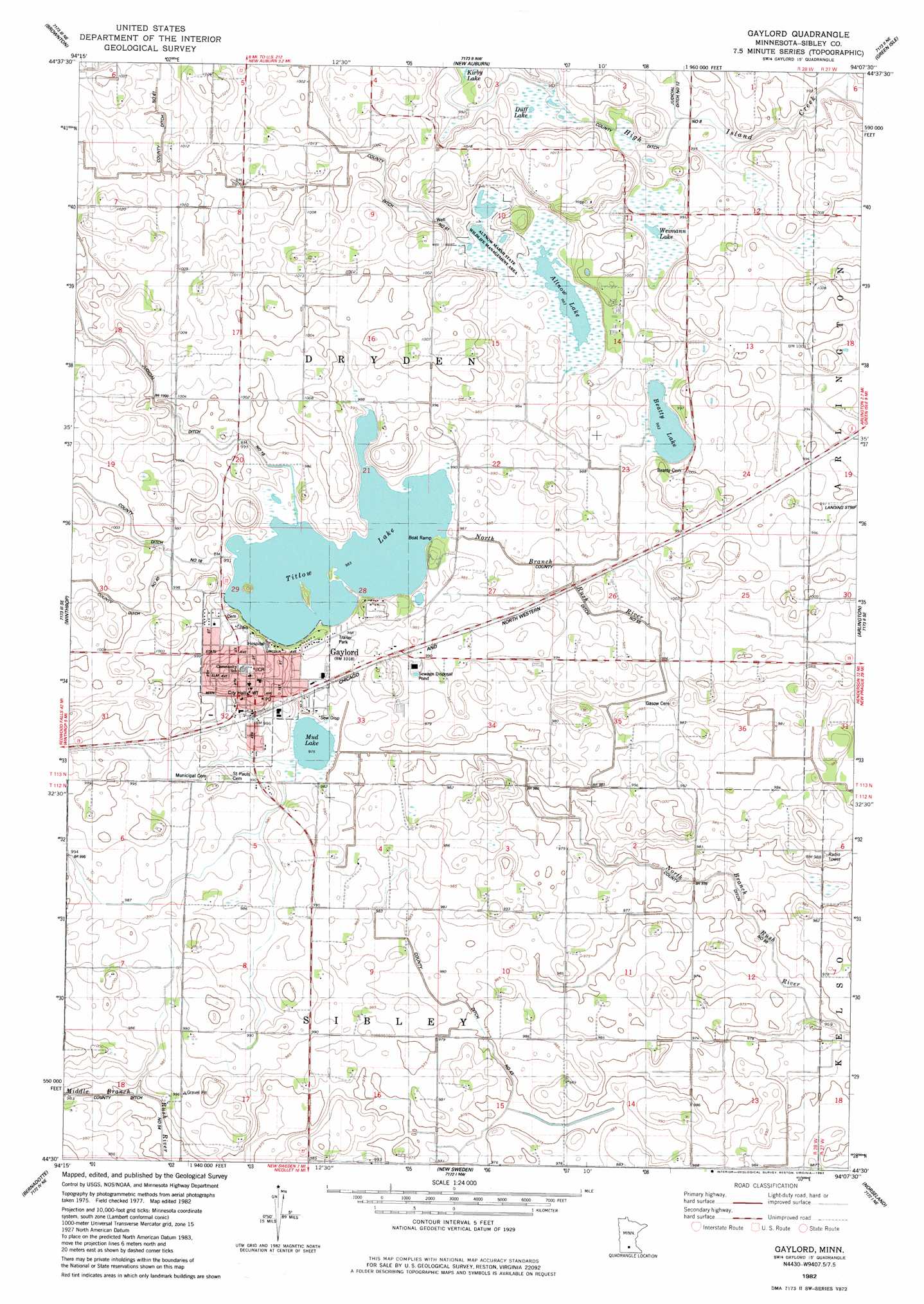
Gaylord Topo Map Minnesota
To zoom in, hover over the map of Gaylord
USGS Topo Quad 44094e2 - 1:24,000 scale
| Topo Map Name: | Gaylord |
| USGS Topo Quad ID: | 44094e2 |
| Print Size: | ca. 21 1/4" wide x 27" high |
| Southeast Coordinates: | 44.5° N latitude / 94.125° W longitude |
| Map Center Coordinates: | 44.5625° N latitude / 94.1875° W longitude |
| U.S. State: | MN |
| Filename: | o44094e2.jpg |
| Download Map JPG Image: | Gaylord topo map 1:24,000 scale |
| Map Type: | Topographic |
| Topo Series: | 7.5´ |
| Map Scale: | 1:24,000 |
| Source of Map Images: | United States Geological Survey (USGS) |
| Alternate Map Versions: |
Gaylord MN 1982, updated 1983 Download PDF Buy paper map Gaylord MN 2010 Download PDF Buy paper map Gaylord MN 2013 Download PDF Buy paper map Gaylord MN 2016 Download PDF Buy paper map |
1:24,000 Topo Quads surrounding Gaylord
Heatwole |
Biscay |
Glenco |
Plato |
Norwood |
Stewart |
Brownton |
New Auburn |
Green Isle |
Hamburg |
Winthrop Sw |
Winthrop |
Gaylord |
Arlington |
Henderson |
Lafayette |
Bernadotte |
New Sweden |
Norseland |
Le Sueur |
New Ulm |
Courtland |
Nicollet |
North Star |
Saint Peter |
> Back to 44094e1 at 1:100,000 scale
> Back to 44094a1 at 1:250,000 scale
> Back to U.S. Topo Maps home
Gaylord topo map: Gazetteer
Gaylord: Canals
County Ditch Number Eight elevation 300m 984′County Ditch Number Fiftyfive elevation 294m 964′
County Ditch Number Forty elevation 305m 1000′
County Ditch Number Fortythree elevation 297m 974′
County Ditch Number Sixtyone elevation 306m 1003′
Gaylord: Dams
Titlow Lake Dam elevation 301m 987′Gaylord: Lakes
Altnow Lake elevation 300m 984′Beatty Lake elevation 300m 984′
Mud Lake elevation 297m 974′
Titlow Lake elevation 300m 984′
Weimann Lake elevation 301m 987′
Gaylord: Parks
Altnow Marsh State Wildlife Management Area elevation 300m 984′Gaylord: Populated Places
Gaylord elevation 309m 1013′Gaylord Mobile Home Park elevation 301m 987′
Gaylord: Post Offices
Gaylord Post Office elevation 308m 1010′Gaylord: Reservoirs
Titlow Lake elevation 301m 987′Gaylord: Swamps
Duff Lake elevation 301m 987′Gaylord digital topo map on disk
Buy this Gaylord topo map showing relief, roads, GPS coordinates and other geographical features, as a high-resolution digital map file on DVD: