Fairfax Topo Map Minnesota
To zoom in, hover over the map of Fairfax
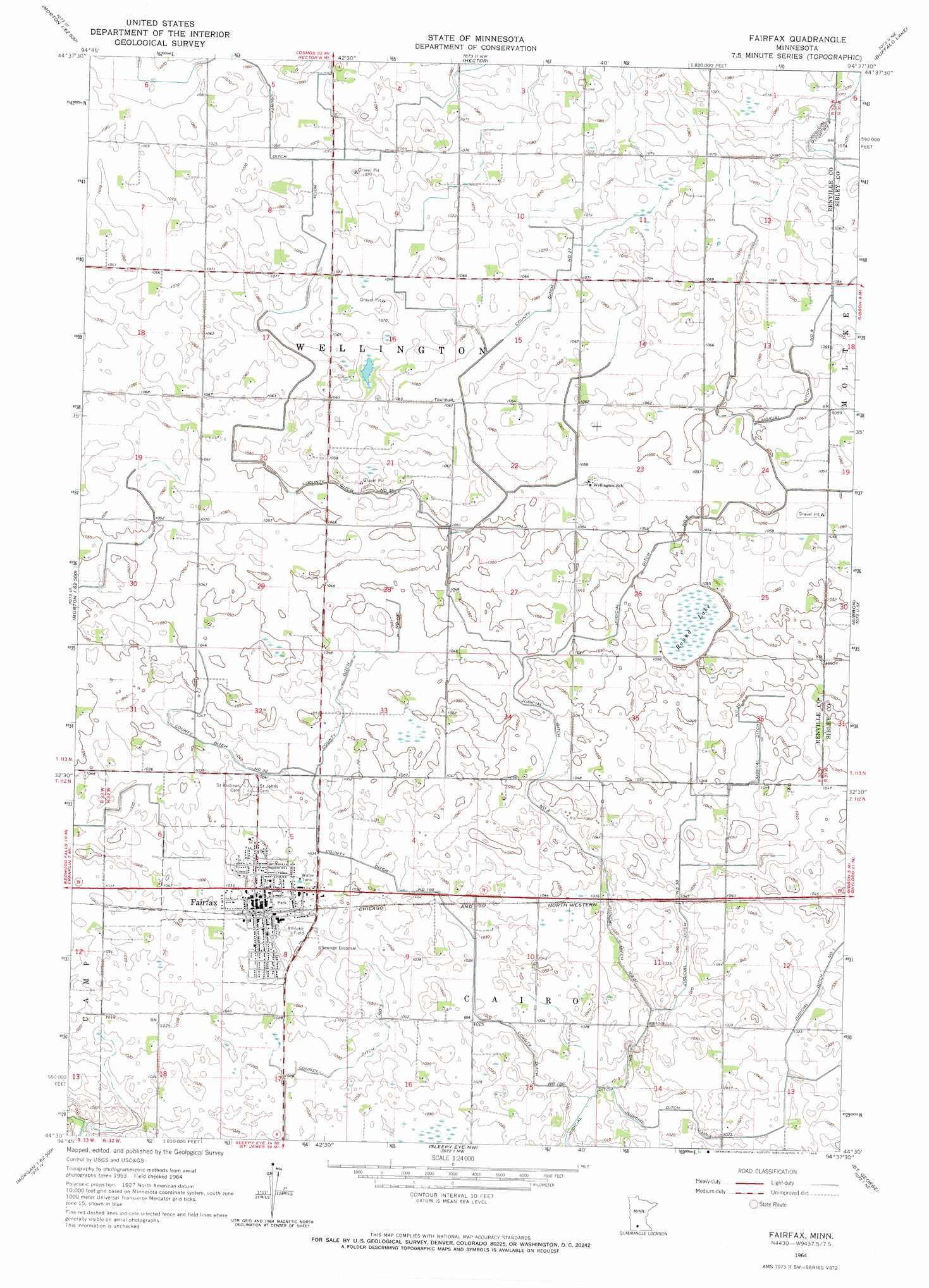
USGS Topo Quad 44094e6 - 1:24,000 scale
| Topo Map Name: | Fairfax |
| USGS Topo Quad ID: | 44094e6 |
| Print Size: | ca. 21 1/4" wide x 27" high |
| Southeast Coordinates: | 44.5° N latitude / 94.625° W longitude |
| Map Center Coordinates: | 44.5625° N latitude / 94.6875° W longitude |
| U.S. State: | MN |
| Filename: | o44094e6.jpg |
| Download Map JPG Image: | Fairfax topo map 1:24,000 scale |
| Map Type: | Topographic |
| Topo Series: | 7.5´ |
| Map Scale: | 1:24,000 |
| Source of Map Images: | United States Geological Survey (USGS) |
| Alternate Map Versions: |
Fairfax MN 1964, updated 1965 Download PDF Buy paper map Fairfax MN 2010 Download PDF Buy paper map Fairfax MN 2013 Download PDF Buy paper map Fairfax MN 2016 Download PDF Buy paper map |
1:24,000 Topo Quads surrounding Fairfax
Olivia |
Olivia Se |
Churchill |
Lake Allie |
Heatwole |
Morton Nw |
Morton Ne |
Hector |
Buffalo Lake |
Stewart |
Morton |
Morton Se |
Fairfax |
Gibbon |
Winthrop Sw |
Morgan |
Morgan Ne |
Sleepy Eye Nw |
Saint George |
Lafayette |
Boise Lake |
Evan |
Sleepy Eye |
Essig |
New Ulm |
> Back to 44094e1 at 1:100,000 scale
> Back to 44094a1 at 1:250,000 scale
> Back to U.S. Topo Maps home
Fairfax topo map: Gazetteer
Fairfax: Canals
County Ditch Number One Hundred elevation 313m 1026′County Ditch Number Thirtyfour elevation 324m 1062′
County Ditch Number Three elevation 311m 1020′
County Ditch Number Twentyeight elevation 317m 1040′
County Ditch Number Twentyseven elevation 322m 1056′
Judicial Ditch Number Eight elevation 320m 1049′
Judicial Ditch Number One elevation 311m 1020′
Judicial Ditch Number Thirty elevation 311m 1020′
Fairfax: Populated Places
Countryview Estates elevation 317m 1040′Fairfax elevation 315m 1033′
Fairfax: Post Offices
Fairfax Post Office elevation 318m 1043′Fairfax: Swamps
Round Lake elevation 319m 1046′Fairfax digital topo map on disk
Buy this Fairfax topo map showing relief, roads, GPS coordinates and other geographical features, as a high-resolution digital map file on DVD: