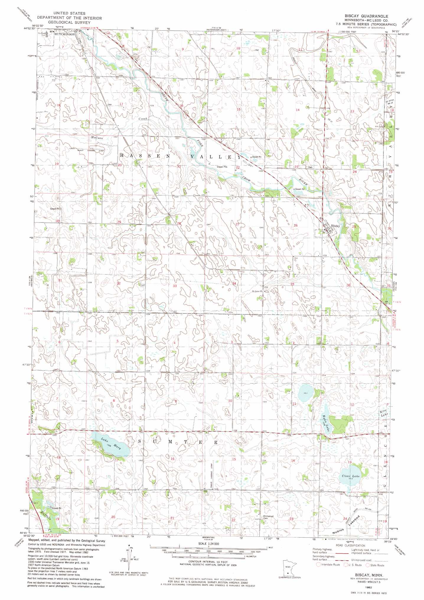
Biscay Topo Map Minnesota
To zoom in, hover over the map of Biscay
USGS Topo Quad 44094g3 - 1:24,000 scale
| Topo Map Name: | Biscay |
| USGS Topo Quad ID: | 44094g3 |
| Print Size: | ca. 21 1/4" wide x 27" high |
| Southeast Coordinates: | 44.75° N latitude / 94.25° W longitude |
| Map Center Coordinates: | 44.8125° N latitude / 94.3125° W longitude |
| U.S. State: | MN |
| Filename: | o44094g3.jpg |
| Download Map JPG Image: | Biscay topo map 1:24,000 scale |
| Map Type: | Topographic |
| Topo Series: | 7.5´ |
| Map Scale: | 1:24,000 |
| Source of Map Images: | United States Geological Survey (USGS) |
| Alternate Map Versions: |
Biscay MN 1982, updated 1982 Download PDF Buy paper map Biscay MN 2010 Download PDF Buy paper map Biscay MN 2013 Download PDF Buy paper map Biscay MN 2016 Download PDF Buy paper map |
1:24,000 Topo Quads surrounding Biscay
Litchfield South |
Darwin |
Dassel |
Cokato |
Howard Lake |
Cedar Mills |
Hutchinson West |
Hutchinson East |
Silver Lake |
Winsted |
Lake Allie |
Heatwole |
Biscay |
Glenco |
Plato |
Buffalo Lake |
Stewart |
Brownton |
New Auburn |
Green Isle |
Gibbon |
Winthrop Sw |
Winthrop |
Gaylord |
Arlington |
> Back to 44094e1 at 1:100,000 scale
> Back to 44094a1 at 1:250,000 scale
> Back to U.S. Topo Maps home
Biscay topo map: Gazetteer
Biscay: Airports
Ewald Landing Strip elevation 313m 1026′Quast Landing Strip elevation 317m 1040′
Biscay: Canals
County Ditch Number Twentyseven elevation 320m 1049′Biscay: Flats
Nobles Lakebed elevation 308m 1010′Biscay: Lakes
Clear Lake elevation 309m 1013′Lake Mary elevation 312m 1023′
Ryan Lake elevation 306m 1003′
Biscay: Parks
Elks Park elevation 324m 1062′Biscay: Populated Places
Biscay elevation 312m 1023′Biscay: Post Offices
Biscay Post Office (historical) elevation 312m 1023′Biscay: Streams
McCuen Creek elevation 310m 1017′Biscay: Swamps
Rice Lake elevation 306m 1003′Biscay digital topo map on disk
Buy this Biscay topo map showing relief, roads, GPS coordinates and other geographical features, as a high-resolution digital map file on DVD: