Lake Lillian Topo Map Minnesota
To zoom in, hover over the map of Lake Lillian
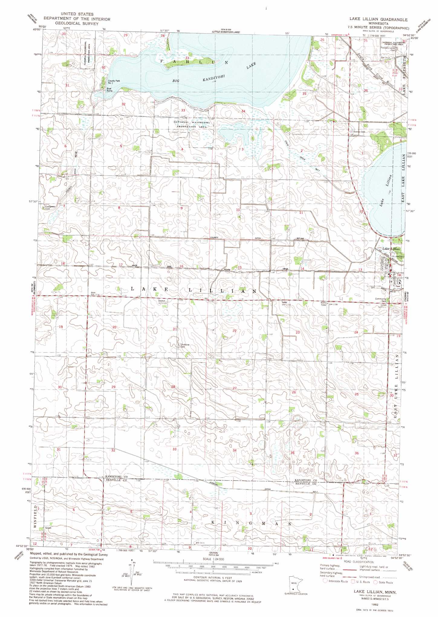
USGS Topo Quad 44094h8 - 1:24,000 scale
| Topo Map Name: | Lake Lillian |
| USGS Topo Quad ID: | 44094h8 |
| Print Size: | ca. 21 1/4" wide x 27" high |
| Southeast Coordinates: | 44.875° N latitude / 94.875° W longitude |
| Map Center Coordinates: | 44.9375° N latitude / 94.9375° W longitude |
| U.S. State: | MN |
| Filename: | o44094h8.jpg |
| Download Map JPG Image: | Lake Lillian topo map 1:24,000 scale |
| Map Type: | Topographic |
| Topo Series: | 7.5´ |
| Map Scale: | 1:24,000 |
| Source of Map Images: | United States Geological Survey (USGS) |
| Alternate Map Versions: |
Lake Lillian MN 1982, updated 1983 Download PDF Buy paper map Lake Lillian MN 2010 Download PDF Buy paper map Lake Lillian MN 2013 Download PDF Buy paper map Lake Lillian MN 2016 Download PDF Buy paper map |
1:24,000 Topo Quads surrounding Lake Lillian
Pennock |
Solomon Lake |
Spicer |
Atwater |
Grove City |
Raymond |
Willmar |
Little Kandiyohi Lake |
Lake Elizabeth |
Rosendale |
Prinsburg |
Blomkest |
Lake Lillian |
Thorpe |
Cosmos |
Renville |
Danube |
Olivia |
Olivia Se |
Churchill |
Vicksburg |
Bechyn |
Morton Nw |
Morton Ne |
Hector |
> Back to 44094e1 at 1:100,000 scale
> Back to 44094a1 at 1:250,000 scale
> Back to U.S. Topo Maps home
Lake Lillian topo map: Gazetteer
Lake Lillian: Canals
County Ditch Number Fiftyeight elevation 338m 1108′County Ditch Number Twentyfour A elevation 335m 1099′
Judicial Ditch Number Two elevation 337m 1105′
State Ditch Number One elevation 336m 1102′
Lake Lillian: Dams
Eagle Lake Dam elevation 338m 1108′Lake Lillian: Lakes
Big Kandiyohi Lake elevation 336m 1102′Lake Lillian elevation 336m 1102′
Lake Lillian: Parks
County Park Number One elevation 337m 1105′Lake Lillian City Park elevation 335m 1099′
Lake Lillian City Park elevation 339m 1112′
Lake Lillian: Populated Places
Lake Lillian elevation 339m 1112′Lake Lillian: Post Offices
Lake Lillian Post Office elevation 339m 1112′Lake Lillian: Reservoirs
Eagle Lake elevation 338m 1108′Lake Lillian: Trails
Luce Line State Trail elevation 337m 1105′Lake Lillian digital topo map on disk
Buy this Lake Lillian topo map showing relief, roads, GPS coordinates and other geographical features, as a high-resolution digital map file on DVD: