Westbrook Topo Map Minnesota
To zoom in, hover over the map of Westbrook
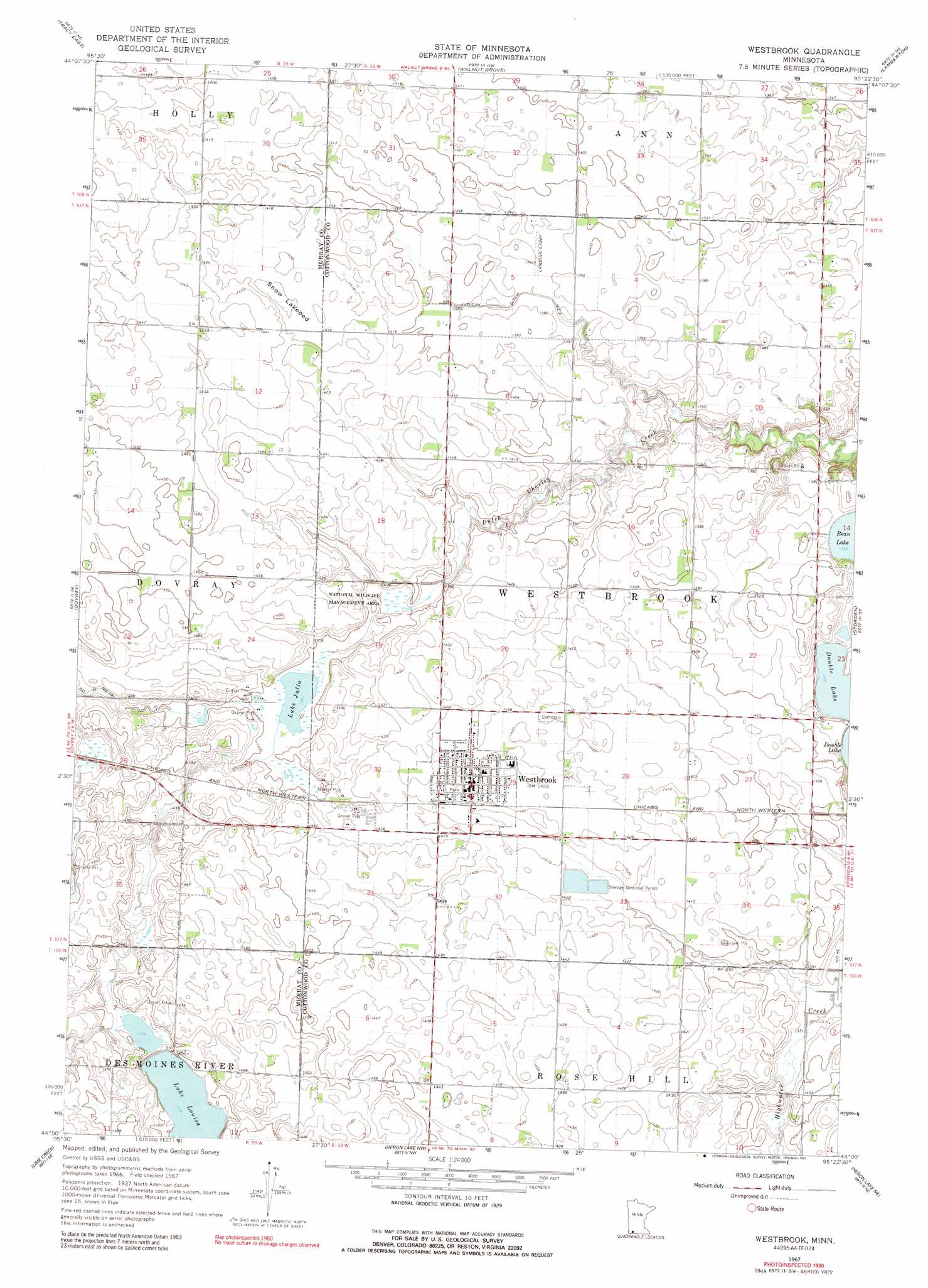
USGS Topo Quad 44095a4 - 1:24,000 scale
| Topo Map Name: | Westbrook |
| USGS Topo Quad ID: | 44095a4 |
| Print Size: | ca. 21 1/4" wide x 27" high |
| Southeast Coordinates: | 44° N latitude / 95.375° W longitude |
| Map Center Coordinates: | 44.0625° N latitude / 95.4375° W longitude |
| U.S. State: | MN |
| Filename: | o44095a4.jpg |
| Download Map JPG Image: | Westbrook topo map 1:24,000 scale |
| Map Type: | Topographic |
| Topo Series: | 7.5´ |
| Map Scale: | 1:24,000 |
| Source of Map Images: | United States Geological Survey (USGS) |
| Alternate Map Versions: |
Westbrook MN 1967, updated 1969 Download PDF Buy paper map Westbrook MN 1967, updated 1991 Download PDF Buy paper map Westbrook MN 2010 Download PDF Buy paper map Westbrook MN 2013 Download PDF Buy paper map Westbrook MN 2016 Download PDF Buy paper map |
1:24,000 Topo Quads surrounding Westbrook
Amiret |
Milroy Se |
Wabasso Sw |
Wabasso Se |
Wanda |
Tracy West |
Tracy East |
Walnut Grove |
Lamberton |
Sanborn |
Currie |
Dovray |
Westbrook |
Storden |
Jeffers |
Avoca |
Lime Creek |
Heron Lake Nw |
Heron Lake Ne |
Harder Lake |
Fulda Sw |
Fulda |
Dundee |
Heron Lake |
Wilder |
> Back to 44095a1 at 1:100,000 scale
> Back to 44094a1 at 1:250,000 scale
> Back to U.S. Topo Maps home
Westbrook topo map: Gazetteer
Westbrook: Canals
Judicial Ditch Number Three elevation 421m 1381′Westbrook: Flats
Snow Lakebed elevation 429m 1407′Westbrook: Lakes
Lake Julia elevation 424m 1391′Lake Louisa elevation 436m 1430′
Westbrook: Parks
South Dutch Charlie County Park elevation 404m 1325′Westbrook: Populated Places
Westbrook elevation 435m 1427′Westbrook: Post Offices
Westbrook Post Office elevation 435m 1427′Westbrook digital topo map on disk
Buy this Westbrook topo map showing relief, roads, GPS coordinates and other geographical features, as a high-resolution digital map file on DVD: