Milroy Topo Map Minnesota
To zoom in, hover over the map of Milroy
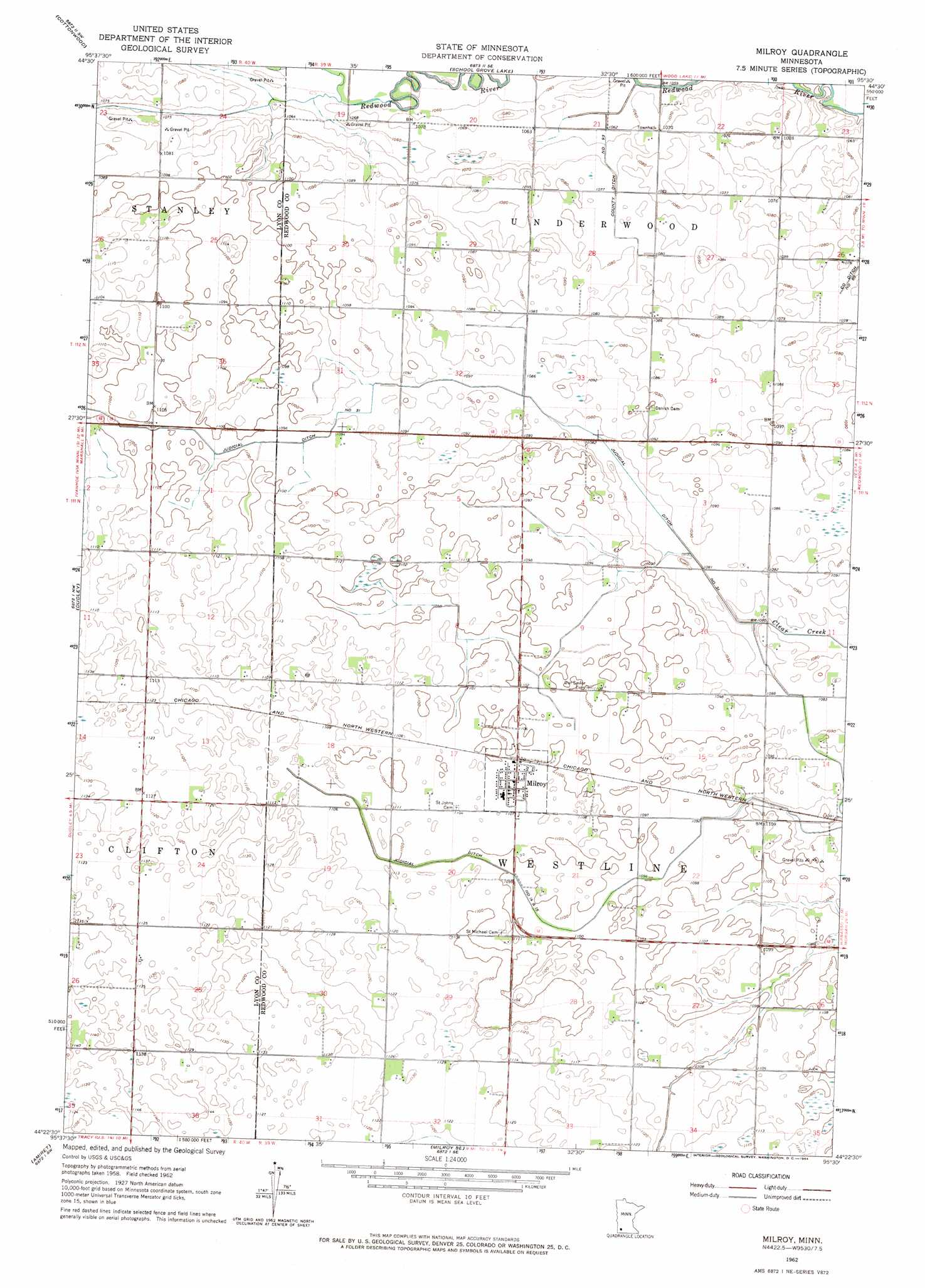
USGS Topo Quad 44095d5 - 1:24,000 scale
| Topo Map Name: | Milroy |
| USGS Topo Quad ID: | 44095d5 |
| Print Size: | ca. 21 1/4" wide x 27" high |
| Southeast Coordinates: | 44.375° N latitude / 95.5° W longitude |
| Map Center Coordinates: | 44.4375° N latitude / 95.5625° W longitude |
| U.S. State: | MN |
| Filename: | o44095d5.jpg |
| Download Map JPG Image: | Milroy topo map 1:24,000 scale |
| Map Type: | Topographic |
| Topo Series: | 7.5´ |
| Map Scale: | 1:24,000 |
| Source of Map Images: | United States Geological Survey (USGS) |
| Alternate Map Versions: |
Milroy MN 1962, updated 1964 Download PDF Buy paper map Milroy MN 2010 Download PDF Buy paper map Milroy MN 2013 Download PDF Buy paper map Milroy MN 2016 Download PDF Buy paper map |
1:24,000 Topo Quads surrounding Milroy
Normania |
Wood Lake Nw |
Wood Lake |
Lone Tree Lake |
Iverson Lake |
Green Valley |
Cottonwood |
School Grove Lake |
Echo |
Belview |
Marshall |
Dudley |
Milroy |
Lucan |
Wabasso |
Marshall Se |
Amiret |
Milroy Se |
Wabasso Sw |
Wabasso Se |
Balaton |
Tracy West |
Tracy East |
Walnut Grove |
Lamberton |
> Back to 44095a1 at 1:100,000 scale
> Back to 44094a1 at 1:250,000 scale
> Back to U.S. Topo Maps home
Milroy topo map: Gazetteer
Milroy: Canals
County Ditch Number Nintythree elevation 326m 1069′Judicial Ditch Number Fifteen elevation 330m 1082′
Judicial Ditch Number Fourteen and Fifteen elevation 334m 1095′
Judicial Ditch Number Thirtyone elevation 329m 1079′
Milroy: Populated Places
Milroy elevation 338m 1108′Milroy: Post Offices
Milroy Post Office elevation 337m 1105′Milroy digital topo map on disk
Buy this Milroy topo map showing relief, roads, GPS coordinates and other geographical features, as a high-resolution digital map file on DVD: