Minneota Topo Map Minnesota
To zoom in, hover over the map of Minneota
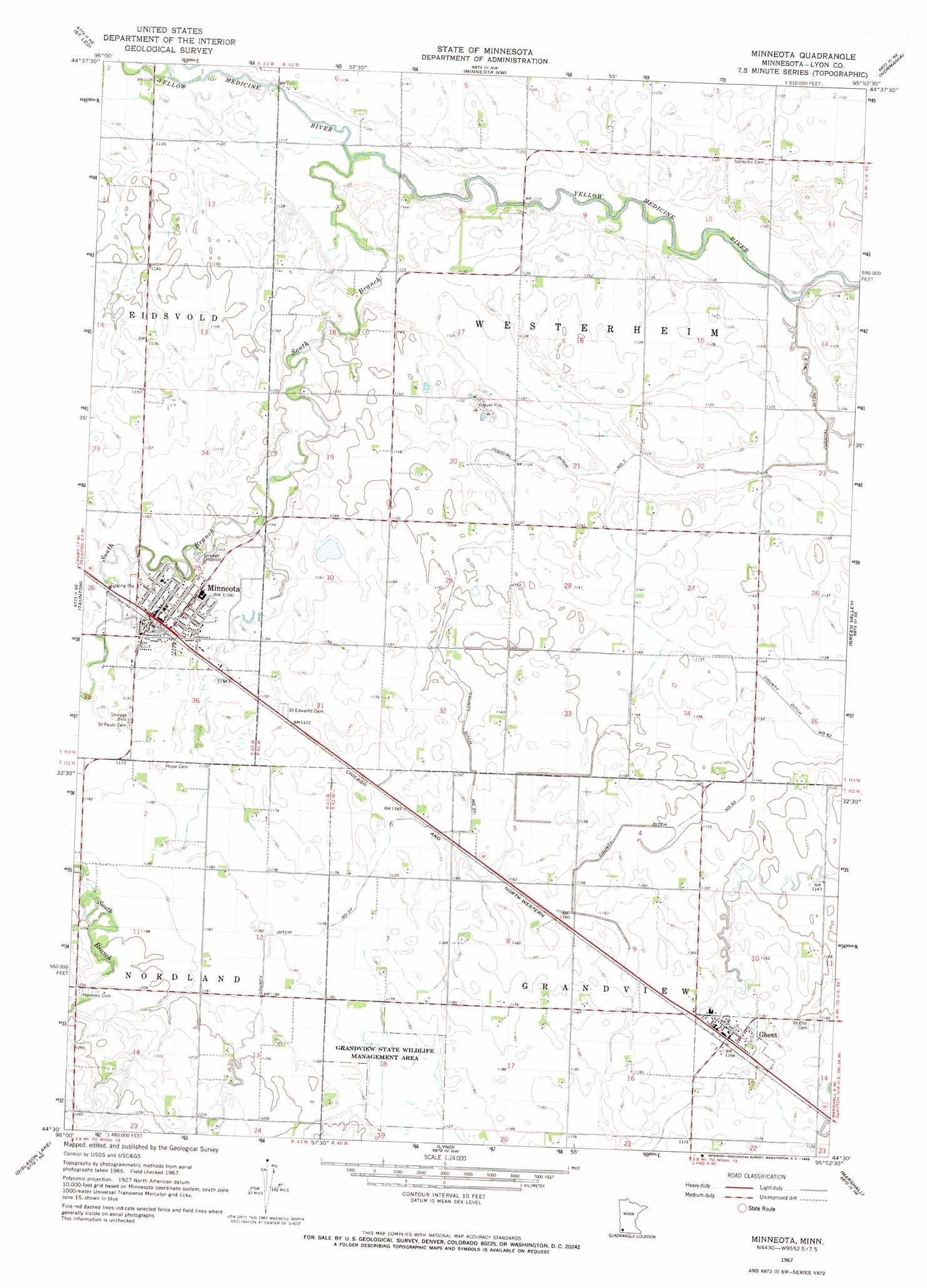
USGS Topo Quad 44095e8 - 1:24,000 scale
| Topo Map Name: | Minneota |
| USGS Topo Quad ID: | 44095e8 |
| Print Size: | ca. 21 1/4" wide x 27" high |
| Southeast Coordinates: | 44.5° N latitude / 95.875° W longitude |
| Map Center Coordinates: | 44.5625° N latitude / 95.9375° W longitude |
| U.S. State: | MN |
| Filename: | o44095e8.jpg |
| Download Map JPG Image: | Minneota topo map 1:24,000 scale |
| Map Type: | Topographic |
| Topo Series: | 7.5´ |
| Map Scale: | 1:24,000 |
| Source of Map Images: | United States Geological Survey (USGS) |
| Alternate Map Versions: |
Minneota MN 1967, updated 1968 Download PDF Buy paper map Minneota MN 2010 Download PDF Buy paper map Minneota MN 2013 Download PDF Buy paper map Minneota MN 2016 Download PDF Buy paper map |
1:24,000 Topo Quads surrounding Minneota
Dawson Sw |
Providence |
Boyd |
Clarkfield |
Hazel Run |
Porter |
Saint Leo |
Minneota Nw |
Normania |
Wood Lake Nw |
Porter Sw |
Taunton |
Minneota |
Green Valley |
Cottonwood |
Arco |
Gislason Lake |
Lynd |
Marshall |
Dudley |
Tyler |
Dead Coon Lake |
Russell |
Marshall Se |
Amiret |
> Back to 44095e1 at 1:100,000 scale
> Back to 44094a1 at 1:250,000 scale
> Back to U.S. Topo Maps home
Minneota topo map: Gazetteer
Minneota: Canals
County Ditch Number Sixtythree elevation 348m 1141′County Ditch Number Thirtyseven elevation 355m 1164′
Judicial Ditch Number Seven elevation 342m 1122′
Minneota: Parks
First Settlement of Icelanders in Minnesota Historical Monument elevation 356m 1167′Grandview State Wildlife Management Area elevation 360m 1181′
Westerheim Pioneer Cemetery Historical Marker elevation 341m 1118′
Minneota: Populated Places
Ghent elevation 357m 1171′Kesteloot's Trailer Court elevation 360m 1181′
Minneota elevation 356m 1167′
Minneota: Post Offices
Ghent Post Office elevation 355m 1164′Minneota Post Office elevation 356m 1167′
Minneota: Streams
Mud Creek elevation 342m 1122′South Branch Yellow Medicine River elevation 339m 1112′
Minneota digital topo map on disk
Buy this Minneota topo map showing relief, roads, GPS coordinates and other geographical features, as a high-resolution digital map file on DVD: