Flandreau Topo Map South Dakota
To zoom in, hover over the map of Flandreau
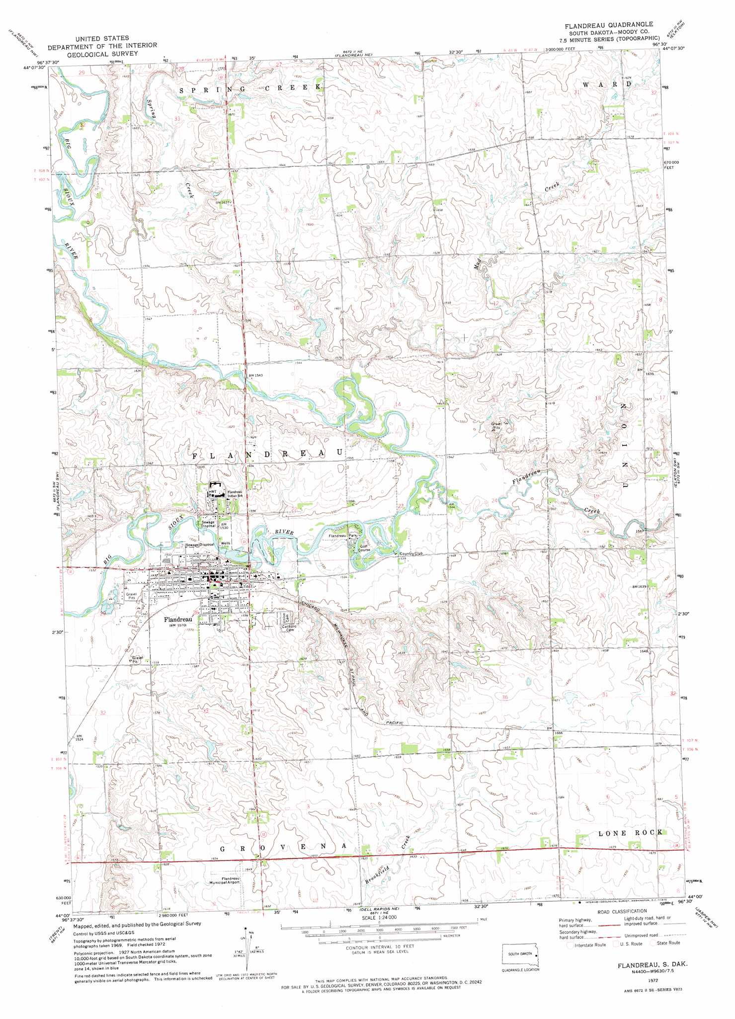
USGS Topo Quad 44096a5 - 1:24,000 scale
| Topo Map Name: | Flandreau |
| USGS Topo Quad ID: | 44096a5 |
| Print Size: | ca. 21 1/4" wide x 27" high |
| Southeast Coordinates: | 44° N latitude / 96.5° W longitude |
| Map Center Coordinates: | 44.0625° N latitude / 96.5625° W longitude |
| U.S. State: | SD |
| Filename: | o44096a5.jpg |
| Download Map JPG Image: | Flandreau topo map 1:24,000 scale |
| Map Type: | Topographic |
| Topo Series: | 7.5´ |
| Map Scale: | 1:24,000 |
| Source of Map Images: | United States Geological Survey (USGS) |
| Alternate Map Versions: |
Flandreau SD 1972, updated 1973 Download PDF Buy paper map Flandreau SD 2012 Download PDF Buy paper map Flandreau SD 2015 Download PDF Buy paper map |
1:24,000 Topo Quads surrounding Flandreau
Brookings |
Aurora |
White Se |
Lake Benton Sw |
Lake Benton |
Medary |
Flandreau Nw |
Flandreau Ne |
Elkton |
Verdi |
Rutland Se |
Flandreau Sw |
Flandreau |
Elkton Sw |
Pipestone North |
Colman |
Trent |
Dell Rapids Ne |
Jasper Nw |
Pipestone South |
Colton Se |
Dell Rapids |
Dell Rapids Se |
Jasper |
Jasper Se |
> Back to 44096a1 at 1:100,000 scale
> Back to 44096a1 at 1:250,000 scale
> Back to U.S. Topo Maps home
Flandreau topo map: Gazetteer
Flandreau: Airports
Flandreau Municipal Airport elevation 500m 1640′Flandreau: Parks
Flandreau Park elevation 467m 1532′Flandreau: Populated Places
Flandreau elevation 477m 1564′Flandreau: Streams
Flandreau Creek elevation 467m 1532′Flandreau Creek elevation 467m 1532′
Mud Creek elevation 465m 1525′
Spring Creek elevation 470m 1541′
Spring Creek elevation 470m 1541′
Flandreau digital topo map on disk
Buy this Flandreau topo map showing relief, roads, GPS coordinates and other geographical features, as a high-resolution digital map file on DVD:
Eastern North Dakota & Eastern South Dakota
Buy digital topo maps: Eastern North Dakota & Eastern South Dakota