Howard Topo Map South Dakota
To zoom in, hover over the map of Howard
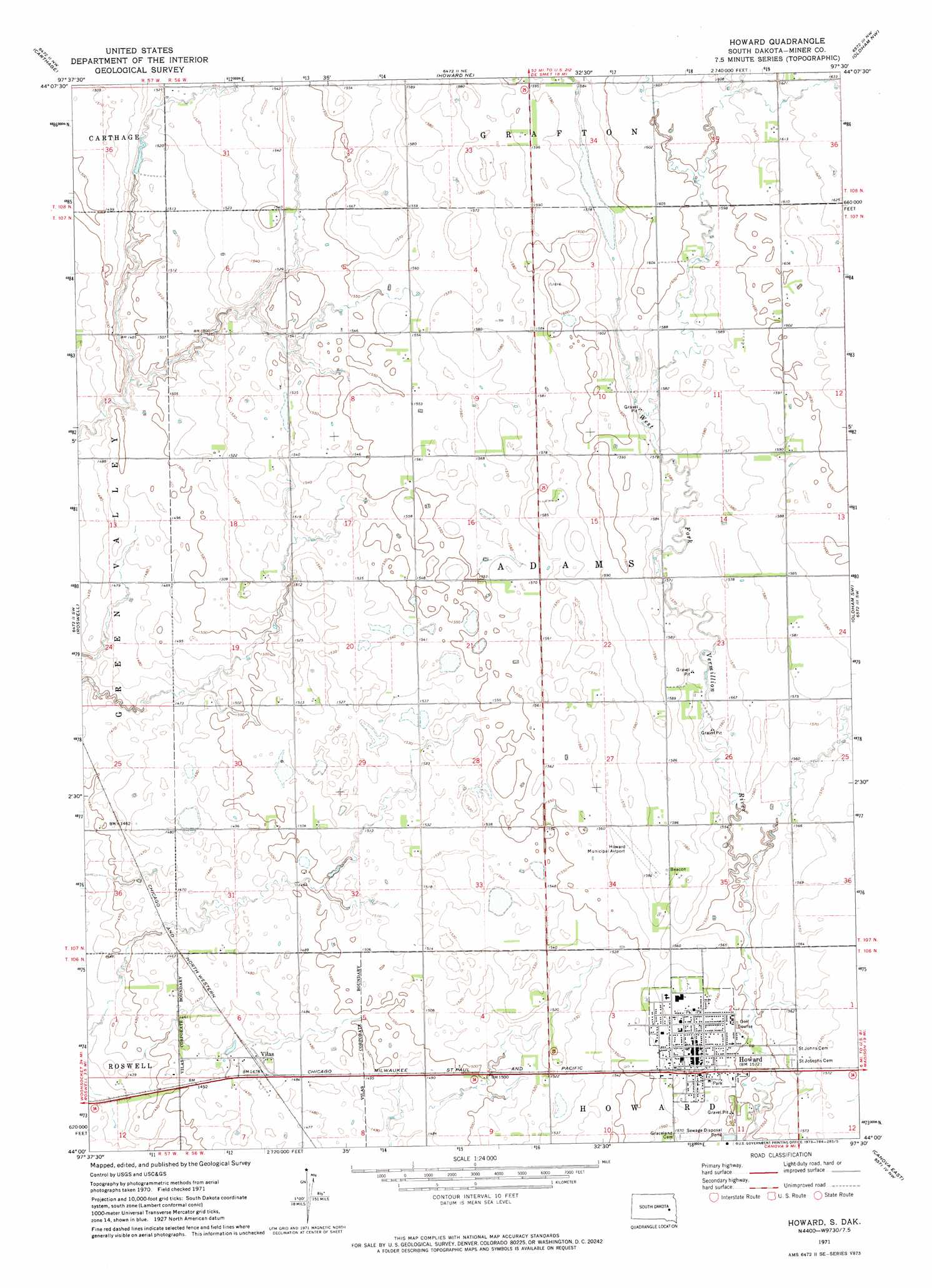
USGS Topo Quad 44097a5 - 1:24,000 scale
| Topo Map Name: | Howard |
| USGS Topo Quad ID: | 44097a5 |
| Print Size: | ca. 21 1/4" wide x 27" high |
| Southeast Coordinates: | 44° N latitude / 97.5° W longitude |
| Map Center Coordinates: | 44.0625° N latitude / 97.5625° W longitude |
| U.S. State: | SD |
| Filename: | o44097a5.jpg |
| Download Map JPG Image: | Howard topo map 1:24,000 scale |
| Map Type: | Topographic |
| Topo Series: | 7.5´ |
| Map Scale: | 1:24,000 |
| Source of Map Images: | United States Geological Survey (USGS) |
| Alternate Map Versions: |
Howard SD 1971, updated 1973 Download PDF Buy paper map Howard SD 2012 Download PDF Buy paper map Howard SD 2015 Download PDF Buy paper map |
1:24,000 Topo Quads surrounding Howard
Iroquois |
Manchester |
De Smet Se |
Lake Preston West |
Lake Preston East |
Artesian Ne |
Carthage |
Howard Ne |
Oldham Nw |
Oldham |
Fedora |
Roswell |
Howard |
Oldham Sw |
Oldham Se |
Morris Lake |
Bitter Lake |
Canova West |
Canova East |
Winfred |
Ness Chain Lakes |
Epiphany |
Canova Se |
Unityville |
Winfred Se |
> Back to 44097a1 at 1:100,000 scale
> Back to 44096a1 at 1:250,000 scale
> Back to U.S. Topo Maps home
Howard topo map: Gazetteer
Howard: Airports
Howard Municipal Airport elevation 476m 1561′Howard: Populated Places
Howard elevation 480m 1574′Vilas elevation 451m 1479′
Howard digital topo map on disk
Buy this Howard topo map showing relief, roads, GPS coordinates and other geographical features, as a high-resolution digital map file on DVD:
Eastern North Dakota & Eastern South Dakota
Buy digital topo maps: Eastern North Dakota & Eastern South Dakota