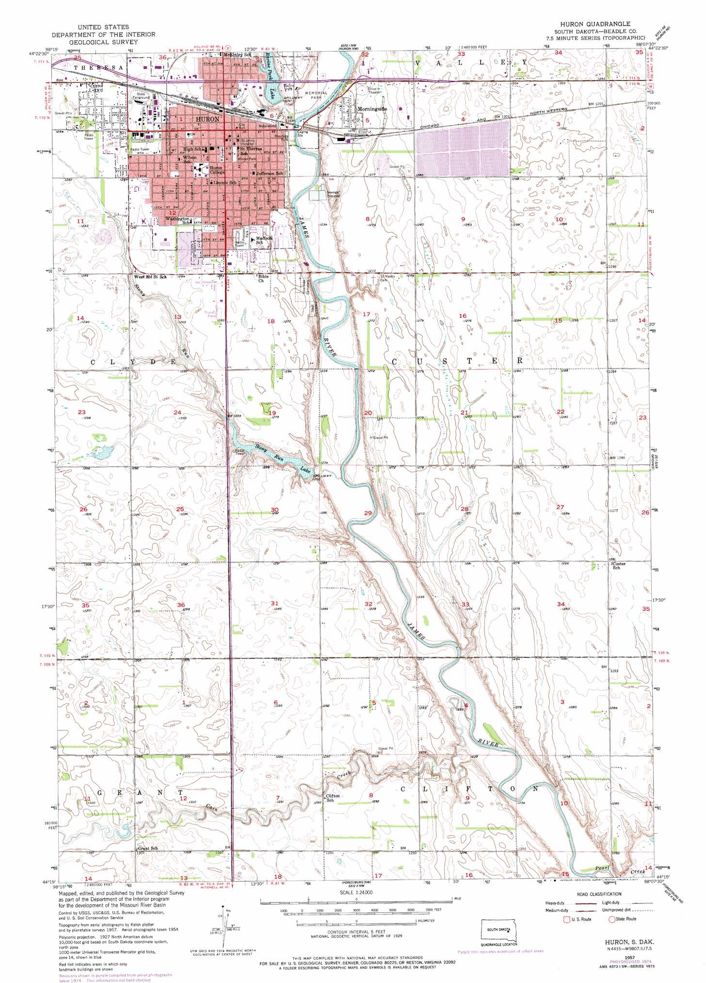
Huron Topo Map South Dakota
To zoom in, hover over the map of Huron
USGS Topo Quad 44098c2 - 1:24,000 scale
| Topo Map Name: | Huron |
| USGS Topo Quad ID: | 44098c2 |
| Print Size: | ca. 21 1/4" wide x 27" high |
| Southeast Coordinates: | 44.25° N latitude / 98.125° W longitude |
| Map Center Coordinates: | 44.3125° N latitude / 98.1875° W longitude |
| U.S. State: | SD |
| Filename: | o44098c2.jpg |
| Download Map JPG Image: | Huron topo map 1:24,000 scale |
| Map Type: | Topographic |
| Topo Series: | 7.5´ |
| Map Scale: | 1:24,000 |
| Source of Map Images: | United States Geological Survey (USGS) |
| Alternate Map Versions: |
Huron SD 1957, updated 1958 Download PDF Buy paper map Huron SD 1957, updated 1977 Download PDF Buy paper map Huron SD 2012 Download PDF Buy paper map Huron SD 2015 Download PDF Buy paper map |
1:24,000 Topo Quads surrounding Huron
Hitchcock Sw |
Hitchcock Se |
Lake Byron |
Lake Byron Se |
Staum Dam |
Wolsey |
Broadland |
Huron Nw |
Huron Ne |
Yale |
Virgil |
Wolsey Se |
Huron |
Cavour |
Pearl Creek Colony |
Woonsocket Nw |
Alpena |
Forestburg Nw |
Forestburg Ne |
Artesian Nw |
Lane |
Woonsocket |
Forestburg Sw |
Forestburg |
Artesian |
> Back to 44098a1 at 1:100,000 scale
> Back to 44098a1 at 1:250,000 scale
> Back to U.S. Topo Maps home
Huron topo map: Gazetteer
Huron: Dams
Ravine Park Dam elevation 380m 1246′Stoney Run Dam elevation 392m 1286′
Huron: Parks
Prospect Park elevation 390m 1279′Riverside Park elevation 378m 1240′
Huron: Populated Places
Huron elevation 390m 1279′Morningside elevation 388m 1272′
Huron: Reservoirs
Ravine Park Lake elevation 380m 1246′Stony Run Lake elevation 382m 1253′
Huron: Streams
Cain Creek elevation 372m 1220′Pearl Creek elevation 373m 1223′
Stony Run elevation 374m 1227′
Huron digital topo map on disk
Buy this Huron topo map showing relief, roads, GPS coordinates and other geographical features, as a high-resolution digital map file on DVD:
Eastern North Dakota & Eastern South Dakota
Buy digital topo maps: Eastern North Dakota & Eastern South Dakota