Huron Ne Topo Map South Dakota
To zoom in, hover over the map of Huron Ne
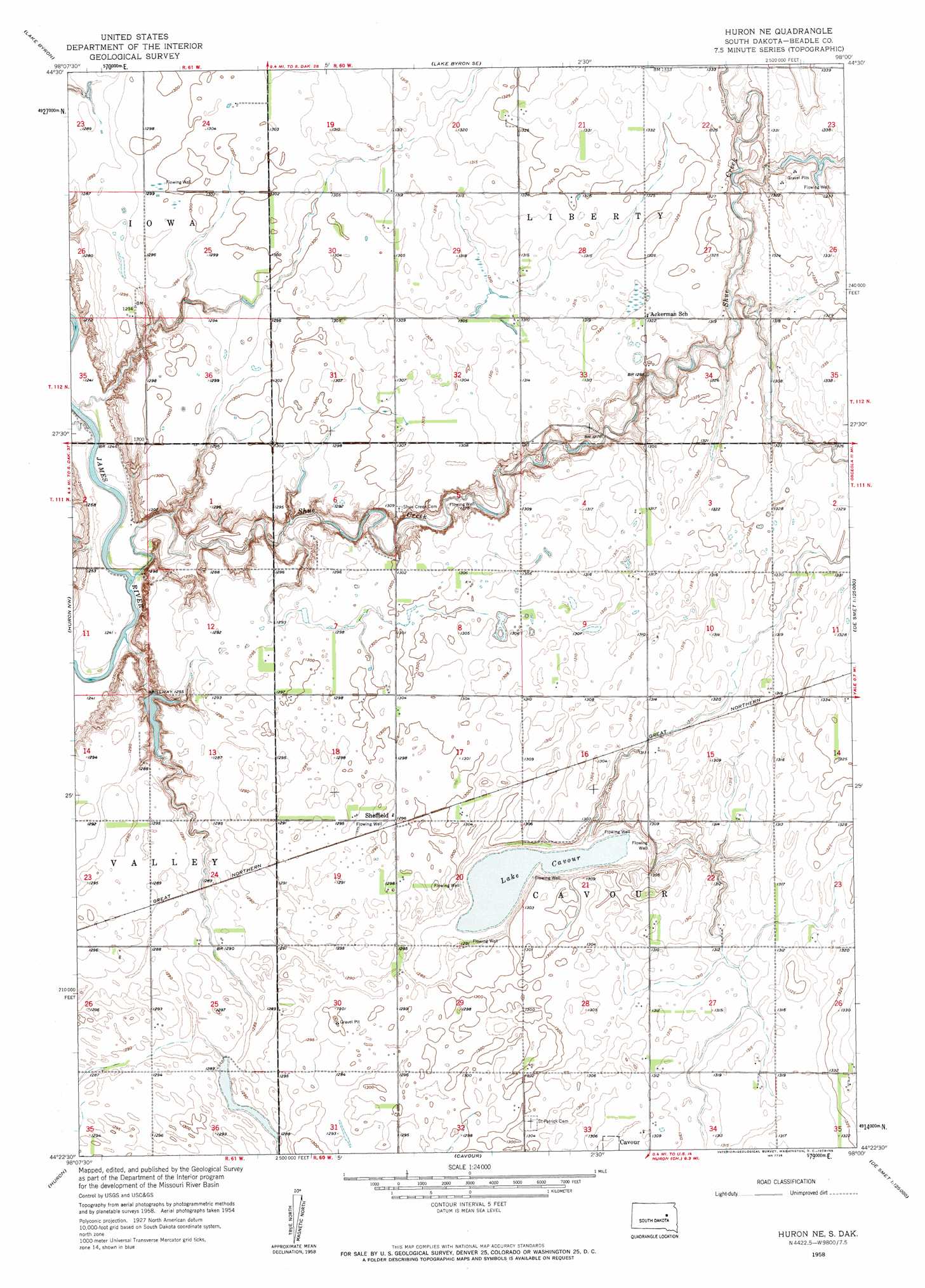
USGS Topo Quad 44098d1 - 1:24,000 scale
| Topo Map Name: | Huron Ne |
| USGS Topo Quad ID: | 44098d1 |
| Print Size: | ca. 21 1/4" wide x 27" high |
| Southeast Coordinates: | 44.375° N latitude / 98° W longitude |
| Map Center Coordinates: | 44.4375° N latitude / 98.0625° W longitude |
| U.S. State: | SD |
| Filename: | o44098d1.jpg |
| Download Map JPG Image: | Huron Ne topo map 1:24,000 scale |
| Map Type: | Topographic |
| Topo Series: | 7.5´ |
| Map Scale: | 1:24,000 |
| Source of Map Images: | United States Geological Survey (USGS) |
| Alternate Map Versions: |
Huron NE SD 1958, updated 1959 Download PDF Buy paper map Huron NE SD 2012 Download PDF Buy paper map Huron NE SD 2015 Download PDF Buy paper map |
1:24,000 Topo Quads surrounding Huron Ne
Spink Colony |
Lake Byron Nw |
Bloomfield |
Carpenter |
Carpenter Ne |
Hitchcock Se |
Lake Byron |
Lake Byron Se |
Staum Dam |
Carpenter Se |
Broadland |
Huron Nw |
Huron Ne |
Yale |
Bancroft West |
Wolsey Se |
Huron |
Cavour |
Pearl Creek Colony |
Iroquois |
Alpena |
Forestburg Nw |
Forestburg Ne |
Artesian Nw |
Artesian Ne |
> Back to 44098a1 at 1:100,000 scale
> Back to 44098a1 at 1:250,000 scale
> Back to U.S. Topo Maps home
Huron Ne topo map: Gazetteer
Huron Ne: Lakes
Lake Cavour elevation 389m 1276′Huron Ne: Populated Places
Sheffield elevation 395m 1295′Huron Ne: Streams
Shue Creek elevation 376m 1233′Huron Ne digital topo map on disk
Buy this Huron Ne topo map showing relief, roads, GPS coordinates and other geographical features, as a high-resolution digital map file on DVD:
Eastern North Dakota & Eastern South Dakota
Buy digital topo maps: Eastern North Dakota & Eastern South Dakota