Wessington Topo Map South Dakota
To zoom in, hover over the map of Wessington
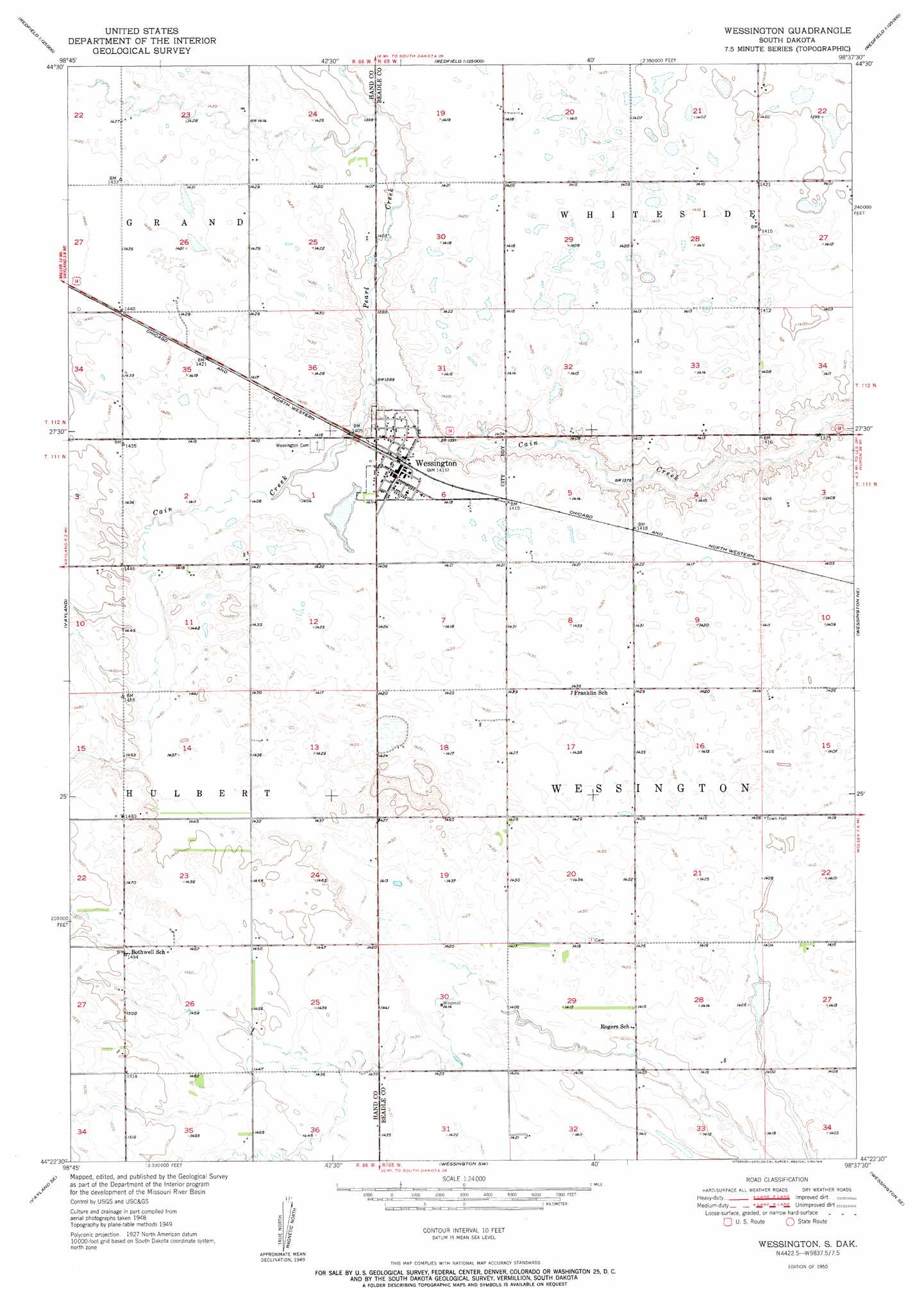
USGS Topo Quad 44098d6 - 1:24,000 scale
| Topo Map Name: | Wessington |
| USGS Topo Quad ID: | 44098d6 |
| Print Size: | ca. 21 1/4" wide x 27" high |
| Southeast Coordinates: | 44.375° N latitude / 98.625° W longitude |
| Map Center Coordinates: | 44.4375° N latitude / 98.6875° W longitude |
| U.S. State: | SD |
| Filename: | o44098d6.jpg |
| Download Map JPG Image: | Wessington topo map 1:24,000 scale |
| Map Type: | Topographic |
| Topo Series: | 7.5´ |
| Map Scale: | 1:24,000 |
| Source of Map Images: | United States Geological Survey (USGS) |
| Alternate Map Versions: |
Wessington SD 1950 Download PDF Buy paper map Wessington SD 1950 Download PDF Buy paper map Wessington SD 2012 Download PDF Buy paper map Wessington SD 2015 Download PDF Buy paper map |
1:24,000 Topo Quads surrounding Wessington
Miller Nw |
Burdette |
Tulare Nw |
Tulare |
Hitchcock |
Miller |
Miller Se |
Tulare Sw |
Tulare Se |
Hitchcock Sw |
Vayland Nw |
Vayland |
Wessington |
Wessington Ne |
Wolsey |
Vayland Sw |
Vayland Se |
Wessington Sw |
Wessington Se |
Virgil |
Mittelstedt Slough |
Cottonwood Lake |
Wessington Springs Nw |
Wessington Springs Ne |
Woonsocket Nw |
> Back to 44098a1 at 1:100,000 scale
> Back to 44098a1 at 1:250,000 scale
> Back to U.S. Topo Maps home
Wessington topo map: Gazetteer
Wessington: Populated Places
Wessington elevation 432m 1417′Wessington: Streams
Pearl Creek elevation 421m 1381′Wessington digital topo map on disk
Buy this Wessington topo map showing relief, roads, GPS coordinates and other geographical features, as a high-resolution digital map file on DVD:
Eastern North Dakota & Eastern South Dakota
Buy digital topo maps: Eastern North Dakota & Eastern South Dakota