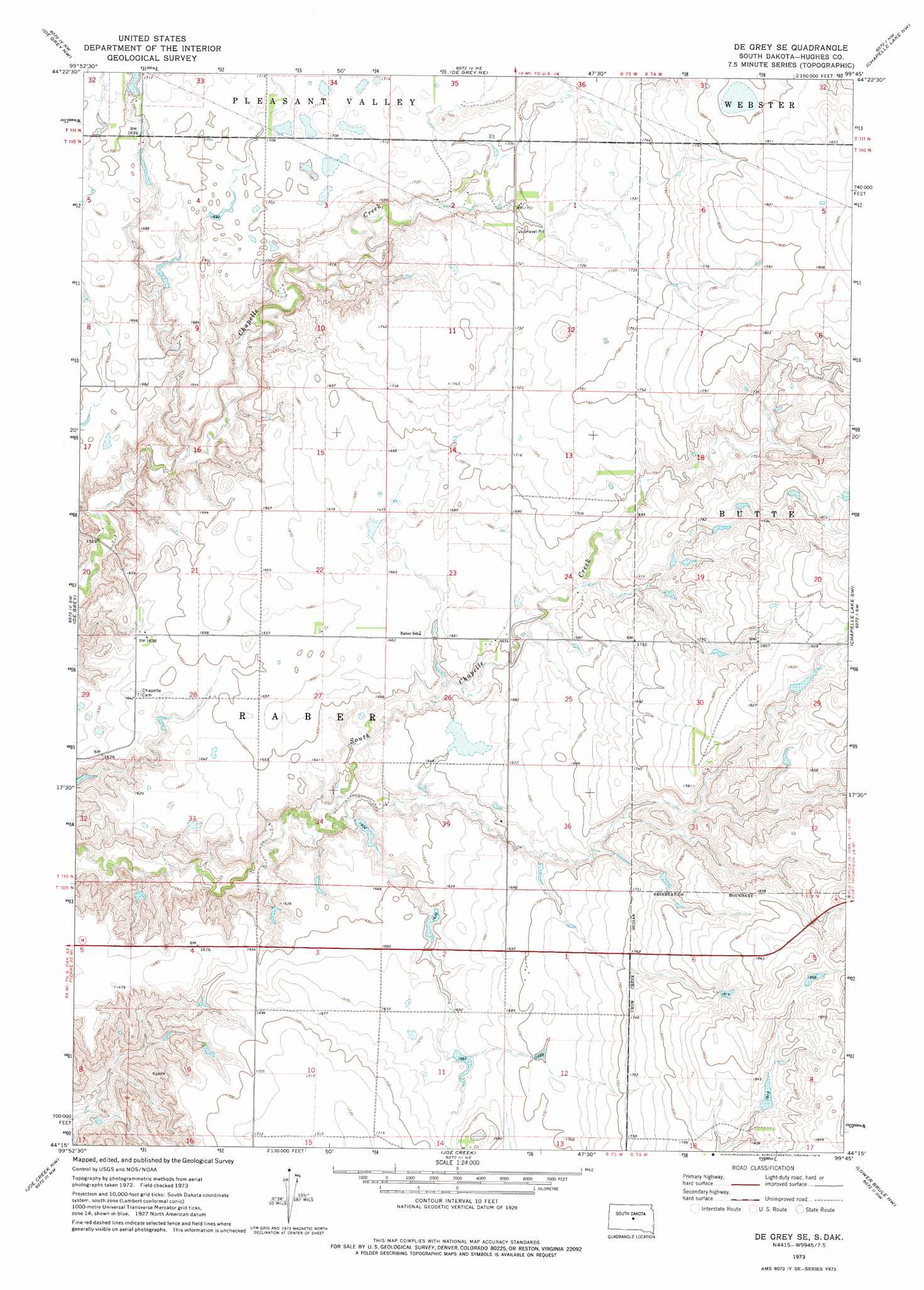
De Grey Se Topo Map South Dakota
To zoom in, hover over the map of De Grey Se
USGS Topo Quad 44099c7 - 1:24,000 scale
| Topo Map Name: | De Grey Se |
| USGS Topo Quad ID: | 44099c7 |
| Print Size: | ca. 21 1/4" wide x 27" high |
| Southeast Coordinates: | 44.25° N latitude / 99.75° W longitude |
| Map Center Coordinates: | 44.3125° N latitude / 99.8125° W longitude |
| U.S. State: | SD |
| Filename: | o44099c7.jpg |
| Download Map JPG Image: | De Grey Se topo map 1:24,000 scale |
| Map Type: | Topographic |
| Topo Series: | 7.5´ |
| Map Scale: | 1:24,000 |
| Source of Map Images: | United States Geological Survey (USGS) |
| Alternate Map Versions: |
De Grey SE SD 1973, updated 1976 Download PDF Buy paper map De Grey SE SD 2012 Download PDF Buy paper map De Grey SE SD 2015 Download PDF Buy paper map |
1:24,000 Topo Quads surrounding De Grey Se
Onida Se |
Blunt |
Blunt Se |
Harrold |
Holabird |
Canning |
De Grey Nw |
De Grey Ne |
Chapelle Lake Nw |
Chapelle Lake |
Rousseau |
De Grey |
De Grey Se |
Chapelle Lake Sw |
Chapelle Lake Se |
Fort George Butte |
Joe Creek Nw |
Joe Creek |
Lower Brule Nw |
Lower Brule Ne |
Fort George Butte Se |
Joe Creek Sw |
Joe Creek Se |
Lower Brule Sw |
Lower Brule |
> Back to 44099a1 at 1:100,000 scale
> Back to 44098a1 at 1:250,000 scale
> Back to U.S. Topo Maps home
De Grey Se topo map: Gazetteer
De Grey Se: Dams
Charles Hyde Dam elevation 510m 1673′Gladys Feller Dam elevation 562m 1843′
Rufus Gray Dam elevation 495m 1624′
Wilbur Russell Dam elevation 520m 1706′
De Grey Se: Post Offices
Giddings Post Office (historical) elevation 506m 1660′De Grey Se digital topo map on disk
Buy this De Grey Se topo map showing relief, roads, GPS coordinates and other geographical features, as a high-resolution digital map file on DVD:
Eastern North Dakota & Eastern South Dakota
Buy digital topo maps: Eastern North Dakota & Eastern South Dakota