Chapelle Lake Nw Topo Map South Dakota
To zoom in, hover over the map of Chapelle Lake Nw
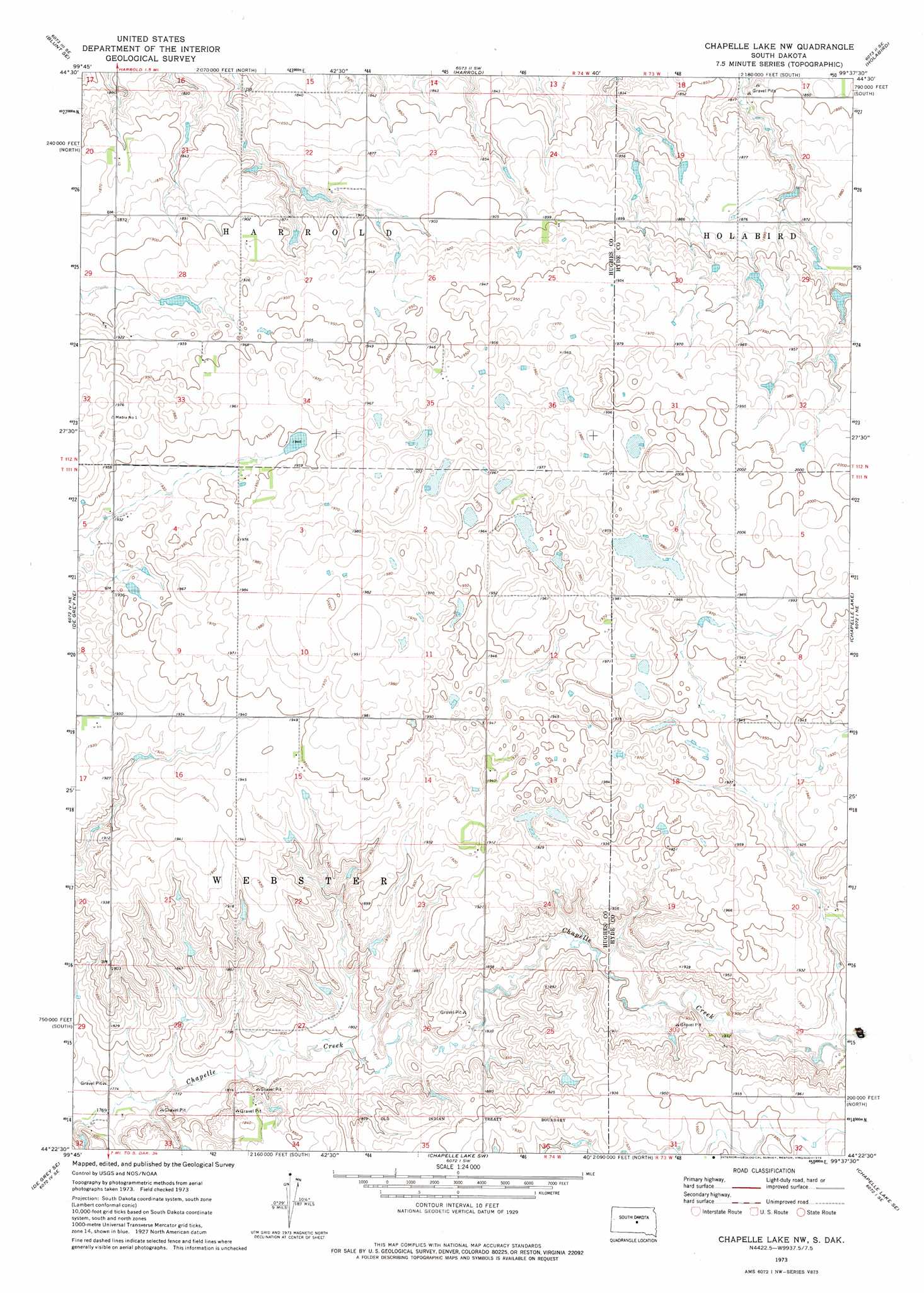
USGS Topo Quad 44099d6 - 1:24,000 scale
| Topo Map Name: | Chapelle Lake Nw |
| USGS Topo Quad ID: | 44099d6 |
| Print Size: | ca. 21 1/4" wide x 27" high |
| Southeast Coordinates: | 44.375° N latitude / 99.625° W longitude |
| Map Center Coordinates: | 44.4375° N latitude / 99.6875° W longitude |
| U.S. State: | SD |
| Filename: | o44099d6.jpg |
| Download Map JPG Image: | Chapelle Lake Nw topo map 1:24,000 scale |
| Map Type: | Topographic |
| Topo Series: | 7.5´ |
| Map Scale: | 1:24,000 |
| Source of Map Images: | United States Geological Survey (USGS) |
| Alternate Map Versions: |
Chapelle Lake NW SD 1973, updated 1976 Download PDF Buy paper map Chapelle Lake NW SD 2012 Download PDF Buy paper map Chapelle Lake NW SD 2015 Download PDF Buy paper map |
1:24,000 Topo Quads surrounding Chapelle Lake Nw
Blunt Nw |
Blunt Ne |
Harrold Nw |
Harrold Ne |
Mitchell Lake |
Blunt |
Blunt Se |
Harrold |
Holabird |
Highmore |
De Grey Nw |
De Grey Ne |
Chapelle Lake Nw |
Chapelle Lake |
Macs Corner Nw |
De Grey |
De Grey Se |
Chapelle Lake Sw |
Chapelle Lake Se |
Macs Corner |
Joe Creek Nw |
Joe Creek |
Lower Brule Nw |
Lower Brule Ne |
Stephan |
> Back to 44099a1 at 1:100,000 scale
> Back to 44098a1 at 1:250,000 scale
> Back to U.S. Topo Maps home
Chapelle Lake Nw digital topo map on disk
Buy this Chapelle Lake Nw topo map showing relief, roads, GPS coordinates and other geographical features, as a high-resolution digital map file on DVD:
Eastern North Dakota & Eastern South Dakota
Buy digital topo maps: Eastern North Dakota & Eastern South Dakota