Blunt Se Topo Map South Dakota
To zoom in, hover over the map of Blunt Se
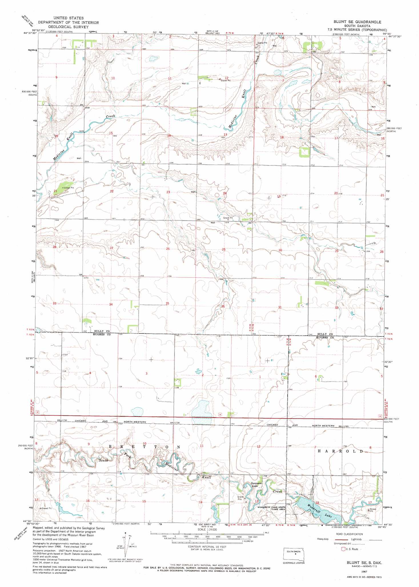
USGS Topo Quad 44099e7 - 1:24,000 scale
| Topo Map Name: | Blunt Se |
| USGS Topo Quad ID: | 44099e7 |
| Print Size: | ca. 21 1/4" wide x 27" high |
| Southeast Coordinates: | 44.5° N latitude / 99.75° W longitude |
| Map Center Coordinates: | 44.5625° N latitude / 99.8125° W longitude |
| U.S. State: | SD |
| Filename: | o44099e7.jpg |
| Download Map JPG Image: | Blunt Se topo map 1:24,000 scale |
| Map Type: | Topographic |
| Topo Series: | 7.5´ |
| Map Scale: | 1:24,000 |
| Source of Map Images: | United States Geological Survey (USGS) |
| Alternate Map Versions: |
Blunt SE SD 1967, updated 1968 Download PDF Buy paper map Blunt SE SD 2012 Download PDF Buy paper map Blunt SE SD 2015 Download PDF Buy paper map |
1:24,000 Topo Quads surrounding Blunt Se
Agar |
Gettysburg Muni Airport Sw |
Gettysburg Muni Airport Se |
Thomas Lake Sw |
Thomas Lake |
Onida |
Blunt Nw |
Blunt Ne |
Harrold Nw |
Harrold Ne |
Onida Se |
Blunt |
Blunt Se |
Harrold |
Holabird |
Canning |
De Grey Nw |
De Grey Ne |
Chapelle Lake Nw |
Chapelle Lake |
Rousseau |
De Grey |
De Grey Se |
Chapelle Lake Sw |
Chapelle Lake Se |
> Back to 44099e1 at 1:100,000 scale
> Back to 44098a1 at 1:250,000 scale
> Back to U.S. Topo Maps home
Blunt Se topo map: Gazetteer
Blunt Se: Airports
Harrold Municipal Airport elevation 543m 1781′Blunt Se: Dams
Heintz Number 1 Dam elevation 528m 1732′Mercer Number 1 Dam elevation 526m 1725′
Woodruff Dam elevation 531m 1742′
Blunt Se: Parks
Woodruff Lake State Game Area elevation 531m 1742′Blunt Se: Reservoirs
Swanson Lake elevation 522m 1712′Woodruff Lake elevation 531m 1742′
Blunt Se digital topo map on disk
Buy this Blunt Se topo map showing relief, roads, GPS coordinates and other geographical features, as a high-resolution digital map file on DVD:
Eastern North Dakota & Eastern South Dakota
Buy digital topo maps: Eastern North Dakota & Eastern South Dakota