Mitchell Lake Topo Map South Dakota
To zoom in, hover over the map of Mitchell Lake
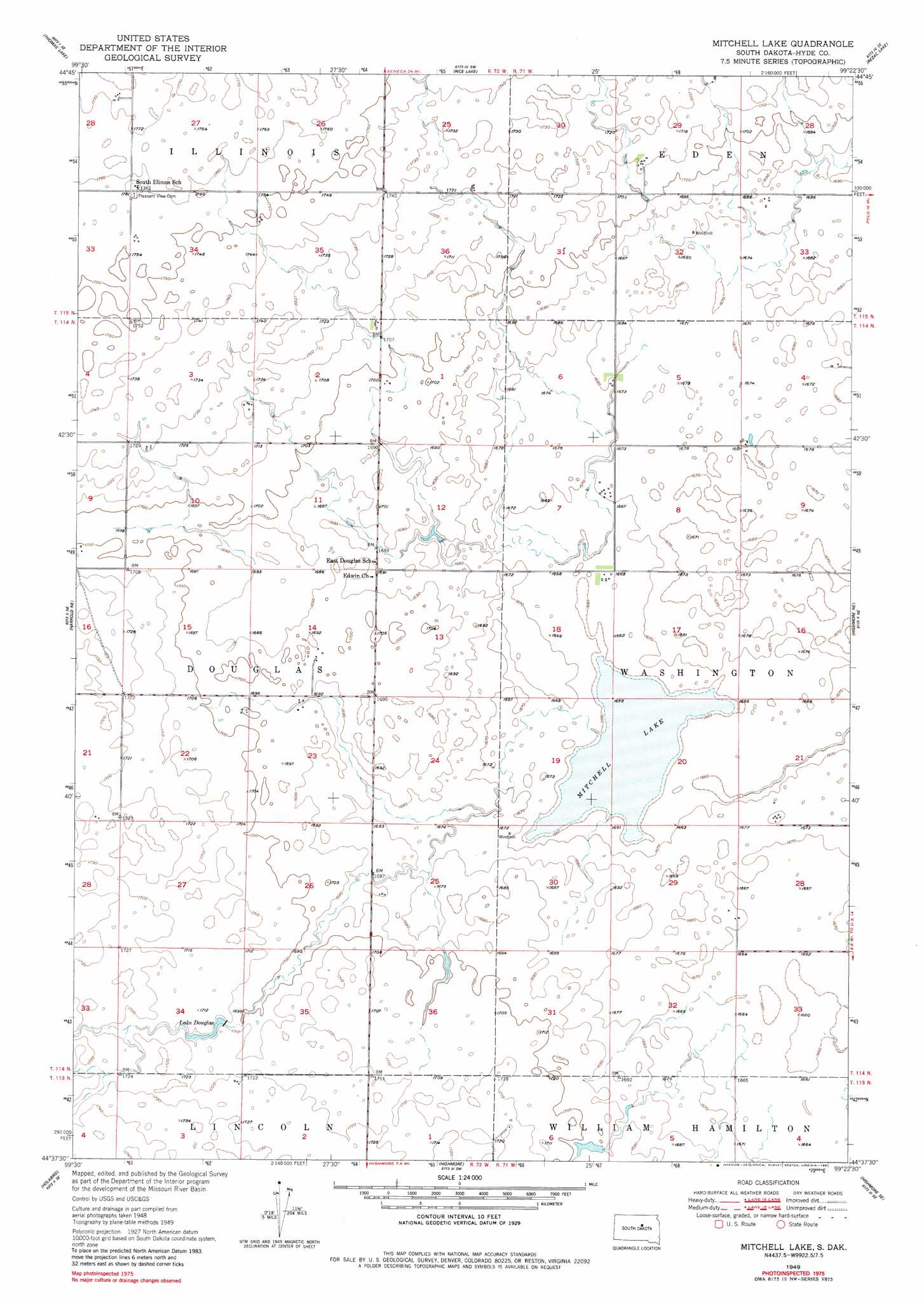
USGS Topo Quad 44099f4 - 1:24,000 scale
| Topo Map Name: | Mitchell Lake |
| USGS Topo Quad ID: | 44099f4 |
| Print Size: | ca. 21 1/4" wide x 27" high |
| Southeast Coordinates: | 44.625° N latitude / 99.375° W longitude |
| Map Center Coordinates: | 44.6875° N latitude / 99.4375° W longitude |
| U.S. State: | SD |
| Filename: | o44099f4.jpg |
| Download Map JPG Image: | Mitchell Lake topo map 1:24,000 scale |
| Map Type: | Topographic |
| Topo Series: | 7.5´ |
| Map Scale: | 1:24,000 |
| Source of Map Images: | United States Geological Survey (USGS) |
| Alternate Map Versions: |
Mitchell Lake SD 1949, updated 1981 Download PDF Buy paper map Mitchell Lake SD 1950 Download PDF Buy paper map Mitchell Lake SD 2012 Download PDF Buy paper map Mitchell Lake SD 2015 Download PDF Buy paper map |
1:24,000 Topo Quads surrounding Mitchell Lake
Thomas Lake Nw |
Bald Hills |
Rezac Lake Nw |
Rezac Lake Ne |
Orient Nw |
Thomas Lake Sw |
Thomas Lake |
Rice Lake |
Rezac Lake |
Orient Sw |
Harrold Nw |
Harrold Ne |
Mitchell Lake |
Highmore Ne |
Ree Heights Nw |
Harrold |
Holabird |
Highmore |
Highmore Se |
Ree Heights |
Chapelle Lake Nw |
Chapelle Lake |
Macs Corner Nw |
Macs Corner Ne |
Miller Dale Colony Nw |
> Back to 44099e1 at 1:100,000 scale
> Back to 44098a1 at 1:250,000 scale
> Back to U.S. Topo Maps home
Mitchell Lake topo map: Gazetteer
Mitchell Lake: Dams
C Clement Dam elevation 512m 1679′D Faulstich Dam elevation 518m 1699′
Mayberry Park Dam elevation 513m 1683′
Mitchell Lake: Lakes
Mitchell Lake elevation 505m 1656′Mitchell Lake: Post Offices
Edwin Post Office (historical) elevation 512m 1679′Mitchell Lake: Reservoirs
Lake Douglas elevation 519m 1702′Mitchell Lake digital topo map on disk
Buy this Mitchell Lake topo map showing relief, roads, GPS coordinates and other geographical features, as a high-resolution digital map file on DVD:
Eastern North Dakota & Eastern South Dakota
Buy digital topo maps: Eastern North Dakota & Eastern South Dakota