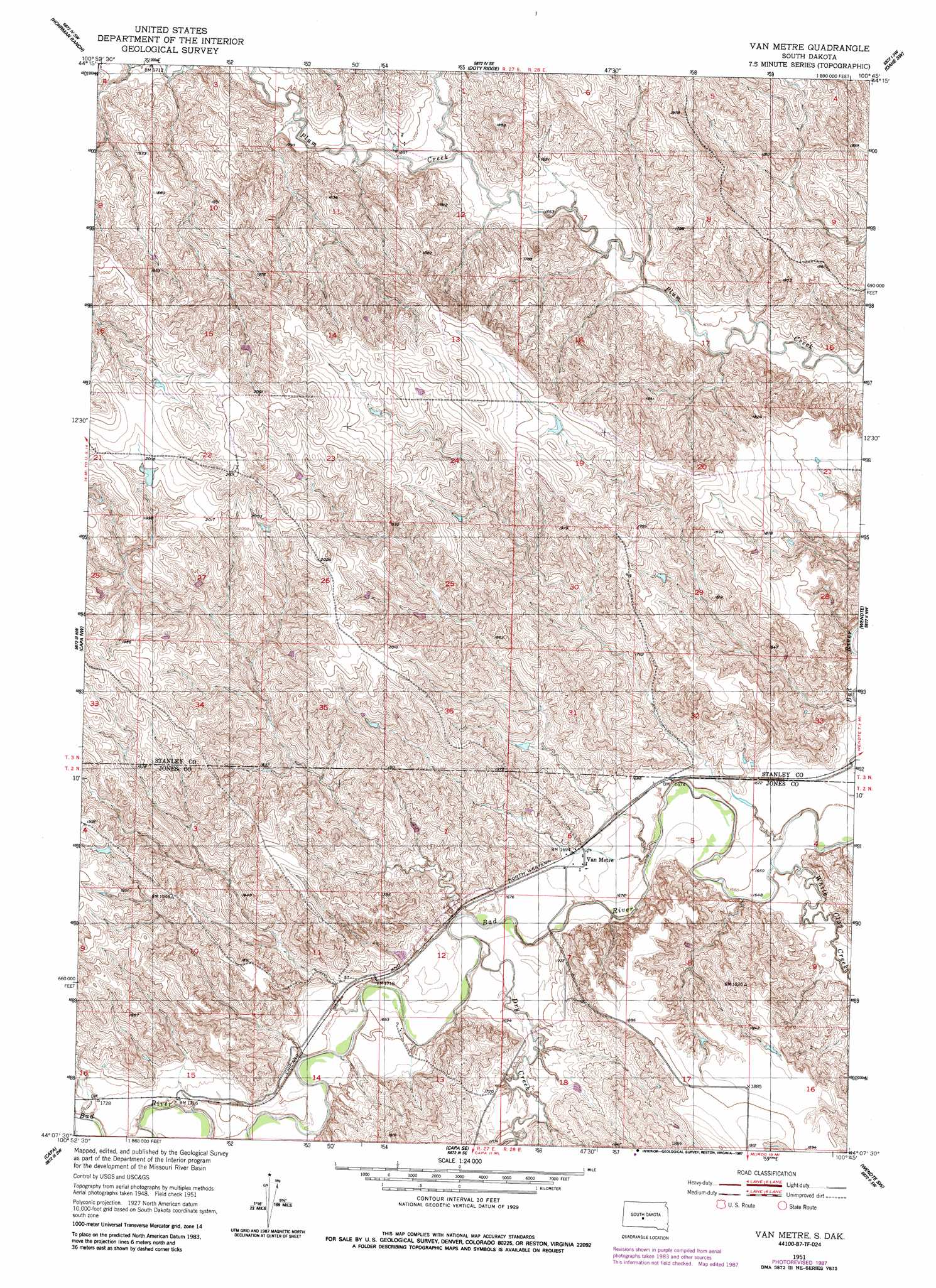
Van Metre Topo Map South Dakota
To zoom in, hover over the map of Van Metre
USGS Topo Quad 44100b7 - 1:24,000 scale
| Topo Map Name: | Van Metre |
| USGS Topo Quad ID: | 44100b7 |
| Print Size: | ca. 21 1/4" wide x 27" high |
| Southeast Coordinates: | 44.125° N latitude / 100.75° W longitude |
| Map Center Coordinates: | 44.1875° N latitude / 100.8125° W longitude |
| U.S. State: | SD |
| Filename: | o44100b7.jpg |
| Download Map JPG Image: | Van Metre topo map 1:24,000 scale |
| Map Type: | Topographic |
| Topo Series: | 7.5´ |
| Map Scale: | 1:24,000 |
| Source of Map Images: | United States Geological Survey (USGS) |
| Alternate Map Versions: |
Van Metre SD 1951, updated 1953 Download PDF Buy paper map Van Metre SD 1951, updated 1987 Download PDF Buy paper map Van Metre SD 2012 Download PDF Buy paper map Van Metre SD 2015 Download PDF Buy paper map |
1:24,000 Topo Quads surrounding Van Metre
Hayes North |
Princes Ranch |
Lacy |
Willow Creek Butte |
|
Hayes South |
Hohrman Ranch |
Doty Ridge |
Oahe Sw |
Teton |
Midland Ne |
Capa Nw |
Van Metre |
Wendte |
Wendte Ne |
Midland Se |
Capa |
Capa Se |
Wendte Sw |
Wendte Se |
Stamford |
Okaton |
Okaton Ne |
Murdo |
Draper |
> Back to 44100a1 at 1:100,000 scale
> Back to 44100a1 at 1:250,000 scale
> Back to U.S. Topo Maps home
Van Metre topo map: Gazetteer
Van Metre: Dams
Leslie Caldwell Dam elevation 615m 2017′Louis Bonhorst Number 2 Dam elevation 570m 1870′
Louis Bonhorst Number 3 Dam elevation 606m 1988′
Louis Bonhorst Number 4 Dam elevation 606m 1988′
Olson Number 3 Dam elevation 515m 1689′
Van Metre: Populated Places
Van Metre elevation 515m 1689′Van Metre: Streams
Brush Creek elevation 506m 1660′Dry Creek elevation 505m 1656′
White Clay Creek elevation 500m 1640′
Van Metre digital topo map on disk
Buy this Van Metre topo map showing relief, roads, GPS coordinates and other geographical features, as a high-resolution digital map file on DVD:
Eastern North Dakota & Eastern South Dakota
Buy digital topo maps: Eastern North Dakota & Eastern South Dakota