Rousseau Topo Map South Dakota
To zoom in, hover over the map of Rousseau
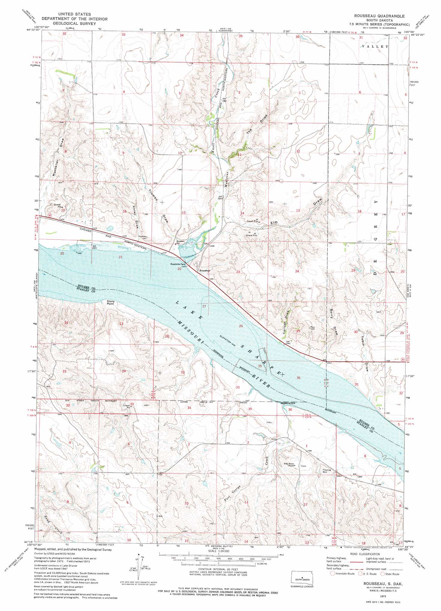
USGS Topo Quad 44100c1 - 1:24,000 scale
| Topo Map Name: | Rousseau |
| USGS Topo Quad ID: | 44100c1 |
| Print Size: | ca. 21 1/4" wide x 27" high |
| Southeast Coordinates: | 44.25° N latitude / 100° W longitude |
| Map Center Coordinates: | 44.3125° N latitude / 100.0625° W longitude |
| U.S. State: | SD |
| Filename: | o44100c1.jpg |
| Download Map JPG Image: | Rousseau topo map 1:24,000 scale |
| Map Type: | Topographic |
| Topo Series: | 7.5´ |
| Map Scale: | 1:24,000 |
| Source of Map Images: | United States Geological Survey (USGS) |
| Alternate Map Versions: |
Rousseau SD 1973, updated 1976 Download PDF Buy paper map Rousseau SD 2012 Download PDF Buy paper map Rousseau SD 2015 Download PDF Buy paper map |
| FStopo: | US Forest Service topo Rousseau is available: Download FStopo PDF Download FStopo TIF |
1:24,000 Topo Quads surrounding Rousseau
Okobojo Se |
Onida Sw |
Onida Se |
Blunt |
Blunt Se |
Pierre Ne |
Canning Nw |
Canning |
De Grey Nw |
De Grey Ne |
Pierre |
Antelope Island |
Rousseau |
De Grey |
De Grey Se |
Pierre 3 Ne |
Fort George Butte Nw |
Fort George Butte |
Joe Creek Nw |
Joe Creek |
Pierre 3 Se |
Fort George Butte Sw |
Fort George Butte Se |
Joe Creek Sw |
Joe Creek Se |
> Back to 44100a1 at 1:100,000 scale
> Back to 44100a1 at 1:250,000 scale
> Back to U.S. Topo Maps home
Rousseau topo map: Gazetteer
Rousseau: Capes
Stony Point elevation 444m 1456′Rousseau: Islands
Fort George Island (historical) elevation 433m 1420′Rousseau: Parks
Rousseau Recreation and Overlook Area elevation 433m 1420′Rousseau: Populated Places
Rousseau elevation 446m 1463′Rousseau: Post Offices
Rousseau Station and Post Office (historical) elevation 440m 1443′Rousseau: Streams
Fort George Creek elevation 433m 1420′Medicine Knoll Creek elevation 437m 1433′
Rousseau: Valleys
Berry Draw elevation 438m 1437′Carlson Draw elevation 439m 1440′
Elm Draw elevation 440m 1443′
Kirley Draw elevation 439m 1440′
The Drips elevation 456m 1496′
Tobin Draw elevation 434m 1423′
Trumbo Draw elevation 434m 1423′
Rousseau digital topo map on disk
Buy this Rousseau topo map showing relief, roads, GPS coordinates and other geographical features, as a high-resolution digital map file on DVD:
Eastern North Dakota & Eastern South Dakota
Buy digital topo maps: Eastern North Dakota & Eastern South Dakota