Pierre Topo Map South Dakota
To zoom in, hover over the map of Pierre
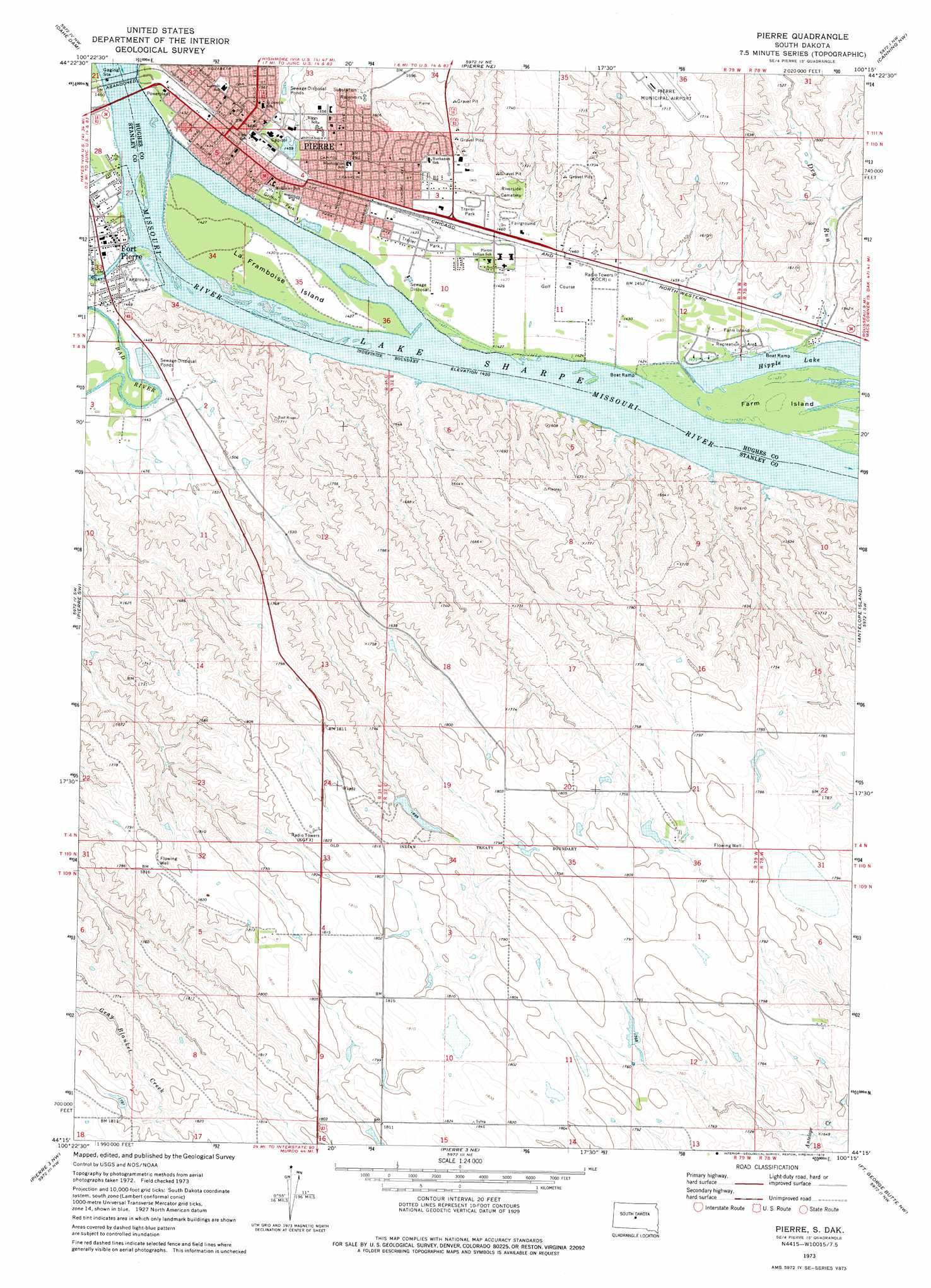
USGS Topo Quad 44100c3 - 1:24,000 scale
| Topo Map Name: | Pierre |
| USGS Topo Quad ID: | 44100c3 |
| Print Size: | ca. 21 1/4" wide x 27" high |
| Southeast Coordinates: | 44.25° N latitude / 100.25° W longitude |
| Map Center Coordinates: | 44.3125° N latitude / 100.3125° W longitude |
| U.S. State: | SD |
| Filename: | o44100c3.jpg |
| Download Map JPG Image: | Pierre topo map 1:24,000 scale |
| Map Type: | Topographic |
| Topo Series: | 7.5´ |
| Map Scale: | 1:24,000 |
| Source of Map Images: | United States Geological Survey (USGS) |
| Alternate Map Versions: |
Pierre SD 1973, updated 1976 Download PDF Buy paper map Pierre SD 2012 Download PDF Buy paper map Pierre SD 2015 Download PDF Buy paper map |
| FStopo: | US Forest Service topo Pierre is available: Download FStopo PDF Download FStopo TIF |
1:24,000 Topo Quads surrounding Pierre
Iron Post Buttes Se |
Okobojo Sw |
Okobojo Se |
Onida Sw |
Onida Se |
Willow Creek Butte |
Oahe Dam |
Pierre Ne |
Canning Nw |
Canning |
Teton |
Pierre Sw |
Pierre |
Antelope Island |
Rousseau |
Wendte Ne |
Pierre 3 Nw |
Pierre 3 Ne |
Fort George Butte Nw |
Fort George Butte |
Wendte Se |
Pierre 3 Sw |
Pierre 3 Se |
Fort George Butte Sw |
Fort George Butte Se |
> Back to 44100a1 at 1:100,000 scale
> Back to 44100a1 at 1:250,000 scale
> Back to U.S. Topo Maps home
Pierre topo map: Gazetteer
Pierre: Bridges
Pierre Bridge (historical) elevation 433m 1420′Pierre: Dams
Joe Schomer 1 Dam elevation 538m 1765′Joe Schomer 2 Dam elevation 538m 1765′
Red Plum Dam elevation 520m 1706′
Pierre: Islands
Farm Island elevation 434m 1423′La Framboise Island elevation 435m 1427′
Marion Island (historical) elevation 436m 1430′
Pierre: Parks
Farm Island Recreation Area elevation 435m 1427′Griffin Park elevation 437m 1433′
Le Framboise Island Recreation Area elevation 435m 1427′
Pierre Marina Recreational Area elevation 433m 1420′
Pierre: Populated Places
Fort Pierre elevation 437m 1433′Pierre elevation 451m 1479′
Pierre: Streams
Bad River elevation 433m 1420′Dry Run elevation 434m 1423′
Pierre: Valleys
Hilgers Gulch elevation 446m 1463′Pierre digital topo map on disk
Buy this Pierre topo map showing relief, roads, GPS coordinates and other geographical features, as a high-resolution digital map file on DVD:
Eastern North Dakota & Eastern South Dakota
Buy digital topo maps: Eastern North Dakota & Eastern South Dakota