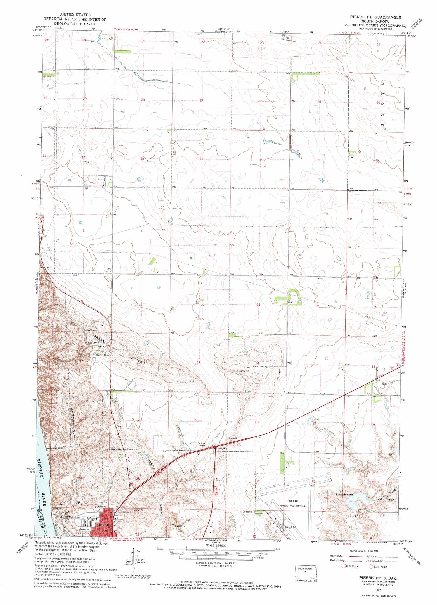
Pierre Ne Topo Map South Dakota
To zoom in, hover over the map of Pierre Ne
USGS Topo Quad 44100d3 - 1:24,000 scale
| Topo Map Name: | Pierre Ne |
| USGS Topo Quad ID: | 44100d3 |
| Print Size: | ca. 21 1/4" wide x 27" high |
| Southeast Coordinates: | 44.375° N latitude / 100.25° W longitude |
| Map Center Coordinates: | 44.4375° N latitude / 100.3125° W longitude |
| U.S. State: | SD |
| Filename: | o44100d3.jpg |
| Download Map JPG Image: | Pierre Ne topo map 1:24,000 scale |
| Map Type: | Topographic |
| Topo Series: | 7.5´ |
| Map Scale: | 1:24,000 |
| Source of Map Images: | United States Geological Survey (USGS) |
| Alternate Map Versions: |
Pierre NE SD 1967, updated 1968 Download PDF Buy paper map Pierre NE SD 2012 Download PDF Buy paper map Pierre NE SD 2015 Download PDF Buy paper map |
1:24,000 Topo Quads surrounding Pierre Ne
Mail Shack Creek |
Okobojo |
Okobojo Ne |
Sully Lake |
Onida |
Iron Post Buttes Se |
Okobojo Sw |
Okobojo Se |
Onida Sw |
Onida Se |
Willow Creek Butte |
Oahe Dam |
Pierre Ne |
Canning Nw |
Canning |
Teton |
Pierre Sw |
Pierre |
Antelope Island |
Rousseau |
Wendte Ne |
Pierre 3 Nw |
Pierre 3 Ne |
Fort George Butte Nw |
Fort George Butte |
> Back to 44100a1 at 1:100,000 scale
> Back to 44100a1 at 1:250,000 scale
> Back to U.S. Topo Maps home
Pierre Ne topo map: Gazetteer
Pierre Ne: Airports
Pierre Municipal Airport elevation 524m 1719′Pierre Ne: Dams
Arikara Dam elevation 479m 1571′Pierre Ne: Reservoirs
Lake Arikara elevation 479m 1571′Pierre Ne: Summits
Snake Butte elevation 537m 1761′Snake Butte elevation 586m 1922′
Pierre Ne: Valleys
Monkhouse Gulch elevation 437m 1433′Whiskey Gulch elevation 434m 1423′
Pierre Ne digital topo map on disk
Buy this Pierre Ne topo map showing relief, roads, GPS coordinates and other geographical features, as a high-resolution digital map file on DVD:
Eastern North Dakota & Eastern South Dakota
Buy digital topo maps: Eastern North Dakota & Eastern South Dakota