Onida Topo Map South Dakota
To zoom in, hover over the map of Onida
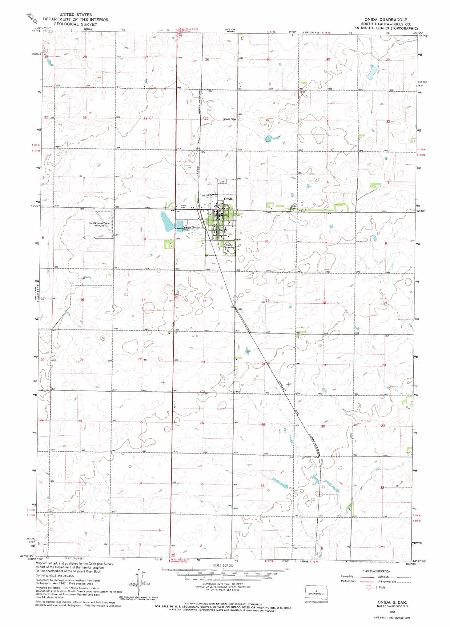
USGS Topo Quad 44100f1 - 1:24,000 scale
| Topo Map Name: | Onida |
| USGS Topo Quad ID: | 44100f1 |
| Print Size: | ca. 21 1/4" wide x 27" high |
| Southeast Coordinates: | 44.625° N latitude / 100° W longitude |
| Map Center Coordinates: | 44.6875° N latitude / 100.0625° W longitude |
| U.S. State: | SD |
| Filename: | o44100f1.jpg |
| Download Map JPG Image: | Onida topo map 1:24,000 scale |
| Map Type: | Topographic |
| Topo Series: | 7.5´ |
| Map Scale: | 1:24,000 |
| Source of Map Images: | United States Geological Survey (USGS) |
| Alternate Map Versions: |
Onida SD 2012 Download PDF Buy paper map Onida SD 2015 Download PDF Buy paper map |
1:24,000 Topo Quads surrounding Onida
Artichoke Butte Ne |
Agar Nw |
Agar Ne |
Gettysburg Muni Airport |
Gettysburg Muni Airport Ne |
Artichoke Butte |
Agar Sw |
Agar |
Gettysburg Muni Airport Sw |
Gettysburg Muni Airport Se |
Okobojo Ne |
Sully Lake |
Onida |
Blunt Nw |
Blunt Ne |
Okobojo Se |
Onida Sw |
Onida Se |
Blunt |
Blunt Se |
Pierre Ne |
Canning Nw |
Canning |
De Grey Nw |
De Grey Ne |
> Back to 44100e1 at 1:100,000 scale
> Back to 44100a1 at 1:250,000 scale
> Back to U.S. Topo Maps home
Onida topo map: Gazetteer
Onida: Airports
Nelson Landing Strip elevation 567m 1860′Onida Municipal Airport elevation 573m 1879′
Onida: Populated Places
Onida elevation 571m 1873′Onida: Post Offices
Ney Post Office (historical) elevation 544m 1784′Onida digital topo map on disk
Buy this Onida topo map showing relief, roads, GPS coordinates and other geographical features, as a high-resolution digital map file on DVD:
Eastern North Dakota & Eastern South Dakota
Buy digital topo maps: Eastern North Dakota & Eastern South Dakota