No Heart Creek Sw Topo Map South Dakota
To zoom in, hover over the map of No Heart Creek Sw
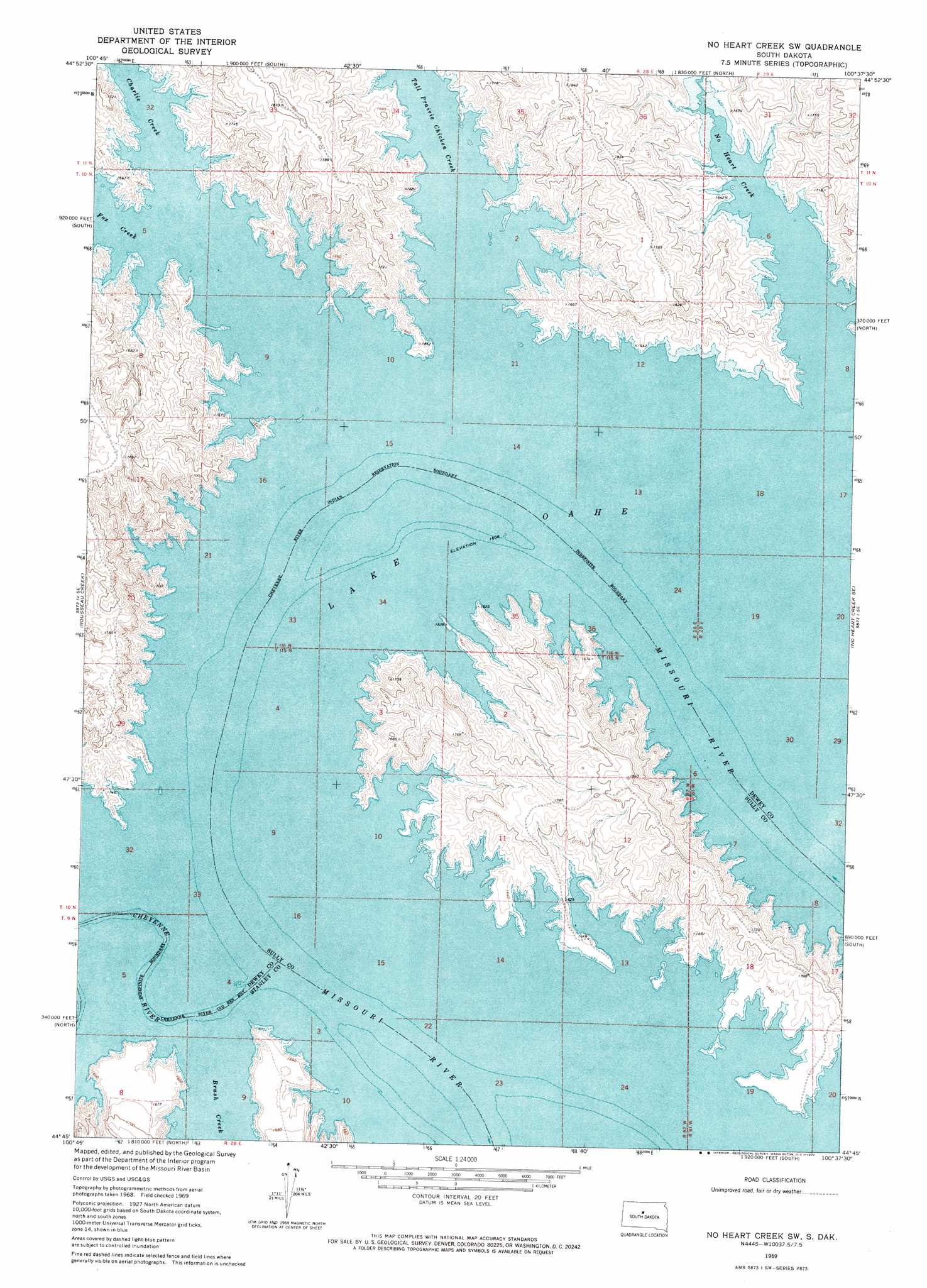
USGS Topo Quad 44100g6 - 1:24,000 scale
| Topo Map Name: | No Heart Creek Sw |
| USGS Topo Quad ID: | 44100g6 |
| Print Size: | ca. 21 1/4" wide x 27" high |
| Southeast Coordinates: | 44.75° N latitude / 100.625° W longitude |
| Map Center Coordinates: | 44.8125° N latitude / 100.6875° W longitude |
| U.S. State: | SD |
| Filename: | o44100g6.jpg |
| Download Map JPG Image: | No Heart Creek Sw topo map 1:24,000 scale |
| Map Type: | Topographic |
| Topo Series: | 7.5´ |
| Map Scale: | 1:24,000 |
| Source of Map Images: | United States Geological Survey (USGS) |
| Alternate Map Versions: |
No Heart Creek SW SD 1969, updated 1972 Download PDF Buy paper map No Heart Creek SW SD 2012 Download PDF Buy paper map No Heart Creek SW SD 2015 Download PDF Buy paper map |
1:24,000 Topo Quads surrounding No Heart Creek Sw
Ridgeview Sw |
Ridgeview |
La Plant Sw |
Stove Creek |
Patch Skin Buttes Sw |
Rousseau Creek Nw |
Charlie Creek |
No Heart Creek |
No Heart Creek Ne |
Artichoke Butte Nw |
Rousseau Creek Sw |
Rousseau Creek |
No Heart Creek Sw |
No Heart Creek Se |
Artichoke Butte Sw |
Crokett Mountains |
Mission Ridge |
Iron Post Buttes |
Mail Shack Creek |
Okobojo |
Standing Butte Sw |
Standing Butte |
Iron Post Buttes Sw |
Iron Post Buttes Se |
Okobojo Sw |
> Back to 44100e1 at 1:100,000 scale
> Back to 44100a1 at 1:250,000 scale
> Back to U.S. Topo Maps home
No Heart Creek Sw topo map: Gazetteer
No Heart Creek Sw: Bends
Angel Bottom (historical) elevation 491m 1610′Little Bend elevation 491m 1610′
Little Bend elevation 491m 1610′
No Heart Creek Sw: Parks
Little Bend Recreational Area elevation 496m 1627′No Heart Creek Sw: Post Offices
Little Bend Post Office (historical) elevation 491m 1610′No Heart Creek Sw: Streams
Brush Creek elevation 491m 1610′Charlie Creek elevation 491m 1610′
Cheyenne River elevation 491m 1610′
Cheyenne River elevation 491m 1610′
Fox Creek elevation 491m 1610′
No Heart Creek elevation 491m 1610′
Tall Prairie Chicken Creek elevation 491m 1610′
No Heart Creek Sw digital topo map on disk
Buy this No Heart Creek Sw topo map showing relief, roads, GPS coordinates and other geographical features, as a high-resolution digital map file on DVD:
Eastern North Dakota & Eastern South Dakota
Buy digital topo maps: Eastern North Dakota & Eastern South Dakota