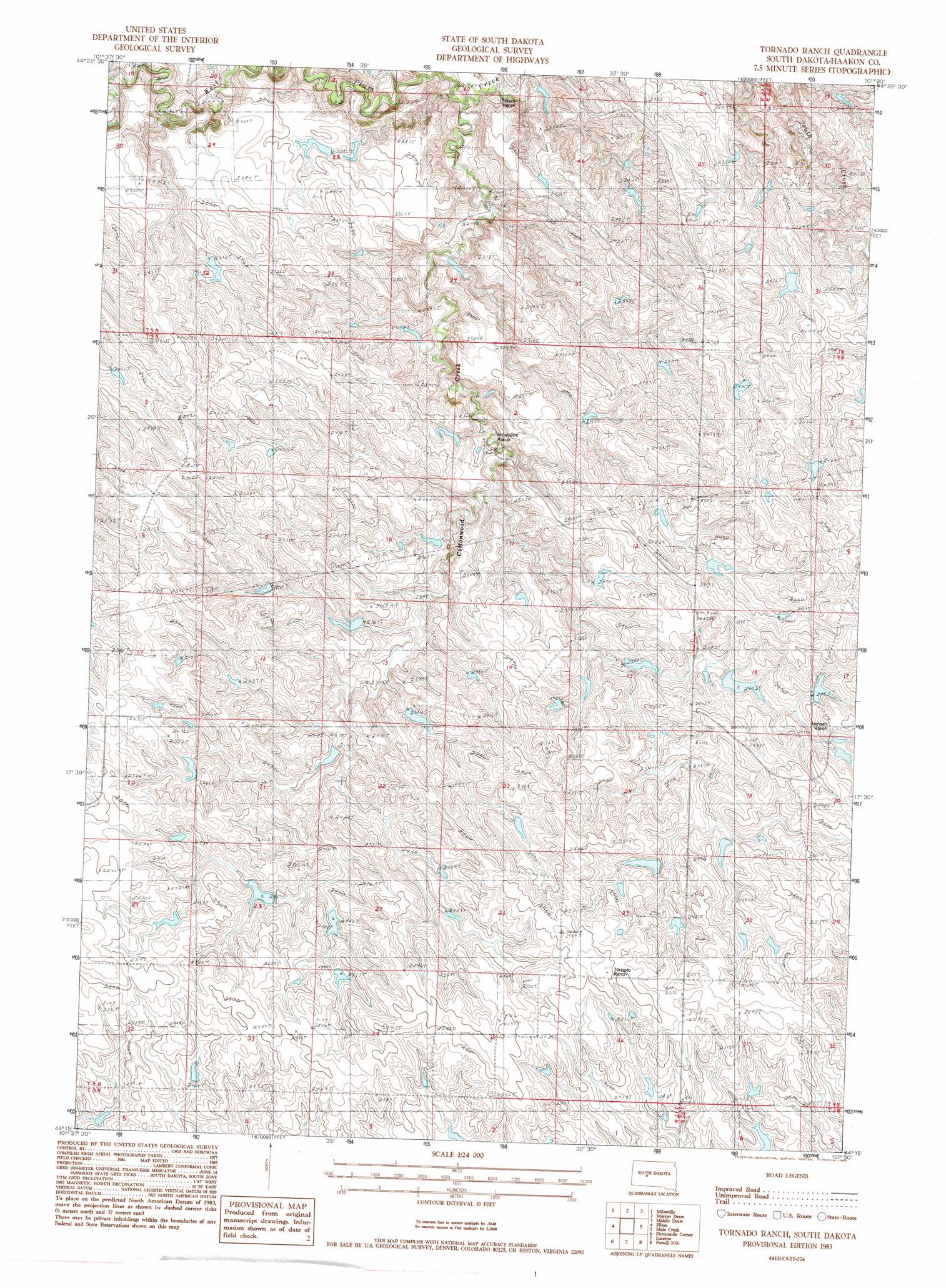
Tornado Ranch Topo Map South Dakota
To zoom in, hover over the map of Tornado Ranch
USGS Topo Quad 44101c5 - 1:24,000 scale
| Topo Map Name: | Tornado Ranch |
| USGS Topo Quad ID: | 44101c5 |
| Print Size: | ca. 21 1/4" wide x 27" high |
| Southeast Coordinates: | 44.25° N latitude / 101.5° W longitude |
| Map Center Coordinates: | 44.3125° N latitude / 101.5625° W longitude |
| U.S. State: | SD |
| Filename: | o44101c5.jpg |
| Download Map JPG Image: | Tornado Ranch topo map 1:24,000 scale |
| Map Type: | Topographic |
| Topo Series: | 7.5´ |
| Map Scale: | 1:24,000 |
| Source of Map Images: | United States Geological Survey (USGS) |
| Alternate Map Versions: |
Tornado Ranch SD 1983, updated 1984 Download PDF Buy paper map Tornado Ranch SD 2012 Download PDF Buy paper map Tornado Ranch SD 2015 Download PDF Buy paper map |
1:24,000 Topo Quads surrounding Tornado Ranch
Bridger Se |
Rattlesnake Lake Sw |
Rattlesnake Lake Se |
Cherry Creek |
Kirley |
Hartley |
Milesville |
Murray Draw |
Middle Draw |
Moenville |
Hilland |
Elbon |
Tornado Ranch |
Mule Creek |
Pheba 2 Se |
Grindstone Butte |
Elevenmile Corner |
Lucerne |
Powell Nw |
Ottumwa |
Bowen Ranch |
Philip |
Philip Se |
Powell |
Nowlin |
> Back to 44101a1 at 1:100,000 scale
> Back to 44100a1 at 1:250,000 scale
> Back to U.S. Topo Maps home
Tornado Ranch topo map: Gazetteer
Tornado Ranch: Dams
Hilland Dam elevation 762m 2500′Tornado Ranch: Streams
Cottonwood Creek elevation 649m 2129′Tornado Ranch digital topo map on disk
Buy this Tornado Ranch topo map showing relief, roads, GPS coordinates and other geographical features, as a high-resolution digital map file on DVD:
Eastern North Dakota & Eastern South Dakota
Buy digital topo maps: Eastern North Dakota & Eastern South Dakota