Murray Draw Topo Map South Dakota
To zoom in, hover over the map of Murray Draw
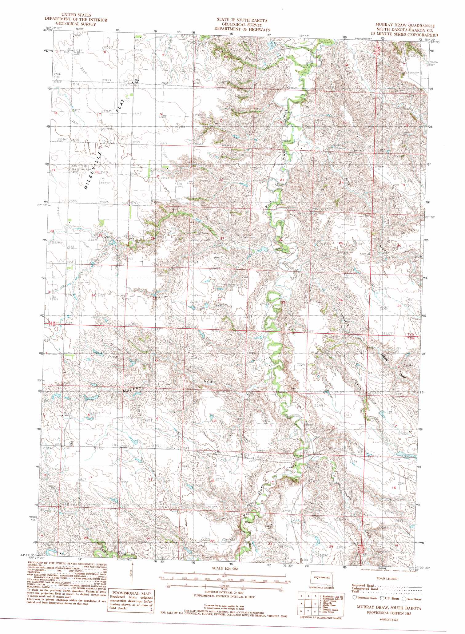
USGS Topo Quad 44101d5 - 1:24,000 scale
| Topo Map Name: | Murray Draw |
| USGS Topo Quad ID: | 44101d5 |
| Print Size: | ca. 21 1/4" wide x 27" high |
| Southeast Coordinates: | 44.375° N latitude / 101.5° W longitude |
| Map Center Coordinates: | 44.4375° N latitude / 101.5625° W longitude |
| U.S. State: | SD |
| Filename: | o44101d5.jpg |
| Download Map JPG Image: | Murray Draw topo map 1:24,000 scale |
| Map Type: | Topographic |
| Topo Series: | 7.5´ |
| Map Scale: | 1:24,000 |
| Source of Map Images: | United States Geological Survey (USGS) |
| Alternate Map Versions: |
Murray Draw SD 2012 Download PDF Buy paper map Murray Draw SD 2015 Download PDF Buy paper map |
1:24,000 Topo Quads surrounding Murray Draw
Bridger Ne |
Rattlesnake Lake |
Rattlesnake Lake Ne |
Cherry Creek Nw |
Carlin Flat |
Bridger Se |
Rattlesnake Lake Sw |
Rattlesnake Lake Se |
Cherry Creek |
Kirley |
Hartley |
Milesville |
Murray Draw |
Middle Draw |
Moenville |
Hilland |
Elbon |
Tornado Ranch |
Mule Creek |
Pheba 2 Se |
Grindstone Butte |
Elevenmile Corner |
Lucerne |
Powell Nw |
Ottumwa |
> Back to 44101a1 at 1:100,000 scale
> Back to 44100a1 at 1:250,000 scale
> Back to U.S. Topo Maps home
Murray Draw topo map: Gazetteer
Murray Draw: Populated Places
West Fork elevation 614m 2014′Murray Draw: Streams
Hump Creek elevation 586m 1922′Long Branch elevation 597m 1958′
Shanty Creek elevation 610m 2001′
South Creek elevation 634m 2080′
Murray Draw: Valleys
Middle Draw elevation 633m 2076′Murray Draw elevation 628m 2060′
Murray Draw digital topo map on disk
Buy this Murray Draw topo map showing relief, roads, GPS coordinates and other geographical features, as a high-resolution digital map file on DVD:
Eastern North Dakota & Eastern South Dakota
Buy digital topo maps: Eastern North Dakota & Eastern South Dakota