Alleman Station Topo Map South Dakota
To zoom in, hover over the map of Alleman Station
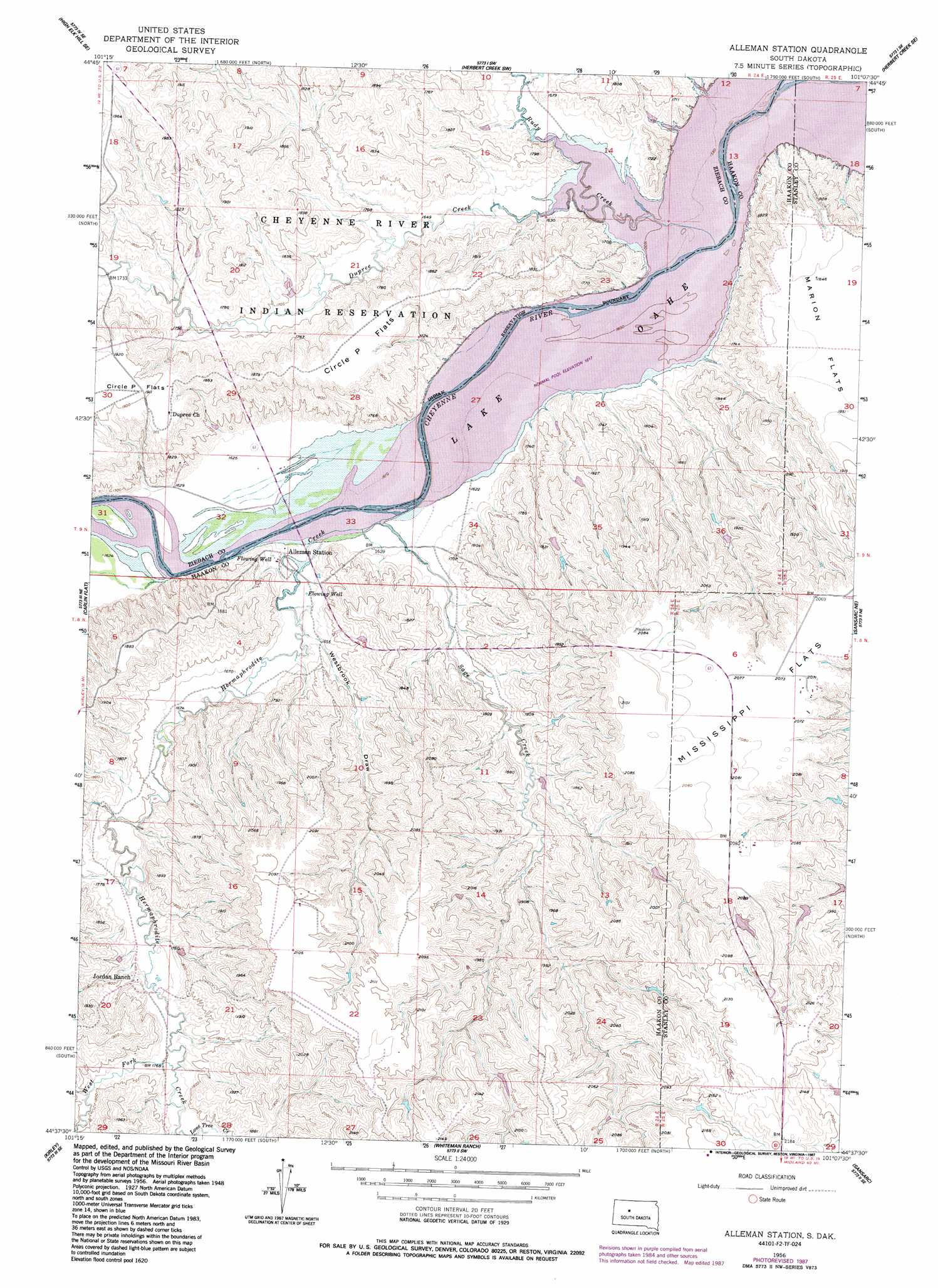
USGS Topo Quad 44101f2 - 1:24,000 scale
| Topo Map Name: | Alleman Station |
| USGS Topo Quad ID: | 44101f2 |
| Print Size: | ca. 21 1/4" wide x 27" high |
| Southeast Coordinates: | 44.625° N latitude / 101.125° W longitude |
| Map Center Coordinates: | 44.6875° N latitude / 101.1875° W longitude |
| U.S. State: | SD |
| Filename: | o44101f2.jpg |
| Download Map JPG Image: | Alleman Station topo map 1:24,000 scale |
| Map Type: | Topographic |
| Topo Series: | 7.5´ |
| Map Scale: | 1:24,000 |
| Source of Map Images: | United States Geological Survey (USGS) |
| Alternate Map Versions: |
Alleman Station SD 1956, updated 1957 Download PDF Buy paper map Alleman Station SD 1956, updated 1972 Download PDF Buy paper map Alleman Station SD 1956, updated 1987 Download PDF Buy paper map Alleman Station SD 2012 Download PDF Buy paper map Alleman Station SD 2015 Download PDF Buy paper map |
1:24,000 Topo Quads surrounding Alleman Station
High Elk Hill Nw |
High Elk Hill |
Herbert Creek |
Herbert Creek Ne |
Rousseau Creek Nw |
High Elk Hill Sw |
High Elk Hill Se |
Herbert Creek Sw |
Herbert Creek Se |
Rousseau Creek Sw |
Cherry Creek Nw |
Carlin Flat |
Alleman Station |
Sansarc Ne |
Crokett Mountains |
Cherry Creek |
Kirley |
Whiteman Ranch |
Sansarc |
Standing Butte Sw |
Middle Draw |
Moenville |
Bentley Ranch |
Hayes North |
> Back to 44101e1 at 1:100,000 scale
> Back to 44100a1 at 1:250,000 scale
> Back to U.S. Topo Maps home
Alleman Station topo map: Gazetteer
Alleman Station: Airports
Scarborough Airstrip elevation 634m 2080′Alleman Station: Bridges
Carlin Bridge elevation 493m 1617′Alleman Station: Flats
Circle P Flats elevation 576m 1889′Mississippi Flats elevation 631m 2070′
Alleman Station: Streams
Dupree Creek elevation 488m 1601′Hermaphrodite Creek elevation 494m 1620′
Rudy Creek elevation 483m 1584′
Sage Creek elevation 494m 1620′
West Fork Hermaphrodite Creek elevation 531m 1742′
Alleman Station: Valleys
Westbrook Draw elevation 501m 1643′Alleman Station digital topo map on disk
Buy this Alleman Station topo map showing relief, roads, GPS coordinates and other geographical features, as a high-resolution digital map file on DVD:
Eastern North Dakota & Eastern South Dakota
Buy digital topo maps: Eastern North Dakota & Eastern South Dakota