Dead Horse Draw Topo Map South Dakota
To zoom in, hover over the map of Dead Horse Draw
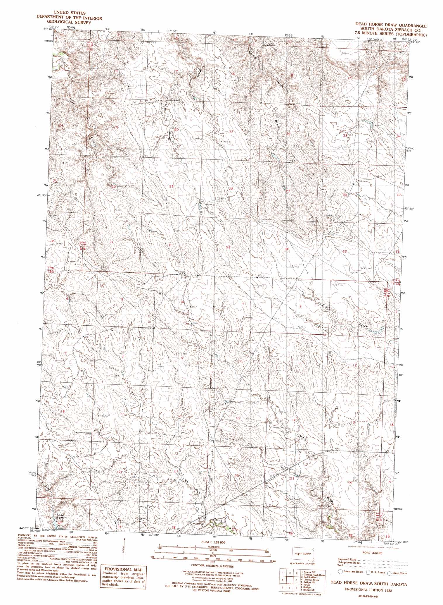
USGS Topo Quad 44101f8 - 1:24,000 scale
| Topo Map Name: | Dead Horse Draw |
| USGS Topo Quad ID: | 44101f8 |
| Print Size: | ca. 21 1/4" wide x 27" high |
| Southeast Coordinates: | 44.625° N latitude / 101.875° W longitude |
| Map Center Coordinates: | 44.6875° N latitude / 101.9375° W longitude |
| U.S. State: | SD |
| Filename: | o44101f8.jpg |
| Download Map JPG Image: | Dead Horse Draw topo map 1:24,000 scale |
| Map Type: | Topographic |
| Topo Series: | 7.5´ |
| Map Scale: | 1:24,000 |
| Source of Map Images: | United States Geological Survey (USGS) |
| Alternate Map Versions: |
Dead Horse Draw SD 1982, updated 1983 Download PDF Buy paper map Dead Horse Draw SD 2012 Download PDF Buy paper map Dead Horse Draw SD 2015 Download PDF Buy paper map |
1:24,000 Topo Quads surrounding Dead Horse Draw
Avance |
Durkee Lake |
Bessie Butte |
Bull Creek 2 Ne |
Diermier Ranch |
Reed Dam |
Avance Se |
Chasing Hawk Draw |
Red Scaffold |
Longbrake Ranch |
Thompson Lake |
Lemmon Creek |
Dead Horse Draw |
Bridger Ne |
Rattlesnake Lake |
Plainview |
Howes |
Bridger |
Bridger Se |
Rattlesnake Lake Sw |
Pedro Nw |
Pedro |
Hilland Nw |
Hartley |
Milesville |
> Back to 44101e1 at 1:100,000 scale
> Back to 44100a1 at 1:250,000 scale
> Back to U.S. Topo Maps home
Dead Horse Draw topo map: Gazetteer
Dead Horse Draw: Dams
Road Dam Number 1 elevation 678m 2224′Tribe Number 6 Dam elevation 726m 2381′
Tribe Number 7 Dam elevation 711m 2332′
Dead Horse Draw: Lakes
Lake Buffalo elevation 712m 2335′Dead Horse Draw: Streams
Deer Creek elevation 645m 2116′Dead Horse Draw digital topo map on disk
Buy this Dead Horse Draw topo map showing relief, roads, GPS coordinates and other geographical features, as a high-resolution digital map file on DVD:
Eastern North Dakota & Eastern South Dakota
Buy digital topo maps: Eastern North Dakota & Eastern South Dakota