Chasing Hawk Draw Topo Map South Dakota
To zoom in, hover over the map of Chasing Hawk Draw
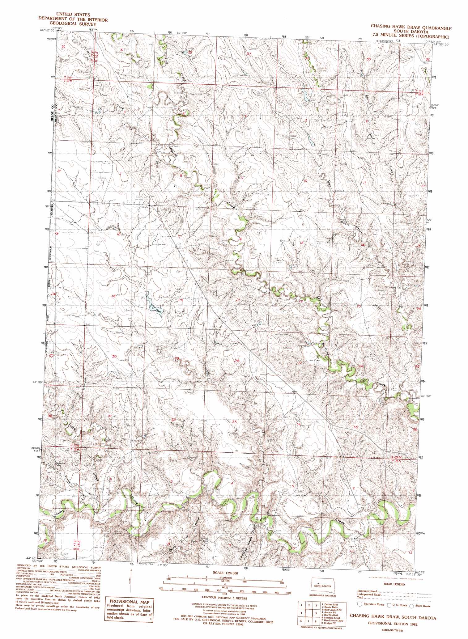
USGS Topo Quad 44101g8 - 1:24,000 scale
| Topo Map Name: | Chasing Hawk Draw |
| USGS Topo Quad ID: | 44101g8 |
| Print Size: | ca. 21 1/4" wide x 27" high |
| Southeast Coordinates: | 44.75° N latitude / 101.875° W longitude |
| Map Center Coordinates: | 44.8125° N latitude / 101.9375° W longitude |
| U.S. State: | SD |
| Filename: | o44101g8.jpg |
| Download Map JPG Image: | Chasing Hawk Draw topo map 1:24,000 scale |
| Map Type: | Topographic |
| Topo Series: | 7.5´ |
| Map Scale: | 1:24,000 |
| Source of Map Images: | United States Geological Survey (USGS) |
| Alternate Map Versions: |
Chasing Hawk Draw SD 1982, updated 1983 Download PDF Buy paper map Chasing Hawk Draw SD 2012 Download PDF Buy paper map Chasing Hawk Draw SD 2015 Download PDF Buy paper map |
1:24,000 Topo Quads surrounding Chasing Hawk Draw
Faith Sw |
Faith |
Red Elm Sw |
Red Elm |
|
Avance |
Durkee Lake |
Bessie Butte |
Bull Creek 2 Ne |
Diermier Ranch |
Reed Dam |
Avance Se |
Chasing Hawk Draw |
Red Scaffold |
Longbrake Ranch |
Thompson Lake |
Lemmon Creek |
Dead Horse Draw |
Bridger Ne |
Rattlesnake Lake |
Plainview |
Howes |
Bridger |
Bridger Se |
Rattlesnake Lake Sw |
> Back to 44101e1 at 1:100,000 scale
> Back to 44100a1 at 1:250,000 scale
> Back to U.S. Topo Maps home
Chasing Hawk Draw topo map: Gazetteer
Chasing Hawk Draw: Dams
Circle Eagle Dam elevation 708m 2322′Chasing Hawk Draw: Reservoirs
K C Dam elevation 692m 2270′Chasing Hawk Draw: Streams
Butcher Creek elevation 675m 2214′Little Mud Creek elevation 646m 2119′
Little Turtle Creek elevation 634m 2080′
Mud Creek elevation 625m 2050′
Turtle Creek elevation 630m 2066′
Chasing Hawk Draw: Valleys
Chasing Hawk Draw elevation 622m 2040′Dead Horse Draw elevation 626m 2053′
Chasing Hawk Draw digital topo map on disk
Buy this Chasing Hawk Draw topo map showing relief, roads, GPS coordinates and other geographical features, as a high-resolution digital map file on DVD:
Eastern North Dakota & Eastern South Dakota
Buy digital topo maps: Eastern North Dakota & Eastern South Dakota