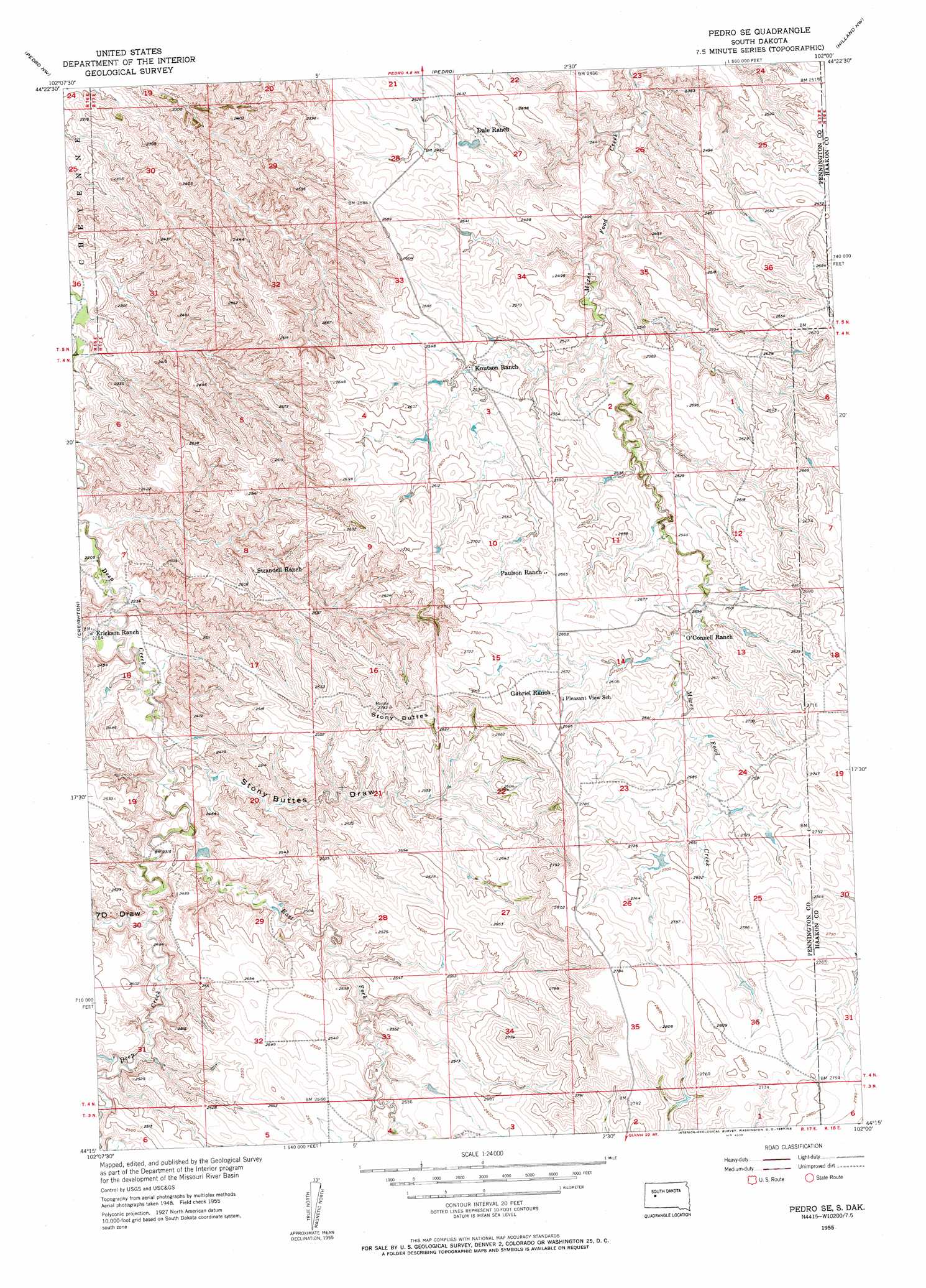
Pedro Se Topo Map South Dakota
To zoom in, hover over the map of Pedro Se
USGS Topo Quad 44102c1 - 1:24,000 scale
| Topo Map Name: | Pedro Se |
| USGS Topo Quad ID: | 44102c1 |
| Print Size: | ca. 21 1/4" wide x 27" high |
| Southeast Coordinates: | 44.25° N latitude / 102° W longitude |
| Map Center Coordinates: | 44.3125° N latitude / 102.0625° W longitude |
| U.S. State: | SD |
| Filename: | o44102c1.jpg |
| Download Map JPG Image: | Pedro Se topo map 1:24,000 scale |
| Map Type: | Topographic |
| Topo Series: | 7.5´ |
| Map Scale: | 1:24,000 |
| Source of Map Images: | United States Geological Survey (USGS) |
| Alternate Map Versions: |
Pedro SE SD 1955, updated 1957 Download PDF Buy paper map Pedro SE SD 2012 Download PDF Buy paper map Pedro SE SD 2015 Download PDF Buy paper map |
1:24,000 Topo Quads surrounding Pedro Se
White Owl Se |
Plainview |
Howes |
Bridger |
Bridger Se |
Dalzell Ne |
Pedro Nw |
Pedro |
Hilland Nw |
Hartley |
Dalzell Se |
Creighton |
Pedro Se |
Post Ranch |
Hilland |
Wasta Ne |
Pedrow 4 Nw |
Horse Tooth |
Grindstone |
Grindstone Butte |
Wasta Se |
Lake Hill |
Elm Creek Ranch |
Grindstone Sw |
Bowen Ranch |
> Back to 44102a1 at 1:100,000 scale
> Back to 44102a1 at 1:250,000 scale
> Back to U.S. Topo Maps home
Pedro Se topo map: Gazetteer
Pedro Se: Dams
Dannie O'Connell Dam elevation 787m 2582′Kirk Cordes Dam elevation 742m 2434′
Pedro Se: Ranges
Stony Buttes elevation 846m 2775′Pedro Se: Reservoirs
Kirk Cordes Number 30 Reservoir elevation 742m 2434′Pedro Se: Streams
East Fork Deep Creek elevation 702m 2303′Pedro Se: Valleys
Seven D Draw elevation 712m 2335′Stony Buttes Draw elevation 708m 2322′
Pedro Se digital topo map on disk
Buy this Pedro Se topo map showing relief, roads, GPS coordinates and other geographical features, as a high-resolution digital map file on DVD:
Eastern Wyoming & Western South Dakota
Buy digital topo maps: Eastern Wyoming & Western South Dakota