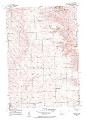
Creighton Topo Map South Dakota
To zoom in, hover over the map of Creighton
USGS Topo Quad 44102c2 - 1:24,000 scale
| Topo Map Name: | Creighton |
| USGS Topo Quad ID: | 44102c2 |
| Print Size: | ca. 21 1/4" wide x 27" high |
| Southeast Coordinates: | 44.25° N latitude / 102.125° W longitude |
| Map Center Coordinates: | 44.3125° N latitude / 102.1875° W longitude |
| U.S. State: | SD |
| Filename: | o44102c2.jpg |
| Download Map JPG Image: | Creighton topo map 1:24,000 scale |
| Map Type: | Topographic |
| Topo Series: | 7.5´ |
| Map Scale: | 1:24,000 |
| Source of Map Images: | United States Geological Survey (USGS) |
| Alternate Map Versions: |
Creighton SD 1955, updated 1956 Download PDF Buy paper map Creighton SD 2012 Download PDF Buy paper map Creighton SD 2015 Download PDF Buy paper map |
1:24,000 Topo Quads surrounding Creighton
> Back to 44102a1 at 1:100,000 scale
> Back to 44102a1 at 1:250,000 scale
> Back to U.S. Topo Maps home
Creighton topo map: Gazetteer
Creighton: Dams
Erwin Eisenbraun Dam elevation 786m 2578′Lewis Dam elevation 793m 2601′
Peno Grazing Association Dam elevation 756m 2480′
Selvin Johnson Dam elevation 757m 2483′
Veryl Schroeder 1 Dam elevation 775m 2542′
Veryl Schroeder 2 Dam elevation 780m 2559′
Creighton: Populated Places
Creighton elevation 806m 2644′Creighton: Reservoirs
Hammann Lake elevation 760m 2493′Creighton: Valleys
Fourmile Draw elevation 677m 2221′Three Tree Draw elevation 664m 2178′
Creighton digital topo map on disk
Buy this Creighton topo map showing relief, roads, GPS coordinates and other geographical features, as a high-resolution digital map file on DVD:
Eastern Wyoming & Western South Dakota
Buy digital topo maps: Eastern Wyoming & Western South Dakota


