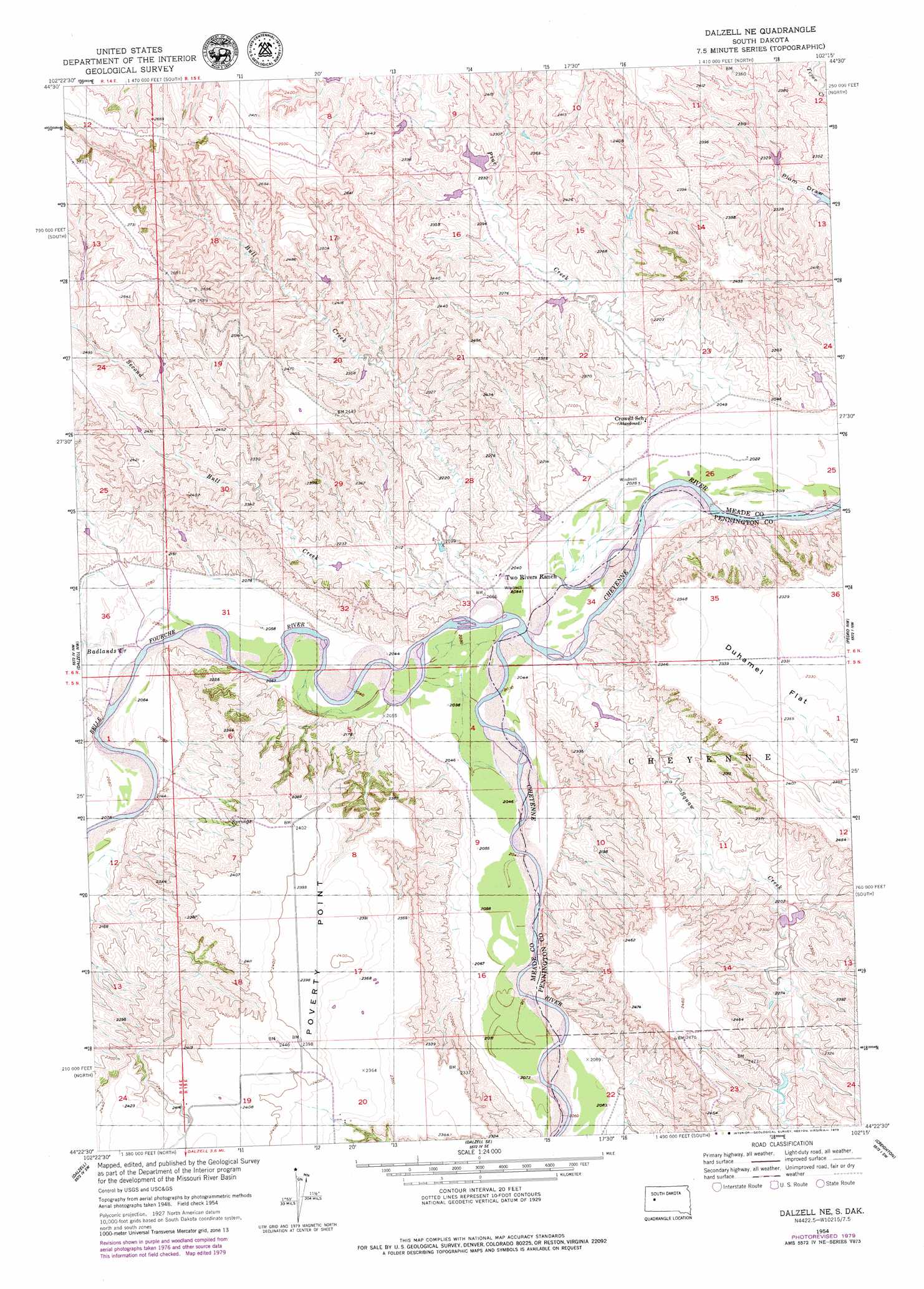
Dalzell Ne Topo Map South Dakota
To zoom in, hover over the map of Dalzell Ne
USGS Topo Quad 44102d3 - 1:24,000 scale
| Topo Map Name: | Dalzell Ne |
| USGS Topo Quad ID: | 44102d3 |
| Print Size: | ca. 21 1/4" wide x 27" high |
| Southeast Coordinates: | 44.375° N latitude / 102.25° W longitude |
| Map Center Coordinates: | 44.4375° N latitude / 102.3125° W longitude |
| U.S. State: | SD |
| Filename: | o44102d3.jpg |
| Download Map JPG Image: | Dalzell Ne topo map 1:24,000 scale |
| Map Type: | Topographic |
| Topo Series: | 7.5´ |
| Map Scale: | 1:24,000 |
| Source of Map Images: | United States Geological Survey (USGS) |
| Alternate Map Versions: |
Dalzell NE SD 1954, updated 1956 Download PDF Buy paper map Dalzell NE SD 1954, updated 1979 Download PDF Buy paper map Dalzell NE SD 2012 Download PDF Buy paper map Dalzell NE SD 2015 Download PDF Buy paper map |
1:24,000 Topo Quads surrounding Dalzell Ne
Redowl |
White Owl Nw |
Marcus |
Thompson Lake |
Lemmon Creek |
Enning |
White Owl |
White Owl Se |
Plainview |
Howes |
Boneita Springs |
Dalzell Nw |
Dalzell Ne |
Pedro Nw |
Pedro |
Elm Springs |
Dalzell |
Dalzell Se |
Creighton |
Pedro Se |
Owanka Ne |
Wasta Nw |
Wasta Ne |
Pedrow 4 Nw |
Horse Tooth |
> Back to 44102a1 at 1:100,000 scale
> Back to 44102a1 at 1:250,000 scale
> Back to U.S. Topo Maps home
Dalzell Ne topo map: Gazetteer
Dalzell Ne: Dams
McCasland and Schiller Number 4 Dam elevation 701m 2299′Dalzell Ne: Flats
Duhamel Flat elevation 713m 2339′Kent Flat elevation 766m 2513′
Dalzell Ne: Streams
Badlands Creek elevation 628m 2060′Belle Fourche River elevation 619m 2030′
Bull Creek elevation 622m 2040′
Cedar Breaks Creek elevation 623m 2043′
Pine Creek elevation 625m 2050′
Second Bull Creek elevation 622m 2040′
Dalzell Ne: Summits
Poverty Point elevation 730m 2395′Dalzell Ne digital topo map on disk
Buy this Dalzell Ne topo map showing relief, roads, GPS coordinates and other geographical features, as a high-resolution digital map file on DVD:
Eastern Wyoming & Western South Dakota
Buy digital topo maps: Eastern Wyoming & Western South Dakota