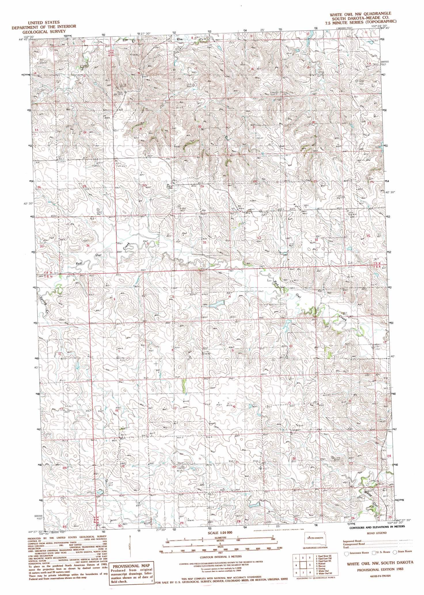
White Owl Nw Topo Map South Dakota
To zoom in, hover over the map of White Owl Nw
USGS Topo Quad 44102f4 - 1:24,000 scale
| Topo Map Name: | White Owl Nw |
| USGS Topo Quad ID: | 44102f4 |
| Print Size: | ca. 21 1/4" wide x 27" high |
| Southeast Coordinates: | 44.625° N latitude / 102.375° W longitude |
| Map Center Coordinates: | 44.6875° N latitude / 102.4375° W longitude |
| U.S. State: | SD |
| Filename: | o44102f4.jpg |
| Download Map JPG Image: | White Owl Nw topo map 1:24,000 scale |
| Map Type: | Topographic |
| Topo Series: | 7.5´ |
| Map Scale: | 1:24,000 |
| Source of Map Images: | United States Geological Survey (USGS) |
| Alternate Map Versions: |
Whiteman Owl NW SD 1983, updated 1984 Download PDF Buy paper map White Owl NW SD 2012 Download PDF Buy paper map White Owl NW SD 2015 Download PDF Buy paper map |
1:24,000 Topo Quads surrounding White Owl Nw
Squaw Buttes |
Opal West |
Opal East |
Lemmon Butte |
Avance |
Big Draw |
Opal West Se |
Opal East Sw |
Opal East Se |
Reed Dam |
Stoneville |
Redowl |
White Owl Nw |
Marcus |
Thompson Lake |
Union Center |
Enning |
White Owl |
White Owl Se |
Plainview |
Haydraw |
Boneita Springs |
Dalzell Nw |
Dalzell Ne |
Pedro Nw |
> Back to 44102e1 at 1:100,000 scale
> Back to 44102a1 at 1:250,000 scale
> Back to U.S. Topo Maps home
White Owl Nw topo map: Gazetteer
White Owl Nw: Airports
Cobb Ranch Airstrip elevation 835m 2739′White Owl Nw: Dams
Miller Dam elevation 763m 2503′W Mann Number 1 Dam elevation 808m 2650′
W Mann Number 2 Dam elevation 797m 2614′
White Owl Nw: Streams
Spring Creek elevation 816m 2677′White Owl Nw digital topo map on disk
Buy this White Owl Nw topo map showing relief, roads, GPS coordinates and other geographical features, as a high-resolution digital map file on DVD:
Eastern Wyoming & Western South Dakota
Buy digital topo maps: Eastern Wyoming & Western South Dakota