Fairpoint Nw Topo Map South Dakota
To zoom in, hover over the map of Fairpoint Nw
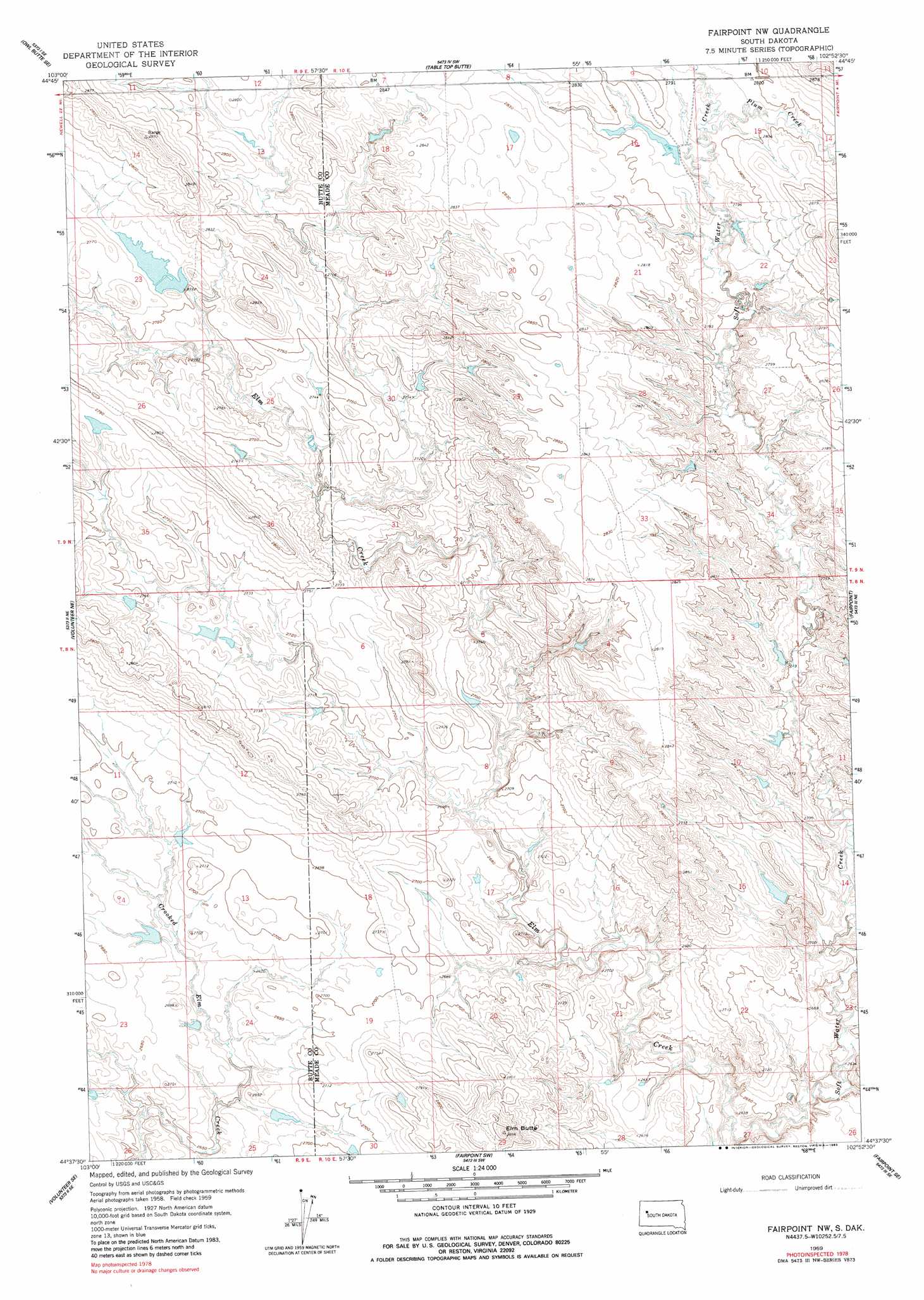
USGS Topo Quad 44102f8 - 1:24,000 scale
| Topo Map Name: | Fairpoint Nw |
| USGS Topo Quad ID: | 44102f8 |
| Print Size: | ca. 21 1/4" wide x 27" high |
| Southeast Coordinates: | 44.625° N latitude / 102.875° W longitude |
| Map Center Coordinates: | 44.6875° N latitude / 102.9375° W longitude |
| U.S. State: | SD |
| Filename: | o44102f8.jpg |
| Download Map JPG Image: | Fairpoint Nw topo map 1:24,000 scale |
| Map Type: | Topographic |
| Topo Series: | 7.5´ |
| Map Scale: | 1:24,000 |
| Source of Map Images: | United States Geological Survey (USGS) |
| Alternate Map Versions: |
Fairpoint NW SD 1959, updated 1960 Download PDF Buy paper map Fairpoint NW SD 1959, updated 1983 Download PDF Buy paper map Fairpoint NW SD 2012 Download PDF Buy paper map Fairpoint NW SD 2015 Download PDF Buy paper map |
1:24,000 Topo Quads surrounding Fairpoint Nw
Deers Ears Butte South |
Owl Butte Ne |
Camp Creek |
Frozen Man Creek |
Squaw Buttes |
Owl Butte |
Owl Butte Se |
Table Top Butte |
Bull Run Creek |
Big Draw |
Volunteer Nw |
Volunteer Ne |
Fairpoint Nw |
Fairpoint |
Stoneville |
Volunteer |
Volunteer Se |
Fairpoint Sw |
Fairpoint Se |
Union Center |
Rapid City 1 Nw |
Rapid City 1 Ne |
Hereford |
Hereford Ne |
Haydraw |
> Back to 44102e1 at 1:100,000 scale
> Back to 44102a1 at 1:250,000 scale
> Back to U.S. Topo Maps home
Fairpoint Nw topo map: Gazetteer
Fairpoint Nw: Dams
State Land Dam elevation 848m 2782′Fairpoint Nw: Streams
Coyote Creek elevation 809m 2654′Soft Water Creek elevation 797m 2614′
Fairpoint Nw: Summits
Elm Butte elevation 878m 2880′Fairpoint Nw digital topo map on disk
Buy this Fairpoint Nw topo map showing relief, roads, GPS coordinates and other geographical features, as a high-resolution digital map file on DVD:
Eastern Wyoming & Western South Dakota
Buy digital topo maps: Eastern Wyoming & Western South Dakota