Deadman Mountain Topo Map South Dakota
To zoom in, hover over the map of Deadman Mountain
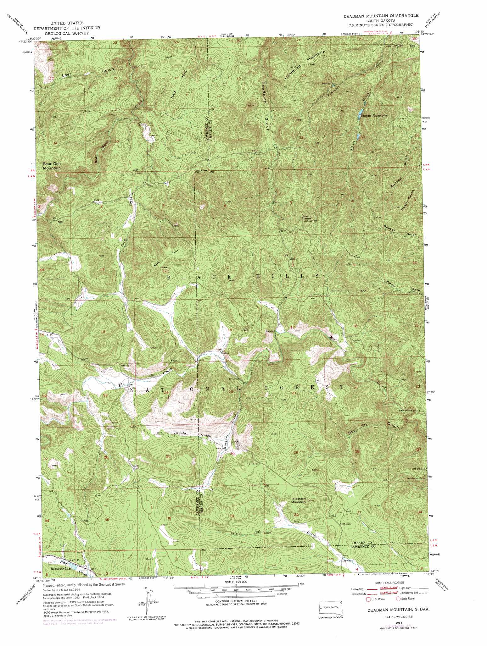
USGS Topo Quad 44103c5 - 1:24,000 scale
| Topo Map Name: | Deadman Mountain |
| USGS Topo Quad ID: | 44103c5 |
| Print Size: | ca. 21 1/4" wide x 27" high |
| Southeast Coordinates: | 44.25° N latitude / 103.5° W longitude |
| Map Center Coordinates: | 44.3125° N latitude / 103.5625° W longitude |
| U.S. State: | SD |
| Filename: | o44103c5.jpg |
| Download Map JPG Image: | Deadman Mountain topo map 1:24,000 scale |
| Map Type: | Topographic |
| Topo Series: | 7.5´ |
| Map Scale: | 1:24,000 |
| Source of Map Images: | United States Geological Survey (USGS) |
| Alternate Map Versions: |
Deadman Mountain SD 1954, updated 1955 Download PDF Buy paper map Deadman Mountain SD 1954, updated 1967 Download PDF Buy paper map Deadman Mountain SD 1954, updated 1972 Download PDF Buy paper map Deadman Mountain SD 1954, updated 1977 Download PDF Buy paper map Deadman Mountain SD 1954, updated 1977 Download PDF Buy paper map Deadman Mountain SD 2012 Download PDF Buy paper map Deadman Mountain SD 2015 Download PDF Buy paper map |
| FStopo: | US Forest Service topo Deadman Mountain is available: Download FStopo PDF Download FStopo TIF |
1:24,000 Topo Quads surrounding Deadman Mountain
Jolly |
Saint Onge |
Saint Onge Se |
Vale |
Vale Se |
Spearfish |
Deadwood North |
Sturgis |
Fort Meade |
Fort Meade Ne |
Lead |
Deadwood South |
Deadman Mountain |
Tilford |
Fort Meade Se |
Nahant |
Minnesota Ridge |
Nemo |
Piedmont |
Blackhawk |
Deerfield |
Rochford |
Silver City |
Pactola Dam |
Rapid City West |
> Back to 44103a1 at 1:100,000 scale
> Back to 44102a1 at 1:250,000 scale
> Back to U.S. Topo Maps home
Deadman Mountain topo map: Gazetteer
Deadman Mountain: Areas
Centennial Trail elevation 1336m 4383′Fort Meade Veterans Administration Watershed elevation 1363m 4471′
Deadman Mountain: Lakes
Reausaw Lake elevation 1608m 5275′Deadman Mountain: Reservoirs
Sturgis Reservoirs elevation 1271m 4169′Deadman Mountain: Streams
Meadow Creek elevation 1436m 4711′Park Creek elevation 1317m 4320′
Deadman Mountain: Summits
Deadman Mountain elevation 1502m 4927′Flagstaff Mountain elevation 1655m 5429′
Kirk Hill elevation 1624m 5328′
Red Hill elevation 1412m 4632′
Deadman Mountain: Valleys
Dry Elk Gulch elevation 1326m 4350′Lost Gulch elevation 1259m 4130′
Virkula Gulch elevation 1483m 4865′
Deadman Mountain digital topo map on disk
Buy this Deadman Mountain topo map showing relief, roads, GPS coordinates and other geographical features, as a high-resolution digital map file on DVD:
Eastern Wyoming & Western South Dakota
Buy digital topo maps: Eastern Wyoming & Western South Dakota