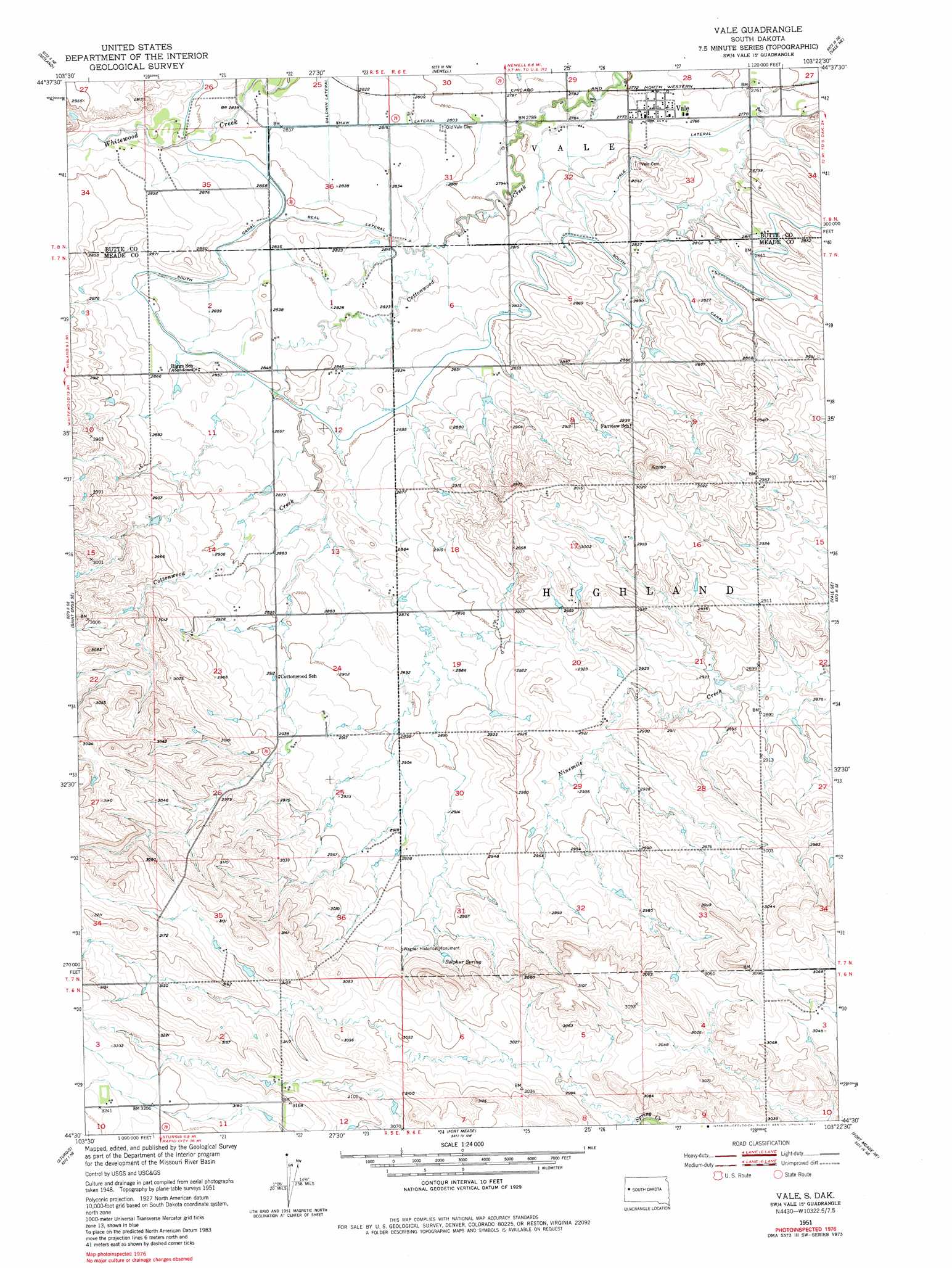
Vale Topo Map South Dakota
To zoom in, hover over the map of Vale
USGS Topo Quad 44103e4 - 1:24,000 scale
| Topo Map Name: | Vale |
| USGS Topo Quad ID: | 44103e4 |
| Print Size: | ca. 21 1/4" wide x 27" high |
| Southeast Coordinates: | 44.5° N latitude / 103.375° W longitude |
| Map Center Coordinates: | 44.5625° N latitude / 103.4375° W longitude |
| U.S. State: | SD |
| Filename: | o44103e4.jpg |
| Download Map JPG Image: | Vale topo map 1:24,000 scale |
| Map Type: | Topographic |
| Topo Series: | 7.5´ |
| Map Scale: | 1:24,000 |
| Source of Map Images: | United States Geological Survey (USGS) |
| Alternate Map Versions: |
Vale SD 1951, updated 1953 Download PDF Buy paper map Vale SD 1951, updated 1982 Download PDF Buy paper map Vale SD 2012 Download PDF Buy paper map Vale SD 2015 Download PDF Buy paper map |
1:24,000 Topo Quads surrounding Vale
Arpan |
Two Top Butte Se |
Newell Lake |
Schoepp Flat |
Owl Butte |
Fruitdale |
Nisland |
Newell |
Vale Ne |
Volunteer Nw |
Saint Onge |
Saint Onge Se |
Vale |
Vale Se |
Volunteer |
Deadwood North |
Sturgis |
Fort Meade |
Fort Meade Ne |
Rapid City 1 Nw |
Deadwood South |
Deadman Mountain |
Tilford |
Fort Meade Se |
Rapid City 1 Sw |
> Back to 44103e1 at 1:100,000 scale
> Back to 44102a1 at 1:250,000 scale
> Back to U.S. Topo Maps home
Vale topo map: Gazetteer
Vale: Canals
Beal Lateral elevation 868m 2847′Shaw Lateral elevation 859m 2818′
Vale Lateral elevation 861m 2824′
Vale: Populated Places
Vale elevation 844m 2769′Vale: Springs
Sulphur Spring elevation 908m 2979′Vale digital topo map on disk
Buy this Vale topo map showing relief, roads, GPS coordinates and other geographical features, as a high-resolution digital map file on DVD:
Eastern Wyoming & Western South Dakota
Buy digital topo maps: Eastern Wyoming & Western South Dakota