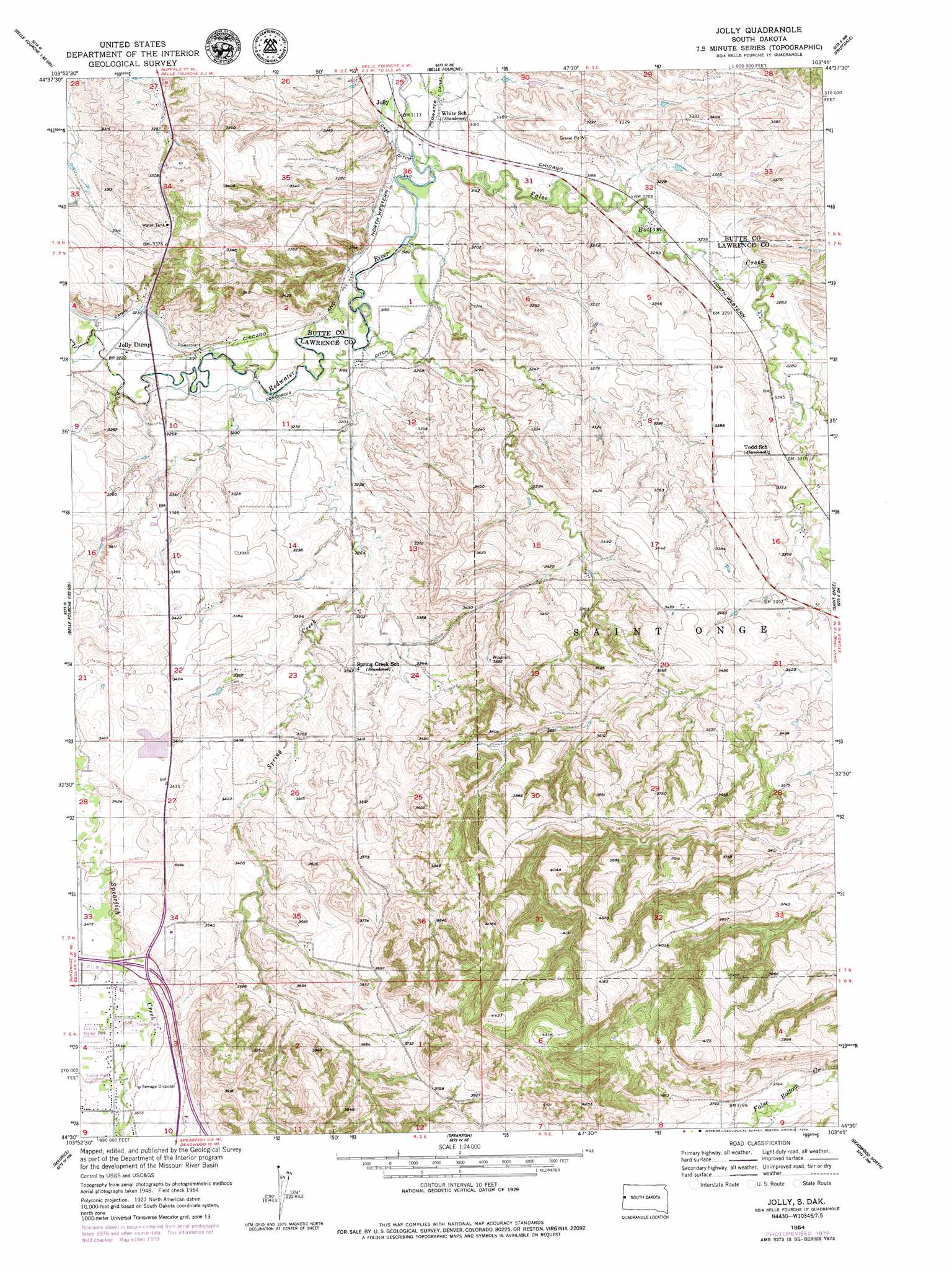
Jolly Topo Map South Dakota
To zoom in, hover over the map of Jolly
USGS Topo Quad 44103e7 - 1:24,000 scale
| Topo Map Name: | Jolly |
| USGS Topo Quad ID: | 44103e7 |
| Print Size: | ca. 21 1/4" wide x 27" high |
| Southeast Coordinates: | 44.5° N latitude / 103.75° W longitude |
| Map Center Coordinates: | 44.5625° N latitude / 103.8125° W longitude |
| U.S. State: | SD |
| Filename: | o44103e7.jpg |
| Download Map JPG Image: | Jolly topo map 1:24,000 scale |
| Map Type: | Topographic |
| Topo Series: | 7.5´ |
| Map Scale: | 1:24,000 |
| Source of Map Images: | United States Geological Survey (USGS) |
| Alternate Map Versions: |
Jolly SD 1954, updated 1956 Download PDF Buy paper map Jolly SD 1954, updated 1974 Download PDF Buy paper map Jolly SD 1954, updated 1979 Download PDF Buy paper map Jolly SD 1954, updated 1979 Download PDF Buy paper map Jolly SD 2012 Download PDF Buy paper map Jolly SD 2015 Download PDF Buy paper map |
1:24,000 Topo Quads surrounding Jolly
Middle Creek Butte |
Bull Creek Butte |
Mud Buttes |
Arpan |
Two Top Butte Se |
The Forks |
Sourdough Flats |
Belle Fourche |
Fruitdale |
Nisland |
Beulah |
Chicken Creek |
Jolly |
Saint Onge |
Saint Onge Se |
Tinton |
Maurice |
Spearfish |
Deadwood North |
Sturgis |
Old Baldy Mountain |
Savoy |
Lead |
Deadwood South |
Deadman Mountain |
> Back to 44103e1 at 1:100,000 scale
> Back to 44102a1 at 1:250,000 scale
> Back to U.S. Topo Maps home
Jolly topo map: Gazetteer
Jolly: Canals
Concordia Ditch elevation 973m 3192′Jolly: Dams
Black Hills RC and D Stabilization Dam elevation 1251m 4104′Spearfish Valley Ranch Dam elevation 1047m 3435′
Jolly: Mines
Columbus Mine (historical) elevation 1081m 3546′Jolly: Populated Places
Jolly Dump elevation 982m 3221′Jolly: Streams
False Bottom Creek elevation 952m 3123′Spearfish Creek elevation 978m 3208′
Spring Creek elevation 963m 3159′
Jolly digital topo map on disk
Buy this Jolly topo map showing relief, roads, GPS coordinates and other geographical features, as a high-resolution digital map file on DVD:
Eastern Wyoming & Western South Dakota
Buy digital topo maps: Eastern Wyoming & Western South Dakota