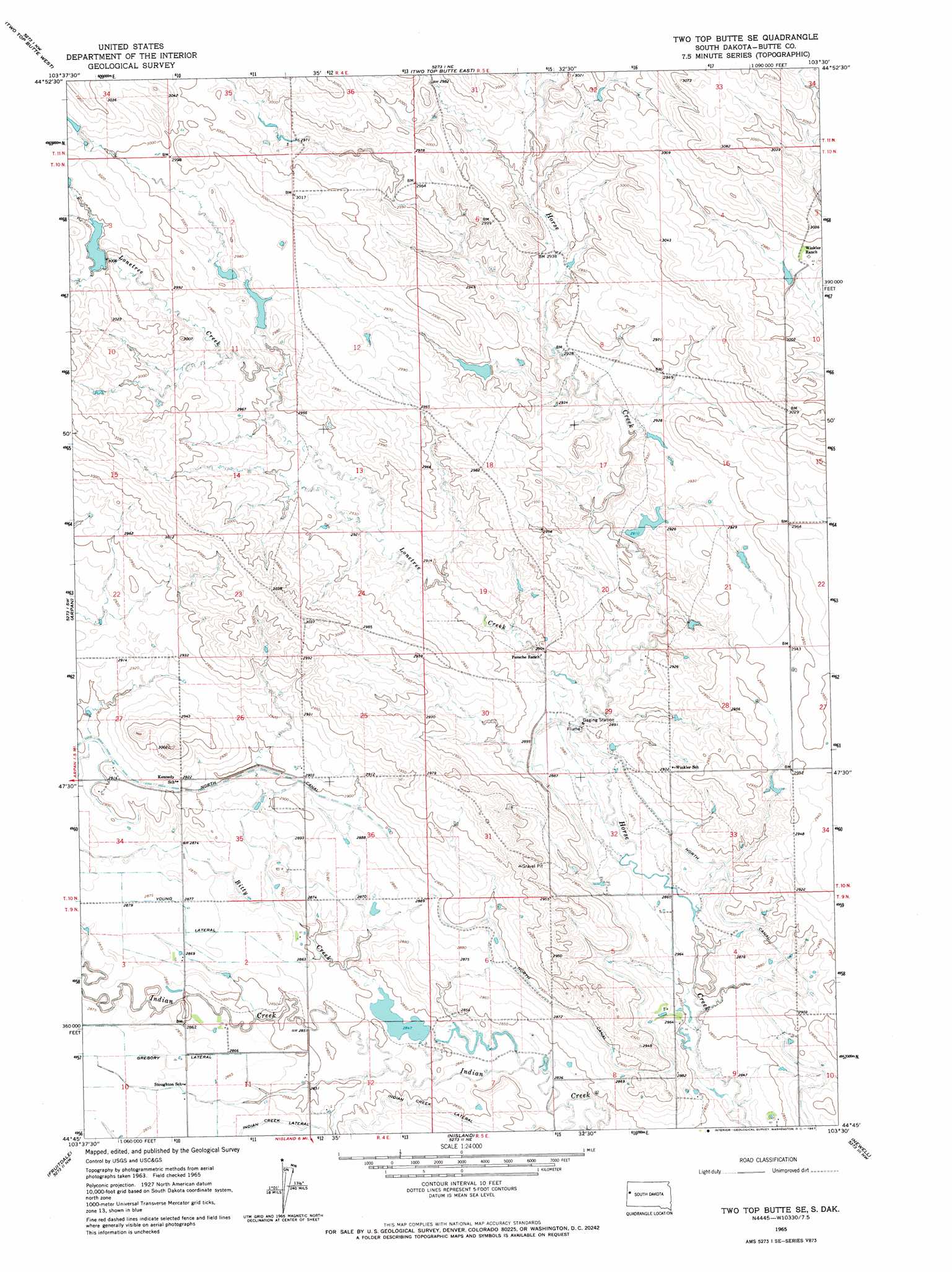
Two Top Butte Se Topo Map South Dakota
To zoom in, hover over the map of Two Top Butte Se
USGS Topo Quad 44103g5 - 1:24,000 scale
| Topo Map Name: | Two Top Butte Se |
| USGS Topo Quad ID: | 44103g5 |
| Print Size: | ca. 21 1/4" wide x 27" high |
| Southeast Coordinates: | 44.75° N latitude / 103.5° W longitude |
| Map Center Coordinates: | 44.8125° N latitude / 103.5625° W longitude |
| U.S. State: | SD |
| Filename: | o44103g5.jpg |
| Download Map JPG Image: | Two Top Butte Se topo map 1:24,000 scale |
| Map Type: | Topographic |
| Topo Series: | 7.5´ |
| Map Scale: | 1:24,000 |
| Source of Map Images: | United States Geological Survey (USGS) |
| Alternate Map Versions: |
Two Top Butte SE SD 1965, updated 1967 Download PDF Buy paper map Two Top Butte SE SD 2012 Download PDF Buy paper map Two Top Butte SE SD 2015 Download PDF Buy paper map |
1:24,000 Topo Quads surrounding Two Top Butte Se
Battle Creek Butte |
Antelope Creek West |
Antelope Creek East |
Haystack Butte |
Hoover |
Antelope Butte |
Two Top Butte West |
Two Top Butte East |
Castle Rock |
Sulphur Butte |
Mud Buttes |
Arpan |
Two Top Butte Se |
Newell Lake |
Schoepp Flat |
Belle Fourche |
Fruitdale |
Nisland |
Newell |
Vale Ne |
Jolly |
Saint Onge |
Saint Onge Se |
Vale |
Vale Se |
> Back to 44103e1 at 1:100,000 scale
> Back to 44102a1 at 1:250,000 scale
> Back to U.S. Topo Maps home
Two Top Butte Se topo map: Gazetteer
Two Top Butte Se: Canals
Indian Creek Lateral elevation 874m 2867′Two Top Butte Se: Dams
Howard Schmele Dam Number 1 elevation 866m 2841′Two Top Butte Se: Streams
Bitty Creek elevation 869m 2851′Lonetree Creek elevation 875m 2870′
Two Top Butte Se digital topo map on disk
Buy this Two Top Butte Se topo map showing relief, roads, GPS coordinates and other geographical features, as a high-resolution digital map file on DVD:
Eastern Wyoming & Western South Dakota
Buy digital topo maps: Eastern Wyoming & Western South Dakota