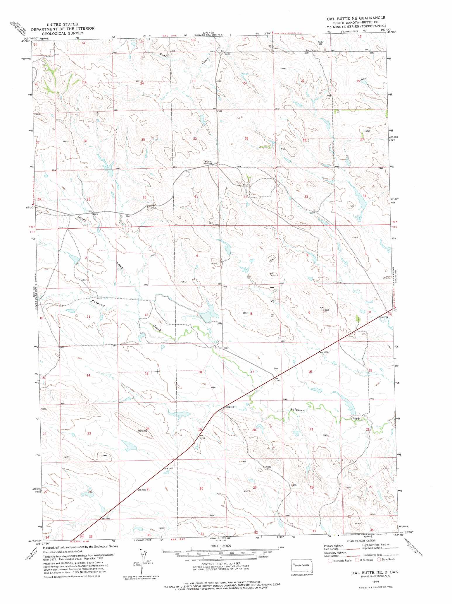
Owl Butte Ne Topo Map South Dakota
To zoom in, hover over the map of Owl Butte Ne
USGS Topo Quad 44103h1 - 1:24,000 scale
| Topo Map Name: | Owl Butte Ne |
| USGS Topo Quad ID: | 44103h1 |
| Print Size: | ca. 21 1/4" wide x 27" high |
| Southeast Coordinates: | 44.875° N latitude / 103° W longitude |
| Map Center Coordinates: | 44.9375° N latitude / 103.0625° W longitude |
| U.S. State: | SD |
| Filename: | o44103h1.jpg |
| Download Map JPG Image: | Owl Butte Ne topo map 1:24,000 scale |
| Map Type: | Topographic |
| Topo Series: | 7.5´ |
| Map Scale: | 1:24,000 |
| Source of Map Images: | United States Geological Survey (USGS) |
| Alternate Map Versions: |
Owl Butte NE SD 1978, updated 1978 Download PDF Buy paper map Owl Butte NE SD 2012 Download PDF Buy paper map Owl Butte NE SD 2015 Download PDF Buy paper map |
1:24,000 Topo Quads surrounding Owl Butte Ne
Granger Creek |
Porter Creek |
Fish Draw |
Zeona Ne |
|
Hoover |
Deers Ears Butte North |
Tomato Can Buttes |
Beverly Creek |
|
Sulphur Butte |
Deers Ears Butte South |
Owl Butte Ne |
Camp Creek |
Frozen Man Creek |
Schoepp Flat |
Owl Butte |
Owl Butte Se |
Table Top Butte |
Bull Run Creek |
Vale Ne |
Volunteer Nw |
Volunteer Ne |
Fairpoint Nw |
Fairpoint |
> Back to 44103e1 at 1:100,000 scale
> Back to 44102a1 at 1:250,000 scale
> Back to U.S. Topo Maps home
Owl Butte Ne digital topo map on disk
Buy this Owl Butte Ne topo map showing relief, roads, GPS coordinates and other geographical features, as a high-resolution digital map file on DVD:
Eastern Wyoming & Western South Dakota
Buy digital topo maps: Eastern Wyoming & Western South Dakota