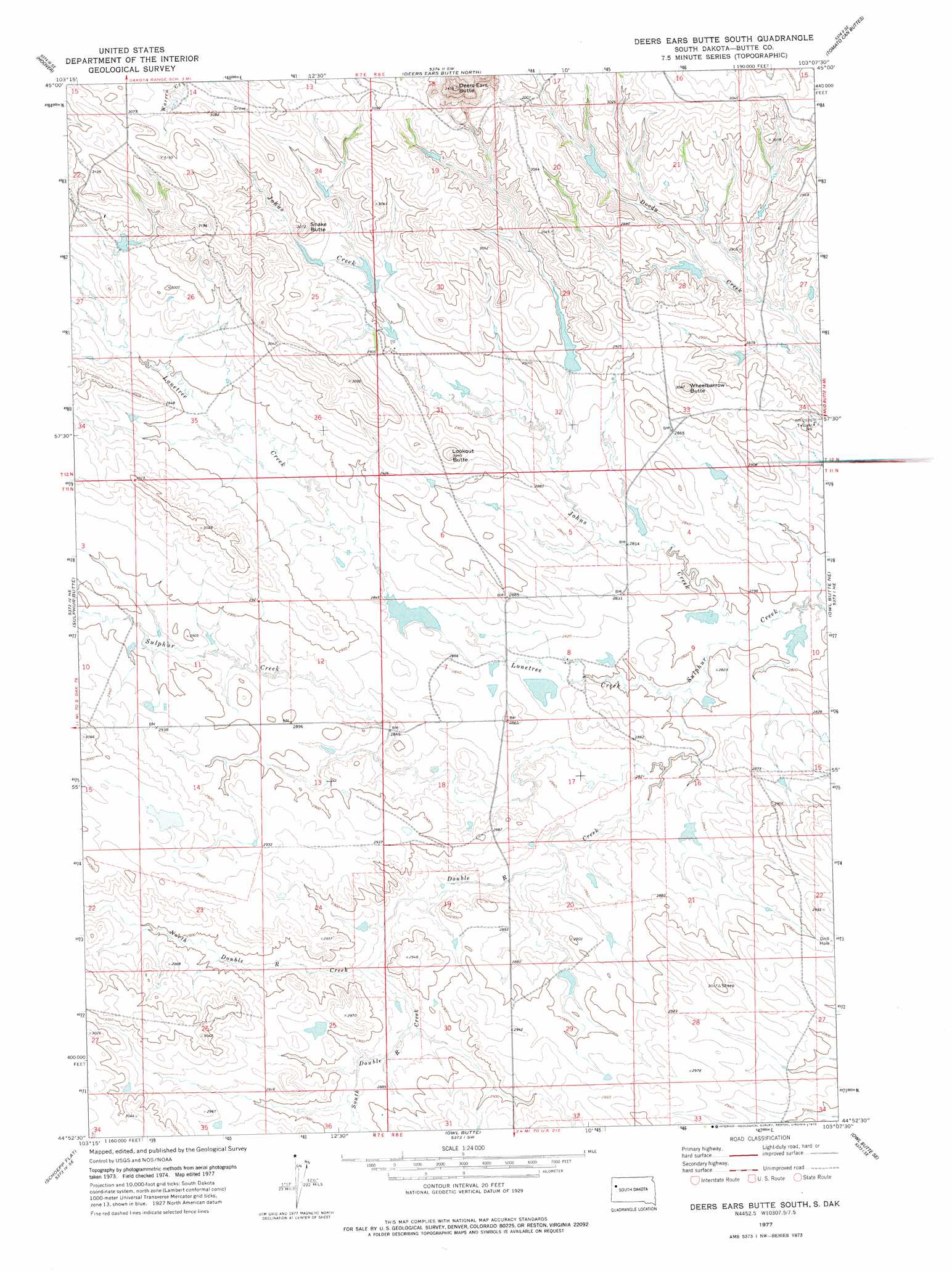
Deers Ears Butte South Topo Map South Dakota
To zoom in, hover over the map of Deers Ears Butte South
USGS Topo Quad 44103h2 - 1:24,000 scale
| Topo Map Name: | Deers Ears Butte South |
| USGS Topo Quad ID: | 44103h2 |
| Print Size: | ca. 21 1/4" wide x 27" high |
| Southeast Coordinates: | 44.875° N latitude / 103.125° W longitude |
| Map Center Coordinates: | 44.9375° N latitude / 103.1875° W longitude |
| U.S. State: | SD |
| Filename: | o44103h2.jpg |
| Download Map JPG Image: | Deers Ears Butte South topo map 1:24,000 scale |
| Map Type: | Topographic |
| Topo Series: | 7.5´ |
| Map Scale: | 1:24,000 |
| Source of Map Images: | United States Geological Survey (USGS) |
| Alternate Map Versions: |
Deers Ears Butte South SD 1977, updated 1978 Download PDF Buy paper map Deers Ears Butte South SD 2012 Download PDF Buy paper map Deers Ears Butte South SD 2015 Download PDF Buy paper map |
1:24,000 Topo Quads surrounding Deers Ears Butte South
Lone Tree Draw East |
Granger Creek |
Porter Creek |
Fish Draw |
|
Haystack Butte |
Hoover |
Deers Ears Butte North |
Tomato Can Buttes |
|
Castle Rock |
Sulphur Butte |
Deers Ears Butte South |
Owl Butte Ne |
Camp Creek |
Newell Lake |
Schoepp Flat |
Owl Butte |
Owl Butte Se |
Table Top Butte |
Newell |
Vale Ne |
Volunteer Nw |
Volunteer Ne |
Fairpoint Nw |
> Back to 44103e1 at 1:100,000 scale
> Back to 44102a1 at 1:250,000 scale
> Back to U.S. Topo Maps home
Deers Ears Butte South topo map: Gazetteer
Deers Ears Butte South: Dams
Nestor Kivimaki Dam Number 1 elevation 863m 2831′Deers Ears Butte South: Streams
Double R Creek elevation 854m 2801′Johns Creek elevation 852m 2795′
Lonetree Creek elevation 852m 2795′
North Double R Creek elevation 871m 2857′
South Double R Creek elevation 871m 2857′
Deers Ears Butte South: Summits
Deers Ears Butte elevation 1035m 3395′Lookout Butte elevation 927m 3041′
Snake Butte elevation 932m 3057′
Wheelbarrow Butte elevation 927m 3041′
Deers Ears Butte South digital topo map on disk
Buy this Deers Ears Butte South topo map showing relief, roads, GPS coordinates and other geographical features, as a high-resolution digital map file on DVD:
Eastern Wyoming & Western South Dakota
Buy digital topo maps: Eastern Wyoming & Western South Dakota