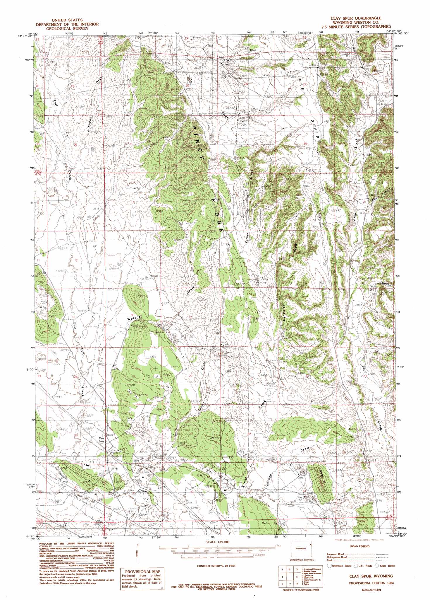
Clay Spur Topo Map Wyoming
To zoom in, hover over the map of Clay Spur
USGS Topo Quad 44104a4 - 1:24,000 scale
| Topo Map Name: | Clay Spur |
| USGS Topo Quad ID: | 44104a4 |
| Print Size: | ca. 21 1/4" wide x 27" high |
| Southeast Coordinates: | 44° N latitude / 104.375° W longitude |
| Map Center Coordinates: | 44.0625° N latitude / 104.4375° W longitude |
| U.S. State: | WY |
| Filename: | o44104a4.jpg |
| Download Map JPG Image: | Clay Spur topo map 1:24,000 scale |
| Map Type: | Topographic |
| Topo Series: | 7.5´ |
| Map Scale: | 1:24,000 |
| Source of Map Images: | United States Geological Survey (USGS) |
| Alternate Map Versions: |
Clay Spur WY 1984, updated 1984 Download PDF Buy paper map Clay Spur WY 2012 Download PDF Buy paper map Clay Spur WY 2015 Download PDF Buy paper map |
| FStopo: | US Forest Service topo Clay Spur is available: Download FStopo PDF Download FStopo TIF |
1:24,000 Topo Quads surrounding Clay Spur
Iron Mountain |
Linden |
Pfeiffer Hill |
Duling Hill |
Moskee |
Thornton |
Arrowhead Reservoir |
Sheldon Creek |
Inyan Kara Mountain |
Dry Draw |
Upton West |
Upton East |
Clay Spur |
Skull Creek |
Four Corners |
Sheep Canyon Creek West |
Sheep Canyon Creek East |
Osage |
Pedro |
Cambria |
Fairview |
Lassen Creek |
Klodt Reservoir |
Osage Se |
Newcastle |
> Back to 44104a1 at 1:100,000 scale
> Back to 44104a1 at 1:250,000 scale
> Back to U.S. Topo Maps home
Clay Spur topo map: Gazetteer
Clay Spur: Mines
Farley Number One Mine elevation 1464m 4803′Farley Number Three Mine elevation 1422m 4665′
Farley Number Two Mine elevation 1422m 4665′
Osage Clay Spur Quarries Mine elevation 1269m 4163′
Osage Mine elevation 1281m 4202′
Tavegia Pit Mine elevation 1518m 4980′
Clay Spur: Populated Places
Clay Spur elevation 1276m 4186′Clay Spur: Reservoirs
Kellog Reservoir elevation 1305m 4281′Clay Spur: Ridges
Piney Ridge elevation 1451m 4760′Clay Spur: Streams
East Iron Creek elevation 1262m 4140′Little Turner Creek elevation 1274m 4179′
West Fork Skull Creek elevation 1443m 4734′
Clay Spur: Summits
Shale Hill elevation 1372m 4501′Clay Spur: Valleys
Berry Canyon elevation 1400m 4593′Bertha Canyon elevation 1427m 4681′
Johnson Draw elevation 1315m 4314′
Jordan Draw elevation 1318m 4324′
Sunquist Draw elevation 1355m 4445′
Walcott Draw elevation 1279m 4196′
Clay Spur digital topo map on disk
Buy this Clay Spur topo map showing relief, roads, GPS coordinates and other geographical features, as a high-resolution digital map file on DVD:
Eastern Wyoming & Western South Dakota
Buy digital topo maps: Eastern Wyoming & Western South Dakota