Thornton Topo Map Wyoming
To zoom in, hover over the map of Thornton
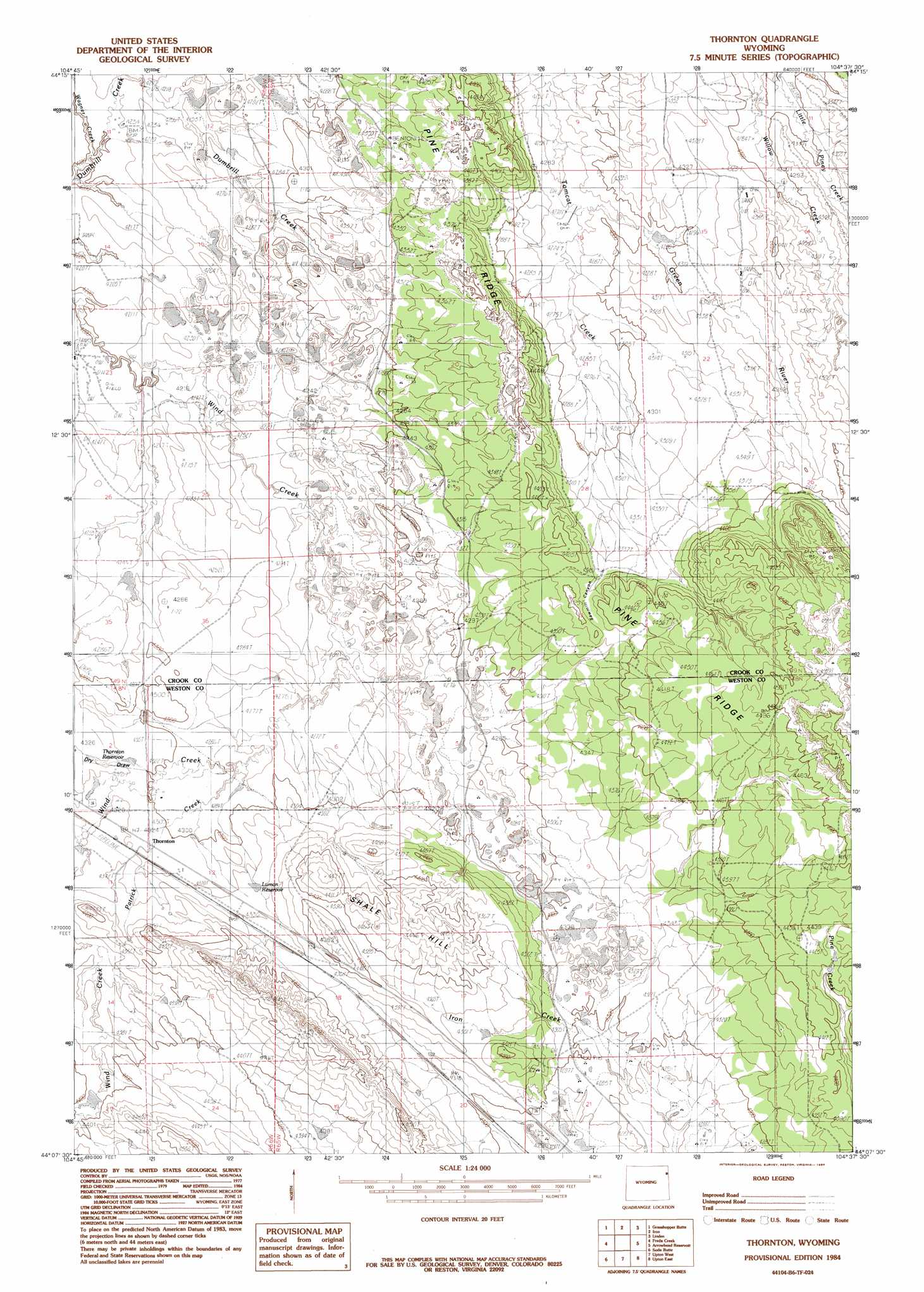
USGS Topo Quad 44104b6 - 1:24,000 scale
| Topo Map Name: | Thornton |
| USGS Topo Quad ID: | 44104b6 |
| Print Size: | ca. 21 1/4" wide x 27" high |
| Southeast Coordinates: | 44.125° N latitude / 104.625° W longitude |
| Map Center Coordinates: | 44.1875° N latitude / 104.6875° W longitude |
| U.S. State: | WY |
| Filename: | o44104b6.jpg |
| Download Map JPG Image: | Thornton topo map 1:24,000 scale |
| Map Type: | Topographic |
| Topo Series: | 7.5´ |
| Map Scale: | 1:24,000 |
| Source of Map Images: | United States Geological Survey (USGS) |
| Alternate Map Versions: |
Thornton WY 1984, updated 1984 Download PDF Buy paper map Thornton WY 2012 Download PDF Buy paper map Thornton WY 2015 Download PDF Buy paper map |
| FStopo: | US Forest Service topo Thornton is available: Download FStopo PDF Download FStopo TIF |
1:24,000 Topo Quads surrounding Thornton
Edith Creek |
Carlile |
Wonder View |
The Rocks |
Sundance West |
Moorcroft |
Grasshopper Butte |
Iron Mountain |
Linden |
Pfeiffer Hill |
Spyglass Hill |
Freda Creek |
Thornton |
Arrowhead Reservoir |
Sheldon Creek |
Cedar Draw |
Soda Butte |
Upton West |
Upton East |
Clay Spur |
Raven |
West Fork Buffalo Creek |
Sheep Canyon Creek West |
Sheep Canyon Creek East |
Osage |
> Back to 44104a1 at 1:100,000 scale
> Back to 44104a1 at 1:250,000 scale
> Back to U.S. Topo Maps home
Thornton topo map: Gazetteer
Thornton: Dams
J W and M J Luman Dam elevation 1323m 4340′Thornton: Mines
Upton Number Two elevation 1303m 4274′Thornton: Populated Places
Thornton elevation 1318m 4324′Thornton: Reservoirs
J W and M J Luman Reservoir elevation 1323m 4340′Luman Reservoir elevation 1319m 4327′
Thornton Reservoir elevation 1312m 4304′
Thornton: Ridges
Pine Ridge elevation 1338m 4389′Thornton: Streams
Green River elevation 1303m 4274′Middle Fork Wind Creek elevation 1325m 4347′
Patrick Creek elevation 1305m 4281′
Thornton: Summits
Shale Hill elevation 1358m 4455′Thornton: Valleys
Dry Draw elevation 1311m 4301′Thornton digital topo map on disk
Buy this Thornton topo map showing relief, roads, GPS coordinates and other geographical features, as a high-resolution digital map file on DVD:
Eastern Wyoming & Western South Dakota
Buy digital topo maps: Eastern Wyoming & Western South Dakota