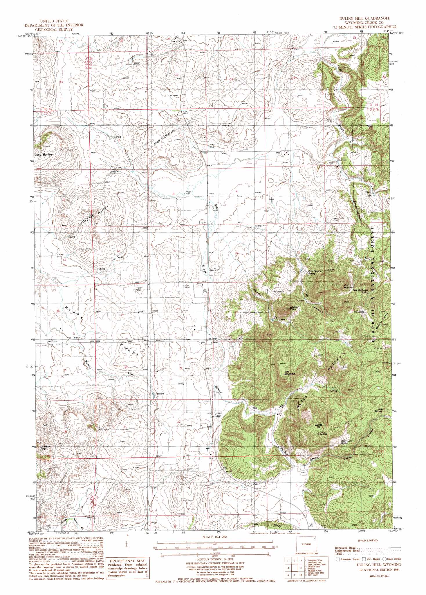
Duling Hill Topo Map Wyoming
To zoom in, hover over the map of Duling Hill
USGS Topo Quad 44104c3 - 1:24,000 scale
| Topo Map Name: | Duling Hill |
| USGS Topo Quad ID: | 44104c3 |
| Print Size: | ca. 21 1/4" wide x 27" high |
| Southeast Coordinates: | 44.25° N latitude / 104.25° W longitude |
| Map Center Coordinates: | 44.3125° N latitude / 104.3125° W longitude |
| U.S. State: | WY |
| Filename: | o44104c3.jpg |
| Download Map JPG Image: | Duling Hill topo map 1:24,000 scale |
| Map Type: | Topographic |
| Topo Series: | 7.5´ |
| Map Scale: | 1:24,000 |
| Source of Map Images: | United States Geological Survey (USGS) |
| Alternate Map Versions: |
Duling Hill WY 1984, updated 1985 Download PDF Buy paper map Duling Hill WY 2012 Download PDF Buy paper map Duling Hill WY 2015 Download PDF Buy paper map |
| FStopo: | US Forest Service topo Duling Hill is available: Download FStopo PDF Download FStopo TIF |
1:24,000 Topo Quads surrounding Duling Hill
Sherrard Hill |
Black Hills |
Sugarloaf Mountain |
Schoolmarm Butte |
Beulah |
The Rocks |
Sundance West |
Sundance East |
Red Canyon Creek |
Tinton |
Linden |
Pfeiffer Hill |
Duling Hill |
Moskee |
Old Baldy Mountain |
Arrowhead Reservoir |
Sheldon Creek |
Inyan Kara Mountain |
Dry Draw |
Buckhorn |
Upton East |
Clay Spur |
Skull Creek |
Four Corners |
Parmlee Canyon |
> Back to 44104a1 at 1:100,000 scale
> Back to 44104a1 at 1:250,000 scale
> Back to U.S. Topo Maps home
Duling Hill topo map: Gazetteer
Duling Hill: Flats
Black Flats elevation 1455m 4773′Duling Hill: Mines
Black Butte Deposit Mine elevation 1684m 5524′Duling Hill: Ridges
Elkhorn Divide elevation 1789m 5869′Duling Hill: Springs
Bear Den Spring elevation 1685m 5528′Boardinghouse Spring elevation 1653m 5423′
Den Spring elevation 1703m 5587′
Fish Canyon Spring elevation 1554m 5098′
Duling Hill: Streams
Boardinghouse Creek elevation 1452m 4763′Spring Creek elevation 1583m 5193′
Duling Hill: Summits
Black Buttes elevation 1785m 5856′Duling Hill elevation 1827m 5994′
Fish Mountain elevation 1805m 5921′
Gypsum Buttes elevation 1517m 4977′
Hooker Peak elevation 1778m 5833′
Iron Mountain elevation 1788m 5866′
Lime Buttes elevation 1556m 5104′
O'Haver Peak elevation 1620m 5314′
Duling Hill: Valleys
Adams Canyon elevation 1511m 4957′Duling Canyon elevation 1583m 5193′
Fish Canyon elevation 1521m 4990′
Duling Hill digital topo map on disk
Buy this Duling Hill topo map showing relief, roads, GPS coordinates and other geographical features, as a high-resolution digital map file on DVD:
Eastern Wyoming & Western South Dakota
Buy digital topo maps: Eastern Wyoming & Western South Dakota