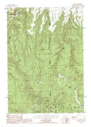
Tinton Topo Map Wyoming
To zoom in, hover over the map of Tinton
USGS Topo Quad 44104d1 - 1:24,000 scale
| Topo Map Name: | Tinton |
| USGS Topo Quad ID: | 44104d1 |
| Print Size: | ca. 21 1/4" wide x 27" high |
| Southeast Coordinates: | 44.375° N latitude / 104° W longitude |
| Map Center Coordinates: | 44.4375° N latitude / 104.0625° W longitude |
| U.S. States: | WY, SD |
| Filename: | o44104d1.jpg |
| Download Map JPG Image: | Tinton topo map 1:24,000 scale |
| Map Type: | Topographic |
| Topo Series: | 7.5´ |
| Map Scale: | 1:24,000 |
| Source of Map Images: | United States Geological Survey (USGS) |
| Alternate Map Versions: |
Tinton SD 1984, updated 1984 Download PDF Buy paper map Tinton SD 1984, updated 1984 Download PDF Buy paper map Tinton SD 2012 Download PDF Buy paper map Tinton SD 2015 Download PDF Buy paper map |
| FStopo: | US Forest Service topo Tinton is available: Download FStopo PDF Download FStopo TIF |
1:24,000 Topo Quads surrounding Tinton
> Back to 44104a1 at 1:100,000 scale
> Back to 44104a1 at 1:250,000 scale
> Back to U.S. Topo Maps home
Tinton topo map: Gazetteer
Tinton: Flats
Seventy Flats elevation 1560m 5118′Tinton: Mines
Apex Mine elevation 1528m 5013′Bear Gulch Placer Mine elevation 1777m 5830′
Bull Hill Mine elevation 1742m 5715′
Eureka Number Mine elevation 1721m 5646′
Giant Mine elevation 1819m 5967′
Rusty Number 9 Mine elevation 1819m 5967′
Tinton Mine elevation 1820m 5971′
Tinton: Pillars
Conners Rock elevation 1696m 5564′Tinton: Populated Places
Beaver Crossing elevation 1679m 5508′Sand Creek Crossing elevation 1526m 5006′
Tinton elevation 1817m 5961′
Tinton: Springs
Boundary Spring elevation 1476m 4842′Centennial Spring elevation 1796m 5892′
Christianson Spring elevation 1692m 5551′
Idol Spring elevation 1706m 5597′
Knight Spring elevation 1411m 4629′
Nelson Spring elevation 1504m 4934′
Potato Spring elevation 1733m 5685′
Soldiers Spring elevation 1597m 5239′
Thompson Spring elevation 1372m 4501′
Tinton: Streams
Potato Creek elevation 1681m 5515′Tinton: Summits
Beartown Hill elevation 1792m 5879′Bull Hill elevation 1916m 6286′
Grandview Hill elevation 1807m 5928′
Green Hill elevation 1768m 5800′
Lytle Hill elevation 1761m 5777′
Negro Hill elevation 1820m 5971′
Sunshine Hill elevation 1809m 5935′
The Needles elevation 1795m 5889′
Tinton: Trails
Bear Gulch Trail elevation 1625m 5331′Beaver Ridge Trail elevation 1443m 4734′
Tinton: Valleys
Boundary Gulch elevation 1205m 3953′Centennial Gulch elevation 1716m 5629′
Chicago Gulch elevation 1576m 5170′
Cummins Gulch elevation 1639m 5377′
Dugout Gulch elevation 1174m 3851′
East Fork Boundary Gulch elevation 1305m 4281′
East Fork Boundary Gulch elevation 1315m 4314′
East Fork Dugout Gulch elevation 1325m 4347′
Hospital Gulch elevation 1137m 3730′
Lincoln Gulch elevation 1751m 5744′
Mallory Gulch elevation 1705m 5593′
Mallory Gulch elevation 1699m 5574′
Middle Fork Boundary Gulch elevation 1304m 4278′
Negro Gulch elevation 1732m 5682′
Roena Gulch elevation 1667m 5469′
Saffron Gulch elevation 1557m 5108′
Spottedtrail Gulch elevation 1638m 5374′
West Fork Boundary Gulch elevation 1304m 4278′
West Fork Dugout Gulch elevation 1318m 4324′
Wyoming Gulch elevation 1628m 5341′
Tinton digital topo map on disk
Buy this Tinton topo map showing relief, roads, GPS coordinates and other geographical features, as a high-resolution digital map file on DVD:
Eastern Wyoming & Western South Dakota
Buy digital topo maps: Eastern Wyoming & Western South Dakota


