Schoolmarm Butte Topo Map Wyoming
To zoom in, hover over the map of Schoolmarm Butte
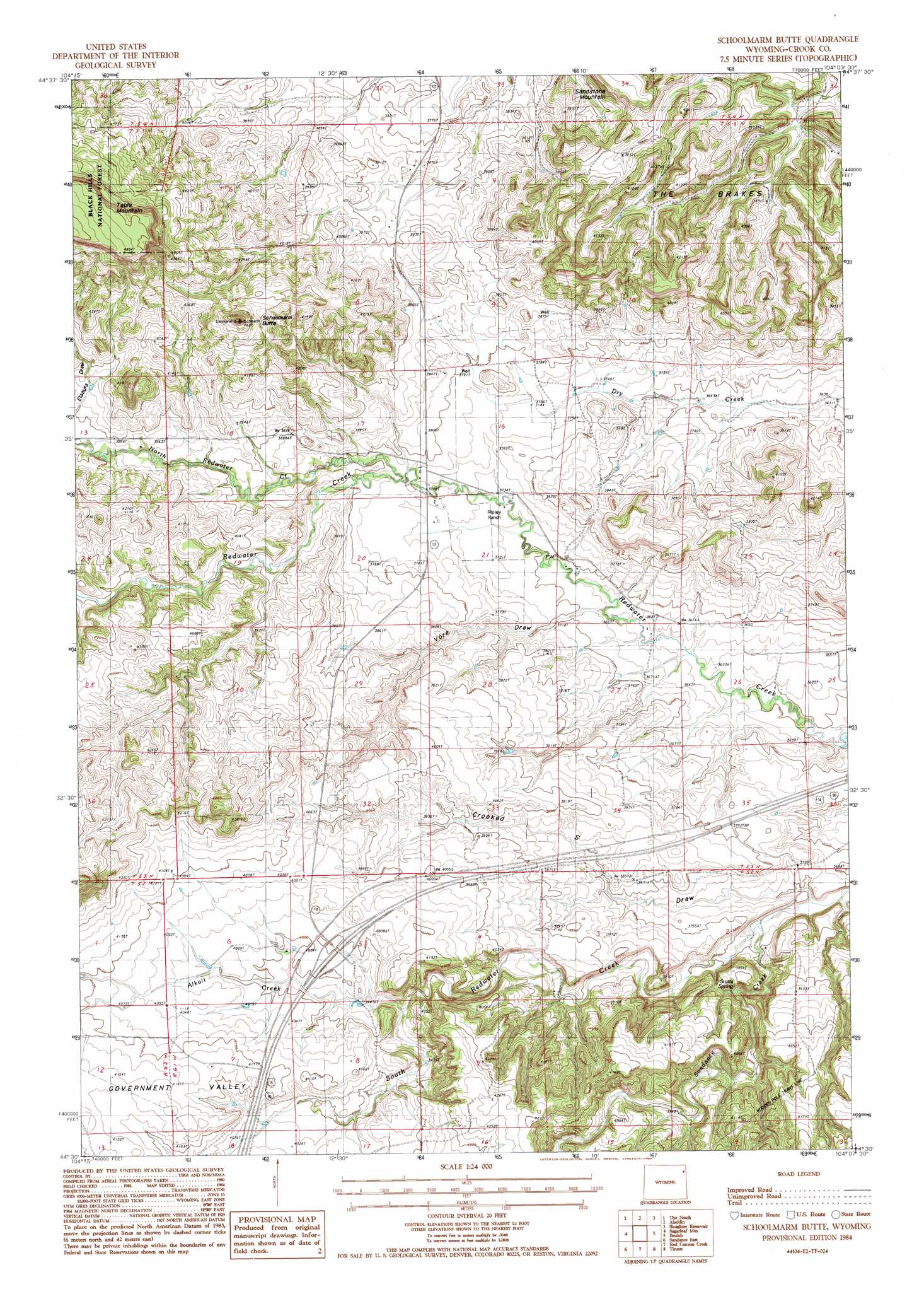
USGS Topo Quad 44104e2 - 1:24,000 scale
| Topo Map Name: | Schoolmarm Butte |
| USGS Topo Quad ID: | 44104e2 |
| Print Size: | ca. 21 1/4" wide x 27" high |
| Southeast Coordinates: | 44.5° N latitude / 104.125° W longitude |
| Map Center Coordinates: | 44.5625° N latitude / 104.1875° W longitude |
| U.S. State: | WY |
| Filename: | o44104e2.jpg |
| Download Map JPG Image: | Schoolmarm Butte topo map 1:24,000 scale |
| Map Type: | Topographic |
| Topo Series: | 7.5´ |
| Map Scale: | 1:24,000 |
| Source of Map Images: | United States Geological Survey (USGS) |
| Alternate Map Versions: |
Schoolmarm Butte WY 1984, updated 1984 Download PDF Buy paper map Schoolmarm Butte WY 2012 Download PDF Buy paper map Schoolmarm Butte WY 2015 Download PDF Buy paper map |
| FStopo: | US Forest Service topo Schoolmarm Butte is available: Download FStopo PDF Download FStopo TIF |
1:24,000 Topo Quads surrounding Schoolmarm Butte
Mona |
Stoney Point |
Kruger Lake |
Middle Creek Butte |
Bull Creek Butte |
Alva |
The Notch |
Aladdin |
The Forks |
Sourdough Flats |
Black Hills |
Sugarloaf Mountain |
Schoolmarm Butte |
Beulah |
Chicken Creek |
Sundance West |
Sundance East |
Red Canyon Creek |
Tinton |
Maurice |
Pfeiffer Hill |
Duling Hill |
Moskee |
Old Baldy Mountain |
Savoy |
> Back to 44104e1 at 1:100,000 scale
> Back to 44104a1 at 1:250,000 scale
> Back to U.S. Topo Maps home
Schoolmarm Butte topo map: Gazetteer
Schoolmarm Butte: Dams
Williams Dam elevation 1130m 3707′Schoolmarm Butte: Mines
Simmons Stockpile Mine elevation 1191m 3907′Schoolmarm Butte: Reservoirs
Williams Reservoir elevation 1130m 3707′Schoolmarm Butte: Springs
Stotts Spring elevation 1154m 3786′Schoolmarm Butte: Streams
Alkali Creek elevation 1191m 3907′North Redwater Creek elevation 1147m 3763′
Sundance Creek elevation 1119m 3671′
Schoolmarm Butte: Summits
Sandstone Mountain elevation 1244m 4081′Schoolmarm Butte elevation 1391m 4563′
Schoolmarm Butte: Valleys
Crooked S Draw elevation 1132m 3713′Government Valley elevation 1235m 4051′
Vore Draw elevation 1134m 3720′
Schoolmarm Butte digital topo map on disk
Buy this Schoolmarm Butte topo map showing relief, roads, GPS coordinates and other geographical features, as a high-resolution digital map file on DVD:
Eastern Wyoming & Western South Dakota
Buy digital topo maps: Eastern Wyoming & Western South Dakota