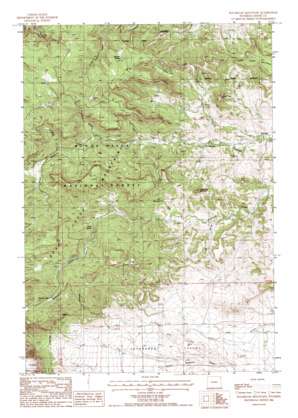
Sugarloaf Mountain Topo Map Wyoming
To zoom in, hover over the map of Sugarloaf Mountain
USGS Topo Quad 44104e3 - 1:24,000 scale
| Topo Map Name: | Sugarloaf Mountain |
| USGS Topo Quad ID: | 44104e3 |
| Print Size: | ca. 21 1/4" wide x 27" high |
| Southeast Coordinates: | 44.5° N latitude / 104.25° W longitude |
| Map Center Coordinates: | 44.5625° N latitude / 104.3125° W longitude |
| U.S. State: | WY |
| Filename: | o44104e3.jpg |
| Download Map JPG Image: | Sugarloaf Mountain topo map 1:24,000 scale |
| Map Type: | Topographic |
| Topo Series: | 7.5´ |
| Map Scale: | 1:24,000 |
| Source of Map Images: | United States Geological Survey (USGS) |
| Alternate Map Versions: |
Sugarloaf Mountain WY 1984, updated 1985 Download PDF Buy paper map Sugarloaf Mountain WY 2012 Download PDF Buy paper map Sugarloaf Mountain WY 2015 Download PDF Buy paper map |
| FStopo: | US Forest Service topo Sugarloaf Mountain is available: Download FStopo PDF Download FStopo TIF |
1:24,000 Topo Quads surrounding Sugarloaf Mountain
> Back to 44104e1 at 1:100,000 scale
> Back to 44104a1 at 1:250,000 scale
> Back to U.S. Topo Maps home
Sugarloaf Mountain topo map: Gazetteer
Sugarloaf Mountain: Populated Places
Farrall elevation 1220m 4002′Sugarloaf Mountain: Reservoirs
Hemler Reservoir elevation 1558m 5111′Sugarloaf Mountain: Springs
Dean Spring elevation 1433m 4701′Merrick Spring elevation 1457m 4780′
Sugarloaf Mountain: Streams
Cow Creek elevation 1503m 4931′North Fork Spring Creek elevation 1269m 4163′
Onemile Creek elevation 1403m 4603′
South Fork Spring Creek elevation 1269m 4163′
Spring Creek elevation 1214m 3982′
Twomile Creek elevation 1348m 4422′
Sugarloaf Mountain: Summits
Skunk Peak elevation 1428m 4685′Sugarloaf Mountain elevation 1452m 4763′
Table Mountain elevation 1497m 4911′
Sugarloaf Mountain: Trails
Lanning Trail elevation 1521m 4990′Table Mountain Trail elevation 1462m 4796′
Sugarloaf Mountain: Valleys
Eisbuts Draw elevation 1221m 4005′Long Draw elevation 1272m 4173′
Mosquito Draw elevation 1320m 4330′
Sugarloaf Mountain digital topo map on disk
Buy this Sugarloaf Mountain topo map showing relief, roads, GPS coordinates and other geographical features, as a high-resolution digital map file on DVD:
Eastern Wyoming & Western South Dakota
Buy digital topo maps: Eastern Wyoming & Western South Dakota


